
File:Map of Asia.svg

Size of this PNG preview of this SVG file: 733 × 600 pixels. Other resolutions: 293 × 240 pixels | 587 × 480 pixels | 939 × 768 pixels | 1,252 × 1,024 pixels | 2,503 × 2,048 pixels | 2,738 × 2,240 pixels.
Original file (SVG file, nominally 2,738 × 2,240 pixels, file size: 2 MB)
| This is a file from the Wikimedia Commons. Information from its description page there is shown below. Commons is a freely licensed media file repository. You can help. |
Summary
| Description |
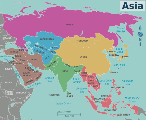
Map of Asia for use on Wikivoyage. Multilingual: in separate layers data for language codes: en, eo, fr, id, nl. Legend:
|
| Date | 5 May 2007 (original upload date) |
| Source | Own work based on the blank world map |
| Author | Cacahuate, adapted by Peter Fitzgerald, Globe-trotter, Joelf, Texugo, Piet-c and Bennylin. |
| Other versions |
PNG files: |
| Other information |
.png)
.png)
.png)
.png)
.png)
.png)
.png)
.png)
.png)
.png)
.png)
.png)
.png)
.png)
.png)
Licensing
This file is licensed under the Creative Commons Attribution-Share Alike 4.0 International, 3.0 Unported, 2.5 Generic, 2.0 Generic and 1.0 Generic license.
- You are free:
- to share – to copy, distribute and transmit the work
- to remix – to adapt the work
- Under the following conditions:
- attribution – You must give appropriate credit, provide a link to the license, and indicate if changes were made. You may do so in any reasonable manner, but not in any way that suggests the licensor endorses you or your use.
- share alike – If you remix, transform, or build upon the material, you must distribute your contributions under the same or compatible license as the original.
Original upload log
| This file was imported from Wikivoyage WTS. |
The original description page was here. All following user names refer to wts.wikivoyage-old.
- 2008-01-26 05:57 (WT-shared) Cacahuate[dead link] 744×1052 (407397 bytes) {{Imagecredit|credit=[[:en:User:Cacahuate|Cacahuate]]|captureDate=|location=Asia|source=Created by user|caption=Map of Asia|description=A ma (Import from wikitravel.org/shared)
- 2008-09-04 03:23 (WT-shared) Cacahuate[dead link] 744×1052 (2472637 bytes) new base map with better lines, fix colors, fonts, etc (Import from wikitravel.org/shared)
- 2010-03-21 17:42 (WT-shared) Peterfitzgerald archive copy at the Wayback Machine 744×1052 (2460391 bytes) add a few more country labels (Import from wikitravel.org/shared)
- 2010-12-05 06:43 (WT-shared) Joelf[dead link] 2738×2240 (2259001 bytes) +fr (Import from wikitravel.org/shared)
- 2011-09-07 01:37 (WT-shared) Peterfitzgerald archive copy at the Wayback Machine 2738×2240 (2005259 bytes) split Sudan/S Sudan & remove all the unnecessary, unused layers (Import from wikitravel.org/shared)
- 2011-12-28 09:17 (WT-shared) Globe-trotter[dead link] 2738×2240 (2148340 bytes) Added Dutch language, added Turkey to Asia (Import from wikitravel.org/shared)
- 2012-09-13 11:42 ImportBot[dead link] 2738×2240 (2113570 bytes) rm WT-logo
[[ |pulgar|continentes]]
File history
Click on a date/time to view the file as it appeared at that time.
| Date/Time | Thumbnail | Dimensions | User | Comment | |
|---|---|---|---|---|---|
| 10:48, 11 January 2021 |  | 2,738 × 2,240 (2.01 MB) | Datu Hulyo | Reverted to version as of 03:30, 20 January 2013 (UTC) | |
| 10:43, 11 January 2021 |  | 2,738 × 2,240 (2.1 MB) | Datu Hulyo | Reverted to version as of 17:33, 12 August 2013 (UTC) | |
| 17:53, 15 June 2014 |  | 2,738 × 2,240 (2.53 MB) | Piet-c | eo 6: aldono de nomoj specife por Sud-Orienta Azio, eo 5: aldono de nomoj specife por Orienta Azio kaj eo 4: aldono de nomoj specife por Centra Azio. | |
| 20:07, 24 May 2014 |  | 2,738 × 2,240 (2.4 MB) | Piet-c | eo 3: aldono de nomoj specife por Kaŭkazo. | |
| 14:37, 24 May 2014 |  | 2,738 × 2,240 (2.36 MB) | Piet-c | eo 2: aldono de nomoj specife por Mezoriento. | |
| 15:03, 18 May 2014 |  | 2,738 × 2,240 (2.31 MB) | Piet-c | eo 1: aldono de nomoj specife por Suda Azio. | |
| 11:33, 6 March 2014 |  | 2,738 × 2,240 (2.27 MB) | Bennylin | +Indonesian translation and some fixing | |
| 17:33, 12 August 2013 |  | 2,738 × 2,240 (2.1 MB) | Piet-c | eo: aldono de landonomoj. | |
| 14:13, 22 June 2013 |  | 2,738 × 2,240 (2.04 MB) | Piet-c | Added something in Esperanto. | |
| 03:30, 20 January 2013 |  | 2,738 × 2,240 (2.01 MB) | Globe-trotter | small changes |
File usage
More than 100 pages use this file. The following list shows the first 100 pages that use this file only. A full list is available.
- Afghan diaspora
- African diaspora
- Aggavamsa
- Alexey Limanzo
- Armenian diaspora
- Asian (South Africa)
- Asian Africans
- Asian Americans
- Asian Argentines
- Asian Australians
- Asian Brazilians
- Asian Canadians
- Asian Caribbeans
- Asian Hispanic and Latino Americans
- Asian Latin Americans
- Asian Peruvians
- Asian Surinamese
- Asian people
- Asians in the Americas
- Assyrian Australians
- Assyrian–Chaldean–Syriac diaspora
- Azerbaijani diaspora
- Baloch diaspora
- Bangladeshi diaspora
- Bengali Hindu diaspora
- Brad Adams
- Burmese diaspora
- Chan Yuk-shee
- Chinese Caribbeans
- Diaspora
- Dougla people
- East Asians in the United Kingdom
- European emigration
- Filipino seamen
- Gladys Li
- Ibn Abi Tahir Tayfur
- Indian diaspora
- Indo-Caribbeans
- Iranian diaspora
- Iraqi Australians
- Iraqi diaspora
- Israeli Australians
- Japanese diaspora
- Jordanian Australians
- Kashmiri diaspora
- Khanlar Safaraliyev
- Korean diaspora
- Laotian diaspora
- Lebanese diaspora
- List of diasporas
- Manuel Teixeira (linguist)
- Marabou (ethnicity)
- Mirpuri diaspora
- Monovithya Kem
- Mujawar Ahmad Zyar
- Muslim diaspora
- Non-Resident Nepali
- Odia diaspora
- Olivia Choong
- Overseas Acehnese
- Overseas Chinese
- Overseas Filipinos
- Overseas Indonesians
- Overseas Malays
- Overseas Minangkabau
- Overseas Vietnamese
- Padma Ratna Tuladhar
- Pakistani diaspora
- Palestinian Australians
- Palestinian diaspora
- Pashtun diaspora
- Punjabi diaspora
- Pınar İlkkaracan
- Rafia Ghubash
- Romani diaspora
- Sa'id ibn Aws al-Ansari
- Samir Nashar
- Saudi Australians
- Sayyar Jamil
- Sindhi diaspora
- South Asian diaspora
- South Asians in the United Kingdom
- Sri Lankan Tamil diaspora
- Sri Lankan diaspora
- Syrian diaspora
- Taiwanese Americans
- Tamil diaspora
- Tej Man Angdembe
- Telugu diaspora
- Tibetan diaspora
- Tsering Shakya
- Turkish Australians
- Turkish diaspora
- Wajih Owais
- Yelü Diela
- Yemeni diaspora
- Yun Il-seon
- Yusuf ibn Ismail al-Kutubi
- Template:Asia-academic-bio-stub
- Template:Asia-activist-stub
View more links to this file.
Global file usage
The following other wikis use this file:
- Usage on bn.wikibooks.org
- Usage on dz.wikipedia.org
- Usage on en.wikibooks.org
- Wikijunior:Asia
- Category:Book:Wikijunior:Asia
- Wikijunior:Asia/Sri Lanka
- Wikijunior:Asia/Pakistan
- Wikijunior:Asia/Indonesia
- Wikijunior:Asia/India
- Wikijunior:Asia/China
- Template:Wikijunior:Asia
- Wikijunior:Asia/Singapore
- Wikijunior:Asia/Bangladesh
- Wikijunior:Asia/Philippines
- Wikijunior:Asia/Bhutan
- Wikijunior:Asia/Japan
- Wikijunior:Asia/Iraq
- Wikijunior:Asia/Mongolia
- Wikijunior:Asia/Timor-Leste
- Wikijunior:Asia/Iran
- User:Ju T Jin/sandbox/Wikijunior Asia
- Wikijunior:Asia/Afghanistan
- Wikijunior:Asia/Thailand
- Wikijunior:Asia/Nepal
- Wikijunior:Asia/Russia
- Wikijunior:Asia/Taiwan
- Wikijunior:Asia/Malaysia
- Wikijunior:Asia/Vietnam
- Wikijunior:Asia/Brunei
- Wikijunior:Asia/Cambodia
- Wikijunior:Asia/Laos
- Wikijunior:Asia/South Korea
- Wikijunior:Asia/Turkey
- Wikijunior:Asia/Armenia
- Wikijunior:Asia/Azerbaijan
- Wikijunior:Asia/Cyprus
- Wikijunior:Asia/Myanmar
- Wikijunior:Asia/Bahrain
- Wikijunior:Asia/Jordan
- Wikijunior:Asia/Yemen
- Wikijunior:Asia/Kazakhstan
- Wikijunior:Asia/Georgia
View more global usage of this file.