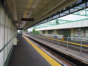
22nd Street station (SkyTrain)
| SkyTrain station | |||||||||||||||
 | |||||||||||||||
| General information | |||||||||||||||
| Location | 649 22nd Street, New Westminster | ||||||||||||||
| Coordinates | 49°12′00″N 122°56′57″W / 49.20000°N 122.94917°W | ||||||||||||||
| Owned by | BC Transit, TransLink | ||||||||||||||
| Platforms | Side platforms | ||||||||||||||
| Tracks | 2 | ||||||||||||||
| Construction | |||||||||||||||
| Structure type | Elevated | ||||||||||||||
| Accessible | Yes | ||||||||||||||
| Other information | |||||||||||||||
| Station code | TS | ||||||||||||||
| Fare zone | 2 | ||||||||||||||
| History | |||||||||||||||
| Opened | December 11, 1985 | ||||||||||||||
| Passengers | |||||||||||||||
| 2023[1] | ERROR | ||||||||||||||
| Services | |||||||||||||||
| |||||||||||||||
22nd Street station is located on an elevated portion of the SkyTrain rapid transit system serving Metro Vancouver. The station opened in 1985 as part of the original Expo Line.
Location
The station is located on 7th Ave between 21 St and 22 St in the western end of New Westminster, an area of low-density residential neighbourhoods. The main functionality of this station, however, is to connect passengers to regional bus routes as it is located close to a major crossroads of the region, where the Queensborough Bridge meets Marine Way and Stewardson Way.
As the station is located on a hill above the Queensborough interchange, it has expansive view of Fraser River and Mount Baker on a clear day.[2]
SkyTrain's operation and maintenance centre is located northwest of this station.
Service
- 22nd Street bus loop is the terminus for a number of various regional bus routes serving Vancouver, Surrey, North Delta, Richmond and Langley.
- Local connections to Queensborough Landing and Uptown New Westminster is also available at this station.
- The station serves as the starting point of early morning Millennium trains toward VCC–Clark station.
Station information
Station layout
Template:TransLink (BC) station layout Template:TransLink (BC) station layout Template:TransLink (BC) station layout Template:TransLink (BC) station layout Template:TransLink (BC) station layout Template:TransLink (BC) station layout Template:TransLink (BC) station layout
22nd Street station is served by a single entrance facing west. The entrance, along with the bus loop that surrounds the station house, is at a level slightly below 7th Avenue, and is connected to the street through ramp and stairs. An up escalator is provided for the westbound (inbound) platform only; passengers accessing the eastbound (outbound) platform must climb up a full flight of stairs.
Transit connections
22nd Street Station offers an off-street transit exchange with on-street stops for HandyDart and bus drop-offs eastbound on 7th Avenue. Bus bay assignment is as follows:[3]
| Bay | Routes |
|---|---|
| 1 | 388 Carvolth Exchange |
| 2 | C98 Kingswood |
| 3 |
|
| 4 | 101 Lougheed Station |
| 5 | 104 Annacis Island |
| 6 | 340 Scottsdale |
| 7 | 410 Railway |
| 8 | 100 Marpole Loop |
References
- ^ "2023 Transit Service Performance Review – SkyTrain Stations Summaries". tableau.com. TransLink. April 17, 2024. Archived from the original on April 30, 2024. Retrieved May 1, 2024.
- ^ "Expo Line Station Review". Translink. Retrieved 19 December 2011.
- ^ "22nd Street Station". TransLink. September 2013. Retrieved November 20, 2016.
External links
![]() Media related to 22nd Street Station at Wikimedia Commons
Media related to 22nd Street Station at Wikimedia Commons
