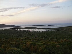
Vele Orjule
Appearance
This article includes a list of general references, but it lacks sufficient corresponding inline citations. (October 2012) |
 Vele Orjule (left) and Male Orjule (right) from Sveti Petar | |
 | |
| Geography | |
|---|---|
| Location | Adriatic Sea |
| Coordinates | 44°30′00″N 14°33′21″E / 44.50000°N 14.55583°E |
| Archipelago | Cres-Lošinj |
| Area | 1.06 km2 (0.41 sq mi) |
| Highest elevation | 30 m (100 ft) |
| Highest point | Pristavnica |
| Administration | |
| Demographics | |
| Population | 0 |
Vele Orjule is an uninhabited Croatian island in the Adriatic Sea located southeast of Lošinj. Its area is 1.06 km2 (0.41 sq mi).[1]
West of this island is good and sheltered anchorage.
In 1996, the statue of Croatian Apoxyomenos got discovered there.

References
- ^ Duplančić Leder, Tea; Ujević, Tin; Čala, Mendi (June 2004). "Coastline lengths and areas of islands in the Croatian part of the Adriatic Sea determined from the topographic maps at the scale of 1 : 25 000" (PDF). Geoadria. 9 (1). Zadar: 5–32. doi:10.15291/geoadria.127. Retrieved 2019-12-23.
