Qurnat as Sawda'
Appearance
| Qurnat as Sawdā | |
|---|---|
 | |
| Highest point | |
| Elevation | 3,088 m (10,131 ft) |
| Prominence | 2,393 m (7,851 ft) |
| Listing | Country high point Ultra |
| Coordinates | 34°18′00″N 36°07′00″E / 34.30000°N 36.11667°Eki |
| Naming | |
| Native name | القرنة السوداء Error {{native name checker}}: parameter value is malformed (help) |
| Geography | |
| Parent range | Bsharri North lebanon |
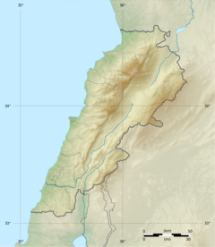
Qurnat as Sawdā (Template:Lang-ar), is the highest point in Lebanon and the Levant, at 3,088 meters above sea level. It is found in Bsharri /North of Lebanon
Meaning
The original meaning is “qornet dsohde” in Aramaic Syriac, meaning Martyr's Mountain, related to the mamalik attack on the northern region in 13th century and the people who died on the mountain while trying to escape the invasion of the region. Later on when the Lebanese stopped speaking Syriac the meaning was forgotten but the name remained same as most of Lebanon villages
References
https://en.wikipedia.org/wiki/Dinniyeh


