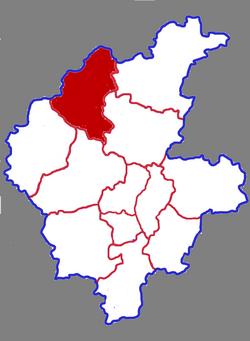
Mengyin County
Appearance
Mengyin County
蒙阴县 | |
|---|---|
 Mengyin in Linyi | |
 Linyi in Shandong | |
| Coordinates: 35°42′36″N 117°56′42″E / 35.710°N 117.945°E | |
| Country | People's Republic of China |
| Province | Shandong |
| Prefecture-level city | Linyi |
| Area | |
• Total | 1,602 km2 (619 sq mi) |
| Elevation | 211 m (692 ft) |
| Population (2019)[2] | |
• Total | 528,000 |
| • Density | 330/km2 (850/sq mi) |
| Time zone | UTC+8 (China Standard) |
| Postal code | 276200 |
Mengyin County (simplified Chinese: 蒙阴县; traditional Chinese: 蒙陰縣; pinyin: Méngyīn Xiàn) is a county in the southwest-central part of Shandong province, People's Republic of China. It is under the administration of Linyi City.
The population was 524,565 in 1999.[3]
Administrative divisions
As 2012, this County is divided to 1 subdistrict, 8 towns and 2 townships.[4]
- Subdistricts
- Mengyin Subdistrict (蒙阴街道)
- Towns
|
|
- Townships
- Liancheng Township (联城乡)
- Jiuzhai Township (旧寨乡)
References
- ^ 最新人口信息 www.hongheiku.com (in Chinese). hongheiku. Retrieved 2021-01-12.
- ^ 最新人口信息 www.hongheiku.com (in Chinese). hongheiku. Retrieved 2021-01-12.
- ^ National Population Statistics Materials by County and City - 1999 Period, in China County & City Population 1999, Harvard China Historical GIS
- ^ 日照市-行政区划网 www.xzqh.org (in Chinese). XZQH. Retrieved 2012-05-24.
