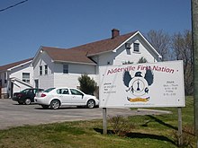
Alderville First Nation

Alderville First Nation is a band of Mississaugas, a sub-nation of the Ojibways. The Alderville and Sugar Island 37A reserves belong to that First Nation band government.
First Nation
The Alderville First Nation is an Anishinaabe First Nation located in southern Ontario, Canada. As of December 2017, Alderville First Nation had 1,162 registered band members, of which their on-Reserve population was only 323 people, meaning the majority of their registered population live outside the reserve (off-reserve) in neighbouring communities.[1]
Governance
The community is governed by an elected Chief and Council and maintains political affiliations with the Ogemawahj Tribal Council, a non-political Regional Chiefs' Council, and the Anishinabek Nation political organization.
Indian reserve
The reserve comprises two areas. The main reserve, the Alderville First Nation (formerly designated as Alderville Indian Reserve 37 by Indian and Northern Affairs Canada), is located near the south shores of Rice Lake in Ontario (44°11′N 78°04′W / 44.183°N 78.067°W). It consists of six non-contiguous areas within the Alnwick/Haldimand Township approximately 30 kilometres (19 mi) north of Cobourg, and occupies a total area of 1,199.8 hectares (2,965 acres). They also maintain a smaller parcel of land on nearby Sugar Island, the 40.5 hectares (100 acres) Sugar Island 37A Indian Reserve (44°13′N 78°8.25′W / 44.217°N 78.13750°W).[2] It has been home to the Mississauga division of the Anishinaabe (Ojibwa) Nation since the mid-1830s.[3]
Prior to its current location, the people of the community had lived in their traditional lands around the Bay of Quinte - located approximately 90 kilometres (56 mi) east of its current location. However, with the influx of refugee settlements following the American Revolution, the community found itself under increased pressure.[3] Having lost its American colonies, the British were forced to relocate the soldiers and civilians loyal to the crown (also known as the United Empire Loyalists) around the Bay of Quinte area. The area is now home to the Mohawks of the Bay of Quinte First Nation (also known as Tyendinaga Mohawk Territory), the land having been promised to Joseph Brant, leader of the Mohawks that were loyal to the British Monarchy.
Cannabis Industry
Alderville Reserve is home to the "Green Mile," a concentration of cannabis dispensaries that are described as being in a legal gray area, as they are legal under tribal law, but possibly illegal (but tolerated) under Ontario provincial law.[4]
References
- ^ Registered Population. First Nation Profiles. Department of Indian Affairs and Northern Development.
- ^ Reserve Detail[dead link]. First Nation Profiles. Department of Indian Affairs and Northern Development.
- ^ a b General History. Alderville First Nation.
- ^ Austen, Ian "2 years after legalizing cannabis, has Canada kept its promises?" Boston Globe (Jan. 23, 2021)
External links
- Alderville First Nation
- Aboriginal Affairs and Northern Development Canada profile
- Valerie MacDonald (2012-02-23). "Alderville First Nations to learn native language". Northumberland Today. Retrieved 2012-08-08.
