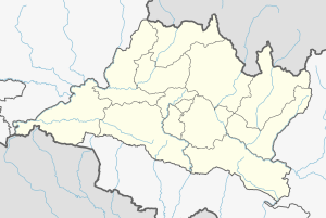
Mahankal Rural Municipality
Mahankal Rural Municipality
महाङ्काल गाउँपालिका | |
|---|---|
Rural Municipality | |
| Coordinates: 27°30′N 85°24′E / 27.50°N 85.40°E | |
| Country | Nepal |
| Province | Bagmati Province |
| District | Lalitpur District |
| Established | March 2017 |
| Government | |
| • Chairperson | Ganesh Kc (Nepali congress) |
| • Vice Chairperson | Dolma Maya Tamang |
| Area | |
• Total | 82.44 km2 (31.83 sq mi) |
| Population | |
• Total | 9,453 |
| • Density | 114.66/km2 (297.0/sq mi) |
| Website | mahankalmun |
Mahankal Rural Municipality Template:Lang-ne, is a Rural Municipality in Lalitpur District in Bagmati Province of Nepal that was established in 2017 by merging the former Village development committees Bukhel, Manikhel, Gotikhel, Chandanpur, Kaleshwar and Thuladurlung.[1] The centre of this rural municipality is located at Old-Gotikhel.
Demographics
At the time of the 2011 Nepal census, Mahankal Rural Municipality had a population of 9,526. Of these, 58.2% spoke Nepali, 40.6% Tamang, 0.4% Sunwar, 0.3% Newar, 0.1% Maithili, 0.1% Pahari and 0.2% other languages as their first language.[2]
In terms of ethnicity/caste, 48.0% were Hill Brahmin, 41.1% Tamang, 6.2% Chhetri, 1.1% Damai/Dholi, 1.1% Brahmu/Baramo, 0.8% Kami, 0.4% Newar, 0.4% Sunuwar, 0.2% Magar, 0.1% Ghale, 0.1% Pahari and 0.5% others.[3]
In terms of religion, 59.3% were Hindu, 39.8% Buddhist and 0.9% Christian.[4]
In terms of literacy, 71.2% could read and write, 2.9% could only read and 25.9% could neither read nor write.[5]
References


