Bois-Franc, Montreal
Appearance
Bois-Franc | |
|---|---|
 An entrance of the Bois-Franc neighbourhood on Alexis Nihon Boulevard. | |
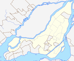
Location of Bois-Franc in Montreal | |
| Coordinates: 45°30′46″N 73°42′42″W / 45.512903°N 73.711569°W | |
| Country | Canada |
| Province | Quebec |
| City | Montreal |
| Borough | Saint-Laurent |
| Postal Code | |
| Area code(s) | 514, 438 |
Bois-Franc is a residential neighbourhood in the borough of Saint-Laurent in Montreal that was designed by the architect Louis Sauer.[1]

History
[edit]Bois-Franc is built on land sold by Bombardier Aerospace that used to be Cartierville Airport.[2][3]
Transportation
[edit]Bois-Franc is bordered by four boulevards: Henri Bourassa Boulevard to the north, Marcel Laurin Boulevard to the east, Cavendish Boulevard to the west, and Thimens Boulevard to the southwest.[4]
Bois Franc train station is relatively nearby.
References
[edit]- ^ "SOURCES OF INSPIRATION AND THE DYCAMICS OF DESIGN THE NEW TOWN OF BOIS-FRANC IN QUEBEC, CANADA". Archived from the original on 2011-07-18. Retrieved 2009-04-05.
- ^ History of Bois-Franc on the city of Montreal website Archived 2005-03-06 at the Wayback Machine
- ^ http://1000aircraftphotos.com/AirportPostcards/Montreal.htm
- ^ Bois-Franc website

