Linton, North Yorkshire
| Linton | |
|---|---|
Location within North Yorkshire | |
| Population | 176 (2011 census)[1] |
| OS grid reference | SD997627 |
| Civil parish |
|
| Unitary authority | |
| Ceremonial county | |
| Region | |
| Country | England |
| Sovereign state | United Kingdom |
| Post town | SKIPTON |
| Postcode district | BD23 |
| Police | North Yorkshire |
| Fire | North Yorkshire |
| Ambulance | Yorkshire |
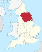
Linton is a village and civil parish in the Craven district of North Yorkshire, England. The population as of the 2011 census was 176.[1] It lies not far from Grassington, just south of the River Wharfe, and is 7 miles (11 km) north of Skipton. Linton Beck runs through the village and then joins the Wharfe at Linton Falls. The beck is crossed by two Grade II listed bridges on the village green,[2][3] and is overlooked by Fountaine's Hospital, a Grade II* listed chapel and almshouse built in the style of Sir John Vanburgh.[4] There is also a public house, the Fountaine Inn.[5]
The parish church of Saint Michael and All Saints stands close to the River Wharfe.[6]

History
Linton was historically a parish in Staincliffe Wapentake in the West Riding of Yorkshire.[7] The ancient parish included the townships of Grassington, Hebden and Threshfield, all of which became separate civil parishes in 1866.[8] Linton was transferred to North Yorkshire in 1974.
Linton Falls
Linton Falls on the River Wharfe consists of a natural limestone waterfall (crossed by a footbridge) and a pair of artificial weirs. The Linton Falls hydroelectric plant was built above the falls in 1909 but later abandoned in 1948. In 2012 it was restored to generate electricity once more.[9] Near the falls is a Grade II listed packhorse bridge over Linton Beck known as Little (or Li'le) Emily's Bridge.[10]
Notable people
- Sheila Bownas (1925–2007), textile designer and botanical illustrator[11]
Gallery
-
Fountaine's Hospital, back view, summer 2008
-
Two stone arch bridges on the village green
-
17th-century barn at Linton Falls
-
Upper weir, summer spate
-
Linton Falls, summer spate
-
Winter view of Linton Falls from north bank
-
Little Emily's Bridge
-
Linton Church of St Michael and All Saints
-
Sample story gravestone, Linton Churchyard
-
SE view of churchyard beside river and old mill site
-
Stepping-stones course, low water, from east
-
Dales Way walker's view of stepping-stones across Wharfe, toward Linton Church
References
- ^ a b UK Census (2011). "Local Area Report – Linton Parish (1170216768)". Nomis. Office for National Statistics. Retrieved 9 April 2018.
- ^ Historic England. "Bridge at ford over Linton Beck (Grade II) (1132118)". National Heritage List for England. Retrieved 4 October 2021.
- ^ Historic England. "Clapper bridge approximately 20 metres east of Fountaines Hospital (Grade II) (1132123)". National Heritage List for England. Retrieved 4 October 2021.
- ^ Historic England. "Fountaines Hospital (Grade II*) (1132124)". National Heritage List for England. Retrieved 4 October 2021.
- ^ "The Fountaine Inn". Individual Inns. Retrieved 4 October 2021.
- ^ "Yorkshire Walks – Linton Falls". Dalesman. Retrieved 31 October 2008.
- ^ Genuki website
- ^ Vision of Britain website
- ^ "Linton Falls hydroelectric plant supplies electricity again". BBC News. 22 March 2012. Retrieved 5 July 2017.
- ^ Historic England. "Lile Emilys Bridge (Grade II) (1167202)". National Heritage List for England. Retrieved 4 October 2021.
- ^ "Iconic work of Dales artist and designer goes on show". Craven Herald. 21 July 2016. Retrieved 27 May 2021.
External links
![]() Media related to Linton, North Yorkshire at Wikimedia Commons
Media related to Linton, North Yorkshire at Wikimedia Commons


