Tylers Common
From Wikipedia, the free encyclopedia
This is an old revision of this page, as edited by Cydebot (talk | contribs) at 15:58, 3 April 2017 (Robot - Moving category Parks and open spaces in Havering to Category:Parks and open spaces in the London Borough of Havering per CFD at Wikipedia:Categories for discussion/Log/2017 February 10.). The present address (URL) is a permanent link to this revision, which may differ significantly from the current revision.
Revision as of 15:58, 3 April 2017 by Cydebot (talk | contribs) (Robot - Moving category Parks and open spaces in Havering to Category:Parks and open spaces in the London Borough of Havering per CFD at Wikipedia:Categories for discussion/Log/2017 February 10.)
| Tylers Common | |
|---|---|
 Tylers Common | |
 | |
| Type | Common land |
| Coordinates | 51°35′31″N 0°15′32″E / 51.592°N 0.259°E / 51.592; 0.259 |
| Area | 79.2 acres (0.321 km2) |
| Operated by | Havering London Borough Council |
| Open | All year |
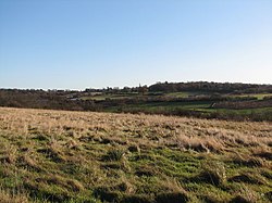
Tylers Common, also known as Upminster Common, is common land in the London Borough of Havering. It is one of the largest areas of common land in Greater London, with 32.06 hectares (79.2 acres) of protected commons.[1]
References
- ^ "Common Land and the Commons Act 2006". Defra. 13 November 2012. Retrieved 3 February 2013.


