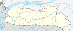
Nongpoh
Nongpoh | |
|---|---|
Town | |
| Coordinates: 25°54′N 91°53′E / 25.9°N 91.88°E | |
| Country | |
| State | Meghalaya |
| District | Ri Bhoi |
| Elevation | 485 m (1,591 ft) |
| Population (2001) | |
| • Total | 13,165 |
| Language | |
| • Official | English[1] |
| Time zone | UTC+5:30 (IST) |
| Vehicle registration | ML-10 |
| Climate | Cwa |
Nongpoh {IPA: nɒŋˈpɒ(ə)} is the administrative centre of Ri-Bhoi district in the Indian state of Meghalaya in the Republic of India. Nongpoh is located on National Highway 40, fifty-two kilometers from the state capital Shillong and forty-eight kilometers from Guwahati in the state of Assam.
Geography
Nongpoh is located at 25°54′N 91°53′E / 25.9°N 91.88°E.[2] It has an average elevation of 485 metres (1591 feet). Because of its proximity to the Brahmaputra plains, the weather during summer months tends to be humid and hot while the winter months are pleasant and warm. Fruits such as pineapples, bananas, papayas and litchi are cultivated extensively throughout the Ri-Bhoi district. Betel leaf and nut trees are visible while traveling the roads that connect Nongpoh with Guwahati.
Demographics

As of 2001[update] India census,[3] Nongpoh had a population of 13,165. Males constitute 51% of the population and females 49%. Nongpoh has an average literacy rate of 61%, higher than the national average of 59.5%: male literacy is 63%, and female literacy is 59%. In Nongpoh, 21% of the population is under 6.
References
- ^ "52nd REPORT OF THE COMMISSIONER FOR LINGUISTIC MINORITIES IN INDIA" (PDF). nclm.nic.in. Ministry of Minority Affairs. Archived from the original (PDF) on 25 May 2017. Retrieved 30 March 2019.
- ^ Falling Rain Genomics, Inc - Nongpoh
- ^ "Census of India 2001: Data from the 2001 Census, including cities, villages and towns (Provisional)". Census Commission of India. Archived from the original on 16 June 2004. Retrieved 1 November 2008.


