
Sault-au-Récollet
This article needs additional citations for verification. (December 2009) |
Recollet Falls | |
|---|---|
| Sault-au-Récollet | |
 | |
 Recollet Falls Location of Sault-au-Récollet in Montreal | |
| Coordinates: 45°34′40″N 73°38′45″W / 45.57764°N 73.64582°W | |
| Country | Canada |
| Province | Quebec |
| City | Montreal |
| Borough | Ahuntsic-Cartierville |
Sault-au-Récollet (Recollet Falls, in English) is a neighbourhood in Montreal. It is located in the eastern edge of the borough of Ahuntsic-Cartierville bordering the Rivière des Prairies. Autoroute 19 connects Sault-au-Récollet to the city of Laval. The neighbourhood was designated as a heritage site by the city of Montreal in 1992.[1]
The Church of the Visitation at Sault-au-Récollet is the oldest church on the Island of Montreal, built between 1749 and 1752.
Gallery
-
 In 1726
 -
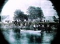 1890
1890 -
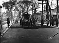 1930
1930


References
- ^ "Neighbourhood Sault-au-Récollet - Discovery". NEIGHBOURHOODS AND SITES. Heritage Montreal. Retrieved 30 April 2012.
See also
This Quebec location article is a stub. You can help Wikipedia by expanding it. |