Durley
| Durley | |
|---|---|
 The Robin Hood Inn on Durley Street in the village | |
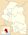
Location within Hampshire | |
| Population | 500 [1] 992 (2011 Census)[2] |
| OS grid reference | SU5218916710 |
| Civil parish |
|
| District | |
| Shire county | |
| Region | |
| Country | England |
| Sovereign state | United Kingdom |
| Post town | SOUTHAMPTON |
| Postcode district | SO32 |
| Dialling code | 01489 |
| Police | Hampshire and Isle of Wight |
| Fire | Hampshire and Isle of Wight |
| Ambulance | South Central |
| UK Parliament | |
Durley is a village and civil parish in the City of Winchester district of Hampshire, England. It is located approximately 7½ miles (12.1 km) northeast of Southampton and has a population of around 500,[3] doubling in the next decade. The village is home to two restaurants, The Robin Hood Inn and the Farmers Home. Both of the pubs have a rich history dating back till the nineteenth century. Durley is home to one school, Durley Primary. Which is home to around a hundred pupils ranging from four to eleven years of age. The village is also home to a local church where services are held often.
Governance
The village is part of the civil parish of Durley[4] and is part of the Owslebury and Curdridge ward of the City of Winchester non-metropolitan district of Hampshire County Council.[5] There are currently seven parishioners in the Parish where elections take place if there is enough people running office. The last election was 2 May 2019.
References
![]() Media related to Durley at Wikimedia Commons
Media related to Durley at Wikimedia Commons
- ^ "Parish Headcounts, 2001 Area: New Alresford CP (Parish)". Neighbourhood Statistics. Office for National Statistics. Retrieved 2 August 2015.
- ^ "Civil Parish population 2011". Neighbourhood Statistics. Office for National Statistics. Retrieved 14 December 2016.
- ^ "Durley Village website". Archived from the original on 2 December 2008. Retrieved 23 November 2007.
- ^ legal record of public rights of way in Hampshire - sheet 1310 (PDF) (Map). 1 : 10,000. Cartography by Ordnance Survey. Hampshire County Council. 2008. Retrieved 5 November 2010.
- ^ "Containing areas from mapit.mysociety.org". 2010. Retrieved 5 November 2010.


