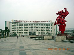
Ningguo
Appearance
Ningguo
宁国市 Ningkwo | |
|---|---|
 Ningguo in 2006 | |
 | |
| Country | People's Republic of China |
| Province | Anhui |
| Prefecture-level city | Xuancheng |
| Time zone | UTC+8 (China Standard) |
Ningguo (simplified Chinese: 宁国市; traditional Chinese: 寧國市; pinyin: Níngguó Shì) is a county-level city in the southeast of Anhui province, People's Republic of China, under the administration of Xuancheng City and bordering Zhejiang province to the south and east. It has a population of 380,000 and an area of 2,447 km2 (945 sq mi).
Ningguo has jurisdiction over eleven towns, seventeen townships, and one ethnic township.
History
Ningguo City is named from "Yi-QianGau" . It is written, "首出庶物,万国咸宁".
Transportation
Rail
Ningguo is served by the Anhui–Jiangxi Railway.
