Soberton
| Soberton | |
|---|---|
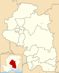
Location within Hampshire | |
| Population | 218 [1] 1,616 (2011 Census)[2] |
| OS grid reference | SU6120216615 |
| District | |
| Shire county | |
| Region | |
| Country | England |
| Sovereign state | United Kingdom |
| Post town | Southampton |
| Postcode district | SO32 |
| Dialling code | 01489 |
| Police | Hampshire and Isle of Wight |
| Fire | Hampshire and Isle of Wight |
| Ambulance | South Central |
| UK Parliament | |
Soberton is a village in the Meon Valley, Hampshire, England, bordered by villages such as Newtown and Droxford. It is listed in the Domesday Book under its original name, "Sudbertone" or "Sudbertune", and comes under Winchester City Council.
Key features of Soberton include the War Memorial at its centre, the early 16th-century Church of St Peter and St Paul, and The White Lion, a 17th-century public house. The church is part of one of the largest parishes in the United Kingdom. The village was part of a well-established smuggling route during the 18th century, and a vault beneath the church was used for the storage of contraband.[3]
It is the Soberton of "Baron Anson of Soberton", an 18th–19th century peerage. The children's writer Barbara Euphan Todd was brought up there.[4]
References
- ^ Census data
- ^ "Civil Parish population 2011". Neighbourhood Statistics. Office for National Statistics. Retrieved 19 January 2017.
- ^ Morley, Geoffrey (1983). Smuggling in Hampshire and Dorset 1700 – 1850. Newbury: Countryside Books. pp. 41–42. ISBN 0905392248.
- ^ Book Rags biography: Retrieved 18 June 2012.
External links


