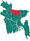
Bhaluka Upazila
Bhaluka
ভালুকা | |
|---|---|
| Coordinates: 24°22.5′N 90°22.7′E / 24.3750°N 90.3783°E | |
| Country | |
| Division | Mymensingh Division |
| District | Mymensingh District |
| Area | |
| • Total | 444.05 km2 (171.45 sq mi) |
| Population (2011) | |
| • Total | 430,320 |
| • Density | 970/km2 (2,500/sq mi) |
| Time zone | UTC+6 (BST) |
| Website | http://bhaluka.mymensingh.gov.bd |
Bhaluka (Bengali: ভালুকা) is an Upazila, or sub-district, of the Mymensingh District in Mymensingh Division , Bangladesh.[1]
- Bhaluka is the 1st Model Thana Of Bangladesh.( Valuka Bangladesh ar porothom model thana )
- It is one of the fastest growing basic industrial area of Bangladesh.( Ati onnotomo droto unnoionshil alala)
Notables
Khan Shaheb Abedullah Chowdhury was a notable zamindar of Bhaluka. Chowdhury's wife, Halimunnesa Chowdhurani, made notable contributions to the development of this Upazila. Their son, Aftabuddin Chowdhury was a member of the National Assembly for the term 1965-1969 from the Pakistani Muslim League, as well as a member of Parliament in Independent Bangladesh from the same party.[2][circular reference] The Dhaka Mymensingh highway was built in the Ayub Khan regime because of the proposal given by Aftabuddin Chowdhury. During the war of liberation, Afsar Uddin Ahmed (Sub Sector Commandar of Sector 11) collected arms and ammunition and challenged the Pakistani army. Late Shah Ali Akbar was a valiant freedom fighter. He, along with Afsar Uddin, organized Mukti bahini (freedom fighter) at Bhaluka.
Geography
Bhaluka has a total area of 444.05 km2. It is bounded by Fulbaria and Trishal Upazilas on the north, Sreepur Upazila on the south, Gaffargaon Upazila on the east and Sakhipur and Ghatail Upazilas on the west. The main rivers are Sutia, Khiru, Lalti, and Bajua.
Demographics
According to the 2011 Bangladesh census, Bhaluka had a population of 430,320. Males constituted 50.46% of the population and females 49.54%. Muslims formed 95.45% of the population, Hindus 4.04%, Christians 0.34% and others 0.17%. Bhaluka had a literacy rate of 49.12% for the population 7 years and above.[3]
As of the 1991 Bangladesh census, Bhaluka had a population of 264,991 in 53,222 households.[4] Males constitute 51.08% of the population, and females 48.92%. The Upazila's 18 year old and up population is 137,860.
Bhaluka has an average literacy rate of 41.10% (7+ years), and a national average literacy rate of 32.4%.[1]
Administration
Bhaluka thana, now an Upazila, was established in 1917. It is one of the oldest small business hubs in the area. It became an Upazila at 1983. The Upazila consists of 11 union parishads, 87 mouzas and 102 villages.[5]
Education
According to Banglapedia, Bhaluka Pilot High School, founded in 1950 by Aftabuddin Chowdhury, is a notable secondary school.[1] Besides, many schools and madrasahs were established by the Chowdhury family. They also gave utmost importance to girls education and established Halimunnesa Chowdhurani Memorial Girls School. Batazor M.U. Founder of Dakhil Madrasah - Alhaj Moslem Uddin Sarkar.
References
- ^ a b c Badal, AKM Amanullah (2012). "Bhaluka Upazila". In Islam, Sirajul; Jamal, Ahmed A. (eds.). Banglapedia: National Encyclopedia of Bangladesh (Second ed.). Asiatic Society of Bangladesh.
- ^ List of members of the 4th National Assembly of Pakistan
- ^ "Bangladesh Population and Housing Census 2011: Zila Report – Mymensingh" (PDF). Table P01 : Household and Population by Sex and Residence, Table P05 : Population by Religion, Age group and Residence, Table P09 : Literacy of Population 7 Years & Above by Religion, Sex and Residence. Bangladesh Bureau of Statistics (BBS), Ministry of Planning, Government of the People’s Republic of Bangladesh. Retrieved 14 December 2018.
- ^ "Population Census Wing, BBS". Archived from the original on 2005-03-27. Retrieved November 10, 2006.
- ^ BANGLADESH BUREAU OF STATISTICS


