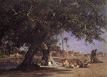
Shubra

Shoubra (Arabic: شبرا, IPA: [ˈʃobɾɑ]; Coptic: ϭⲱⲡⲣⲟ Šopro; also written Shubra or Shobra) is one of the largest districts of Cairo, Egypt and it is administratively divided into three areas: Shubra, Road El Farag, and Elsahel.
Etymology
Although Shoubra has been immensely large for the last few decades, the name originally derives from the Coptic word ϭⲱⲡⲣⲟ Šopro, which means a small village or field, as the area is well known for its rich fields that neighbour the Nile River. In Egypt, there are many neighborhoods, towns and villages that bear the name of Shubra, for example, the administrative region of Shoubra that is within the large district of Shubra, both of which are not to be confused with one of Qalyubia's industrial suburbs, Shubra El-Kheima. Of the less well-known areas — villages specifically — there are also several places that bear the name of Shoubra, such as the Shoubra Bekhoum village that is about 75 minutes away from Cairo.[1] However, these areas are quite distinguishable as the word "Shoubra" has come to include only a general meaning and does not fully describe all of these regions in a literal sense.
Early history

During the rule of Muhammad Ali of Egypt, Shubra was developed into a residential area after he built himself a palace in the area and extended Shubra street in 1808.[2]
Modern Shubra
The present-day area is now heavily populated, with an estimated three million residents. Most of them are Muslims, but there is also a large Christian population. Shubra has the highest concentration of Coptic Christians in Cairo.[3] There are several churches throughout the district's neighborhoods, such as the decades-old Church of St. Mary in Massarra and St. George, El-Geushi. Shubra is served by the Cairo Metro. There are a large number of mosques in Shubra. One of the most renowned mosques in Shubra is el Khazen Dar mosque, which is named after an occupation at the time of the Ottoman Empire. The palace of Muhammad Ali is the most renowned tourist attraction in Shubra, and cost more than 50 million Egyptian pounds to be restored.
Administrative regions
Due to the large population of the area of Shubra, it is divided into three administrative regions:
- Shubra (administrative region)
- Elsahel
- Road El Farag or Rhodhe روض : literally means garden which is in the Arabic translation of Rhodhe el farag
Notable residents
- In the 1940s and 1950s, Nazir Gayyed (before becoming Pope Shenouda III of Alexandria in 1971) was notable in serving the Coptic Orthodox communities in the district of Shubra, particularly Saint Antonious Church in Shubra.[4]
- Bishop Moussa, Bishop of Youth, attended and served the churches in Shubra before being a monk.
- Bishop Raphael, General Bishop of down town Cairo, attended and served the churches in Shubra before being a monk.
- Bishop Youssef, http://suscopts.org/diocese/bishop/, was also attending and serving Saint Antonious Church in Shubra, before joining St. Mary Monastery (EL-Sorian) as a monk.
- Father Raphael Ava Mina (candidate of the 2012 Papacy elections) used to live in Shubra (Gezerat Badran).
- The famous French-Egyptian-Italian singer Dalida was born in Shubra in 1933.[5]
References
- ^ Find Articles (Online). The Cairo Experiment — It Takes a Village. Accessed August 23, 2008.
- ^ Al Jazeera Talk, Al Jazeera. (in Arabic)
- ^ Ibrahim, Barbara (2003). Egypt: an economic geography. I.B.Tauris. p. 26. ISBN 978-1-86064-547-1.
- ^ St Takla Online. Biography of HH Pope Shenouda III. Accessed August 23, 2008.
- ^ Dalida, Foxy Tunes.


