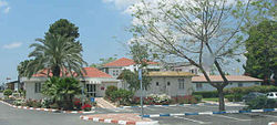
Bnei Shimon Regional Council
Bnei Shimon
מועצה אזורית בני שמעון مجلس إقليمي بني شمعون | |
|---|---|
Regional council (from 1951) | |
 | |
| District | Southern |
| Government | |
| • Head of Municipality | Sigal Moran |
| Area | |
| • Total | 394,120 dunams (394.12 km2 or 152.17 sq mi) |
| Population (2014) | |
| • Total | 8,500 |
| • Density | 22/km2 (56/sq mi) |
| Website | Official website |


The Bnei Shimon Regional Council (Hebrew: מועצה אזורית בני שמעון, Mo'atza Azorit Bnei Shim'on, lit. Regional Council 'Sons of Shimon'), is a regional council in the northern Negev in the south of Israel. Most of its territory lies north of Beersheba and the rest bounds Beersheba on the west and east sides as well. The eastern border of this territory straddles the Green Line. It is named after the tribe of Shimon which had been allotted this region according to the Book of Joshua (19:1-9).
There are 13 communities including seven kibbutzim, four moshavim, and two new rural towns. Four of the communities (three kibbutzim and one moshav) were established in the founding of the '11 points in the Negev' in 1946. The rest of the kibbutzim and moshavim were set up after the establishment of the State of Israel.
Settlements within the jurisdiction of the Bnei Shimon Regional Council
Kibbutzim
- Beit Kama (1949)
- Dvir
- Hatzerim (1946)
- Kramim
- Lahav
- Mishmar HaNegev (1946)
- Shoval (1946)
- Shomria (1985/2006) - former kibbutz that was modified for settlement of former Gush Katif refugees.
Moshavim
Community village
Institutions
The following institutions operate within the boundaries of the Bnei Shimon Regional Council:
- Adanim, a youth village
- Duda'im, a waste treatment centre, located on Route 25 near the HaNasi Junction
- Duda'im Environmental Protection Visitors Center
- Joe Alon Center, a Bedouin cultural museum
- Mevo'ot HaNegev, the regional high school, located in Shoval
- Nitzanei HaNegev Regional Elementary School, located in Beit Kama
External links
- Official website (Hebrew)
31°27′N 34°46′E / 31.450°N 34.767°E


