
Anniston, Alabama
Anniston, Alabama | |
|---|---|
| Nickname: The Model City | |
 Location in Alabama | |
| Country | United States |
| State | Alabama |
| County | Calhoun |
| Settled | April 1872 |
| Incorporated | 3 July 1883 |
| Government | |
| • Mayor | Hoyt W. “Chip” Howell, Jr. |
| Area | |
| • City | 45 sq mi (116.5 km2) |
| • Land | 45.4 sq mi (117.7 km2) |
| • Water | 0 sq mi (0.1 km2) |
| Elevation | 719 ft (219 m) |
| Population | |
| • City | 23,741 |
| • Density | 534.4/sq mi (203.8/km2) |
| • Metro | 112,240 |
| Time zone | UTC-6 (Central) |
| • Summer (DST) | UTC-5 (Central) |
| Website | www.ci.anniston.al.us |
Anniston is a city in Calhoun County in the state of Alabama, United States. As of the 2000 census, the population of the city is 24,276. According to the 2005 U.S. Census estimates, the city had a population of 23,741.[1] The city is the county seat of Calhoun County and one of two urban centers/principal cities of and included in the Anniston-Oxford Metropolitan Statistical Area.
Named the The Model City by Atlanta newspaperman Henry W. Grady for its careful planning, the city is situated on the slope of Blue Mountain, beginning point of the Blue Ridge region of the Appalachian Mountains.
History
Though the surrounding area was settled long before, it wasn't until the civil war until people recognized the untapped resources the area had to offer. During that time, the Confederacy established and operated an iron furnace near present day downtown Anniston, until the furnace was destroyed by the union troops in 1865.
After the war, many new planned towns were built in the region (ex. Birmingham) over the next decade for the sake of tapping into natural resources such as iron deposits. In 1872, the Woodstock Iron Company organized by Samuel Noble and Union Gen. Daniel Tyler (1799-1882), rebuilt a furnace on a much larger scale, as well as a planned community as well. Iron and steel manufacturing boomed in post Civil War central part of the state. Anniston, along with Birmingham 60 miles (100 km) west of town, became major new cities over night. Though it was not opened for general settlement until twelve years later, it was chartered as a city in 1879. The community name derives from Annie's Town, named for Annie Scott Tyler, wife of railroad president Alfred L. Tyler.
Though the roots of the city’s economy were in Iron and steel, planners pushed it as a health resort as well, attracting many hotels to set up shop, as well as establishing schools like The Noble Institute (a school for girls established in 1886) and the Alabama Presbyterian College for Men (founded in 1905). Planning and easy access to rail transportation helped make Anniston run as the fifth and sometimes even fourth largest city in the state from 1890's to 1950's.[2][3]
In 1917, the United States Army established a presence at Fort McClellan during the start of World War I. On the other side of town, the Anniston Army Depot opened in the World War II years as a major storage and maintenance site, a role it continues to serve. The old site of Fort McClellan was incorporated into Anniston some time after 1997.
Anniston has been a center of national controversy in the past. During the American civil rights movement, a group known as the Freedom Riders was riding an integrated bus in protest of segregation laws at the time in the south. One of the buses was fire-bombed near Anniston on Mother's Day Sunday May 14, 1961. The civil rights protesters inside were beaten by an angry mob from Anniston as they fled the burning bus. [citation needed] The site is now home to a marker along Alabama Highway 202 west about five miles west of downtown.[4]
With an industrial past, Anniston has gone through environmental issues related to the industries of the past and present as well. Anniston residents began class action suits against Monsanto during the early 2000s. Monsanto had knowingly dumped PCBs into the local water supply. The aftermath included poisoning surrounding groundwater, wildlife, and residents.
The Army closed the fort in 1999, as part of the Base Realignment and Closure round of 1995. The old Fort McClellan property is now being redeveloped for civilian use. The Anniston Eastern Bypass is under construction as of 2008, which will give the McClellan property quicker access to I-20.
In 2003, the Anniston Army Depot began the process of destroying nerve agents it had stored over the years. The incinerator was built to destroy the chemical weapons stockpile of Sarin and VX nerve agent and mustard blister agent stored at the depot. The depot, along with associated defense contractors, is now Anniston's largest employer.
Geography
Anniston is located at Coordinates: Unknown argument format
Invalid arguments have been passed to the {{#coordinates:}} function (33.663003, -85.826664)Template:GR.
According to the U.S. Census Bureau, the city has a total area of 45.5 square miles (117.7 km²), of which, 45.4 square miles (117.7 km²) of it is land and 0.04 square miles (0.1 km²) of it (0.07%) is water.
Government
Anniston is governed by Alabama's "weak mayor" form of city government. Four city council members are elected to represent the city's four wards, and the mayor is elected at-large. Day-to-day functions of city government are managed by the city manager, who is appointed by the mayor and city council.
Anniston is the county seat of Calhoun County, Alabama. Circuit and district courts for the county and the district attorney's office are located in the Calhoun County Courthouse at the corner of 11th Street and Gurnee Avenue. Other county administrative offices are in the Calhoun County Administrative Building at the corner of 17th and Noble streets.
A United States Courthouse, part of the U.S. Alabama Northern District Court, is located at the corner of 12th and Noble streets.
People and culture
Demographics
As of the censusTemplate:GR of 2000, there were 24,276 people, 10,447 households, and 6,414 families residing in the city. The population density was 534.4 people per square mile (206.3/km²). There were 12,787 housing units at an average density of 281.5/sq mi (108.7/km²). The racial makeup of the city was 48.71% White, 48.69% Black or African American, 0.27% Native American, 0.78% Asian, 0.07% Pacific Islander, 0.61% from other races, and 0.86% from two or more races. 1.68% of the population were Hispanic or Latino of any race.
There were 10,447 households out of which 24.3% had children under the age of 18 living with them, 38.0% were married couples living together, 20.0% had a female householder with no husband present, and 38.6% were non-families. 34.8% of all households were made up of individuals and 15.6% had someone living alone who was 65 years of age or older. The average household size was 2.26 and the average family size was 2.91.
In the city the population was spread out with 23.6% under the age of 18, 8.7% from 18 to 24, 25.7% from 25 to 44, 23.3% from 45 to 64, and 18.7% who were 65 years of age or older. The median age was 39 years. For every 100 females there were 83.9 males. For every 100 females age 18 and over, there were 78.5 males.
The median income for a household in the city was $27,385, and the median income for a family was $36,067. Males had a median income of $31,429 versus $21,614 for females. The per capita income for the city was $18,769. About 20.1% of families and 22.8% of the population were below the poverty line, including 35.2% of those under age 18 and 16.2% of those age 65 or over.
Culture, events, and attractions
Anniston long has served as a cultural center for northeastern Alabama. The Alabama Shakespeare Festival was founded in the city in 1972 before moving to Montgomery in 1985. The Knox Concert Series regularly brings world-renowned musical and dance productions to the area. The city also is home to the Anniston Museum of Natural History and the Berman Museum of World History. The Alabama Symphony Orchestra since 2004 has performed a summer series of outdoor concerts, Music at McClellan, in Anniston at the former Fort McClellan. Organizers have said they hope to make the concerts the center of an arts community at the closed army base.
The city has many examples of Victorian-style homes, some of which have been restored or preserved. Many others have been destroyed or are in dilapidated conditions. Several of the city’s churches are architecturally significant or historic, including the Church of St. Michael and All Angels, Grace Episcopal Church, and Parker Memorial Baptist Church. Temple Beth EL, dedicated in 1893, has the oldest building in the state continuously and currently being used for Jewish worship.
After decades of decay, Noble Street, is seeing a rebirth as a downtown shopping and dining district in the heart of downtown. There are several large shopping centers in the area as well, such as the Quintard Mall and the Oxford Exchange, both located just outside town in Oxford.
Restaurants
Anniston is home to many restaurants ranging from American, Italian, Greek, Cajun, Mexican, and Chinese cuisines, as well as Barbecue and Southern flavored cuisines. Many locally owned dining establishments are located in the downtown CBD (along Noble Street and Quintard Ave.), as well as Buckner Circle (McClellan), Lenlock, the south Quintard area, and the Golden Springs area.
Media
Anniston is served by one daily newspaper, The Anniston Star, which also covers and is delivered to communities in the surrounding five-county region. Commercial radio stations with broadcast facilities in the city include WHMA 95.5-FM, WHMA 1390-AM and WDNG 1450-AM. There are other in Oxford and Jacksonvile as well.
Television station with broadcast facilities - WJXS-TV, is the only station that directly broadcasts from Anniston (area), but many Birmingham stations as have towers and news bureaus here, such as WJSU-TV (WJSU is a local broadcast station for Birmingham-based ABC 33/40), WBRC-TV (FOX), and WVTM-TV (NBC).
Anniston is a part of the Birmingham-Anniston-Tuscaloosa designated market area when it comes to television. Radio stations are divided up into three sub markets within that market, where Anniston is in the Anniston-Gadsden-Talladega radio sub market.
Transportation
The Anniston Metropolitan Airport is a general aviation facility, south of the city proper, in Oxford. Its single asphalt runway is 7,000 feet (2,100 m) long and 150 feet (46 m) wide.
Amtrak's Crescent train connects Anniston with the cities of New York, Philadelphia, Baltimore, Washington, Charlotte, Atlanta, Birmingham and New Orleans. The Amtrak station is situated at the Southern Railway Depot (which was built in 1926), located at 126 West 4th Street. The city purchased the station in 2001 for $430,000 from federal grants for the restoration, in hopes of turning the building into a multi modal transportation hub for the city. It will be served by Amtrak (train), Greyhound (bus), and local taxi and bus services if all goes as planned.
Street and Highways
- Noble Street runs through downtown, lined with office buildings, specialty shops and restaurants. A major revitalization effort in 2003 made this street more pedestrian friendly. The old four lane thoroughfare was gutted, and turn-of-the-century trolley tracks were removed to help resurface the street. The road was converted to two lane traffic with wider sidewalks.
- Quintard Avenue runs parallel two blocks east of Noble Street. It serves as the main north/south traffic corridor for Anniston. The road is six lanes from East P street to 18th Street, the rest four lanes. It connects central Oxford to the south and Jacksonville, Gadsden, and the McClellan area of Anniston to the north. Traffic is relatively heavy on this road around downtown and in Oxford as well. Since the early 90’s, bypasses have been planned on both sides of town to alleviate traffic.
- The Western Bypass runs from I-20 in Oxford (the Coldwater exit) and runs north into the present AL 202. It is five lanes wide (handling Anniston Army Depot traffic). Future plans will extend it on the present County road 109 by widening it to connect with US 431.
- The Eastern Bypass will run from McIntosh Road (in southeast Oxford) across I-20 following the Golden Springs Road route and cross the Choccolocco Foothills cutting back into 431 where it hits into AL route on McClellan Blvd. It is complete from McIntosh Road to Choccolocco Road (five lanes), but the northern portion, which is to be built at interstate grade with three interchanges, is still under construction. Much development has been the result of this highway in the past decade along I-20 in Oxford and many see it as a way to redevelop McClellan as well as north Anniston.
Military
Anniston is home to the United States Army's Anniston Army Depot which is used for the maintenance of most Army tracked vehicles. The depot houses a major chemical weapons storage facility, the Anniston Chemical Activity, and a program to destroy those weapons, the Anniston Chemical Agent Disposal Facility. Fort McClellan, former site of the U.S. Army Military Police Training Academy and Chemical Warfare training center, was de-commissioned in the 1990s. A portion of the former fort is now home to the Alabama National Guard Training Center. Another 9000 acres (36 km²) of the fort were set aside for the Mountain Longleaf National Wildlife Refuge in 2003. The Department of Homeland Security also uses a portion of the de-commissioned fort for training and fieldwork.
Education
Public schools in Anniston are operated by Anniston City Schools. There is also a public, four-year institution of higher learning, Jacksonville State University, located in nearby Jacksonville, Alabama. Anniston is also home to some satellite campuses of Gadsden State Community College at the former Fort McClellan and the Ayers campus in southern Anniston. There are also some private schools in Anniston. These include a Christian school called Faith Christian, a Catholic school at the former Fort McClellan called Sacred Heart, and a K-12 college prep school called The Donoho School.
Notable Residents and Former Residents
- George T. Anderson, Civil War general.
- Michael Biehn, actor
- Anne Braden, Civil Rights activist
- Red Byron, NASCAR driver
- Asa Earl Carter, Segregationist, speechwriter, and author of The Education of Little Tree
- Quinton Caver, American NFL football player
- B. B. Comer, Governor of Alabama.
- Louie Crew, gay rights activist and college professor.
- Michael Curry, NBA player
- Cow Cow Davenport, Boogie-woogie pianist
- Eric Davis, NFL cornerback.
- William Levi Dawson, (b. 23 September 1899), composer of Negro Folk Symphony.
- Bobby Edwards, country singer
- Kevin Greene, retired American NFL football player
- Thomas Kilby, Governor of Alabama.
- Perry Lentz, author and professor of English
- Lucky Millinder, Rhythm and blues and swing bandleader and singer.
- Will Owsley, singer-songwriter.
- John L. Pennington, Newspaper publisher, governor of Dakota Territory.
- Patrick J. Que Smith, Grammy winning songwriter
- David Satcher, former Surgeon General
- Vaughn Stewart, former NFL football player.
References
- This article incorporates text from a publication now in the public domain: Chisholm, Hugh, ed. (1911). Encyclopædia Britannica (11th ed.). Cambridge University Press.
{{cite encyclopedia}}: Missing or empty|title=(help) - The Model City of the New South: Anniston, Alabama 1872-1900, Grace Hooten Gates, Tuscaloosa: University of Alabama Press, 1996.
- ^ a b "Annual Estimates of the Population for All Incorporated Places in Alabama" (CSV). 2005 Population Estimates. U.S. Census Bureau, Population Division. June 21 2006.
{{cite web}}: Check date values in:|year=(help); Cite has empty unknown parameter:|footnotes=(help); Unknown parameter|accessmonthday=ignored (help); Unknown parameter|accessyear=ignored (|access-date=suggested) (help); Unknown parameter|area_code=ignored (help); Unknown parameter|blank1_info=ignored (help); Unknown parameter|blank1_name=ignored (help); Unknown parameter|blank_info=ignored (help); Unknown parameter|blank_name=ignored (help); Unknown parameter|postal_code=ignored (help); Unknown parameter|postal_code_type=ignored (help); Unknown parameter|timezone=ignored (help); Unknown parameter|timezone_DST=ignored (help); Unknown parameter|utc_offset=ignored (help); Unknown parameter|utc_offset_DST=ignored (help)CS1 maint: year (link) - ^ unter population, Anniston ranks fourth http://encyclopedia.jrank.org/AJA_ALL/ALABAMA.html
- ^ 1913 pop.est. http://www.catholic.org/encyclopedia/view.php?id=366
- ^ JSU News Wire
External links
Municipalities and communities of Calhoun County, Alabama, United States | ||
|---|---|---|
| Cities | 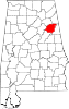 | |
| Towns | ||
| CDPs | ||
| Unincorporated communities | ||
| Ghost town | ||
| Footnotes | ‡This populated place also has portions in an adjacent county or counties | |