Beenkeragh
Appearance
| Beenkeragh (Binn Chaorach) | |
|---|---|
 | |
| Highest point | |
| Elevation | 1,008.2 m (3,308 ft)[1] |
| Prominence | 92 m (302 ft)[1] |
| Listing | Furth, Hewitt |
| Coordinates | 52°00′24″N 9°44′47″W / 52.0068°N 9.7463°W |
| Geography | |
| Parent range | MacGillycuddy's Reeks |
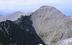
Beenkeragh or Benkeeragh (Irish: Binn Chaorach, meaning 'peak/mountain of the sheep') is the second-highest mountain peak in Ireland, at 1,008.2 metres (3,308 ft) high (Some sources cite 1,010 m).
Geography
It lies to the north of Carrauntoohil (Ireland's highest peak) in the MacGillycuddy's Reeks of County Kerry. Beenkeragh is joined to Carrauntoohil by a narrow ridge called The Bones. It is counted by the Scottish Mountaineering Club as a Furth; a 3,000 ft high peak outside Scotland.[2]
See also
References
- ^ a b Beenkeragh at mountainviews.ie. Accessed on 19 Feb 2013.
- ^ Mountains - Key Facts. The Munros, Corbetts, Grahams, Donalds & Furths at www.smc.org.uk. Accessed on 2 Feb 2013.


