
Big Rock, Illinois
Big Rock | |
|---|---|
 Gazebo in downtown Big Rock | |
 Location of Big Rock in Kane County, Illinois. | |
.svg) Location of Illinois in the United States | |
| Coordinates: 41°45′50″N 88°32′49″W / 41.76389°N 88.54694°W | |
| Country | United States |
| State | Illinois |
| County | Kane |
| Government | |
| Area | |
• Total | 4.32 sq mi (11.18 km2) |
| • Land | 4.32 sq mi (11.18 km2) |
| • Water | 0.00 sq mi (0.00 km2) |
| Population (2010) | |
• Total | 1,126 |
• Estimate (2016)[2] | 1,157 |
| • Density | 268.13/sq mi (103.53/km2) |
| Time zone | UTC-6 (CST) |
| • Summer (DST) | UTC-5 (CDT) |
| Area code | 630 |
| FIPS code | 17-05976 |
| Website | www |
Big Rock is a village in Kane County, Illinois, United States. It is located approximately 50 miles due west of Chicago. It is between the villages of Hinckley and Sugar Grove.
As of the 2000 census, the village had a total population of 658, although it only became incorporated in July 26, 2001.
Geography
Big Rock is located at 41.759308 N, 88.537617 W.[3]
According to the 2010 census, Big Rock has a total area of 4.33 square miles (11.21 km2), all land.[4]
Demographics
This section needs expansion. You can help by adding to it. (July 2015) |
| Census | Pop. | Note | %± |
|---|---|---|---|
| 2010 | 1,126 | — | |
| 2016 (est.) | 1,157 | [2] | 2.8% |
| U.S. Decennial Census[5] | |||
Education
Big Rock Township is a part of the Hinckley-Big Rock CUSD 429.
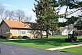
Images
-
 Big Rock Post Office
 -
 Big Rock grain elevator
 -
 downtown Big Rock
 -
 Big Rock town hall


See also
External links
- Official Village of Big Rock website
- Big Rock Forest Preserve
- Big Rock Park District
- Hinckley-Big Rock CUSD 429
References
- ^ "2016 U.S. Gazetteer Files". United States Census Bureau. Retrieved Jun 29, 2017.
- ^ a b "Population and Housing Unit Estimates". Retrieved June 9, 2017.
- ^ "US Gazetteer files: 2010, 2000, and 1990". United States Census Bureau. 2011-02-12. Retrieved 2011-04-23.
- ^ "G001 - Geographic Identifiers - 2010 Census Summary File 1". United States Census Bureau. Retrieved 2015-08-02.
- ^ "Census of Population and Housing". Census.gov. Archived from the original on May 12, 2015. Retrieved June 4, 2015.
{{cite web}}: Unknown parameter|deadurl=ignored (|url-status=suggested) (help)
41°45′50″N 88°32′49″W / 41.76389°N 88.54694°W
Municipalities and communities of Kane County, Illinois, United States | ||
|---|---|---|
| Cities |  | |
| Villages | ||
| Townships | ||
| CDP | ||
| Other unincorporated communities | ||
| Footnotes | ‡This populated place also has portions in an adjacent county or counties | |