
Burt County, Nebraska
Burt County | |
|---|---|
 Location within the U.S. state of Nebraska | |
 Nebraska's location within the U.S. | |
| Coordinates: 41°51′N 96°19′W / 41.85°N 96.32°W | |
| Country | |
| State | |
| Founded | 1854 |
| Seat | Tekamah |
| Largest city | Tekamah |
| Area | |
• Total | 497 sq mi (1,290 km2) |
| • Land | 493 sq mi (1,280 km2) |
| • Water | 4 sq mi (10 km2) 0.87% |
| Population (2000) | |
• Total | 7,791 |
| • Density | 20/sq mi (6/km2) |
| Website | www |
Burt County is a county located in the U.S. state of Nebraska. As of 2000, the population was 7,791. Its county seat is TekamahTemplate:GR.
In the Nebraska license plate system, Burt County is represented by the prefix 31 (it had the thirty-first-largest number of vehicles registered in the county when the license plate system was established in 1922).
Geography
According to the U.S. Census Bureau, the county has a total area of 497 square miles (1,287 km²), of which, 493 square miles (1,276 km²) of it is land and 4 square miles (11 km²) of it (0.87%) is water.
Adjacent counties
- Thurston County, Nebraska - north
- Monona County, Iowa - northeast
- Harrison County, Iowa - southeast
- Washington County, Nebraska - south
- Dodge County, Nebraska - southwest
- Cuming County, Nebraska - west
Places adjacent to Burt County, Nebraska | ||||||||||||||||
|---|---|---|---|---|---|---|---|---|---|---|---|---|---|---|---|---|
| ||||||||||||||||
History
Burt County was formed in 1854. It was named after Francis Burt, a governor of this territory.[1]
Demographics
| Burt County Population by decade | |
|
1860 - 388 | |
As of the censusTemplate:GR of 2000, there were 7,791 people, 3,155 households, and 2,240 families residing in the county. The population density was 16 people per square mile (6/km²). There were 3,723 housing units at an average density of 8 per square mile (3/km²). The racial makeup of the county was 97.63% White, 0.18% Black or African American, 1.07% Native American, 0.19% Asian, 0.03% Pacific Islander, 0.22% from other races, and 0.69% from two or more races. 1.26% of the population were Hispanic or Latino of any race. 33.7% were of German, 13.9% Swedish, 10.1% Irish, 8.8% American, 7.0% English and 5.4% Danish ancestry according to Census 2000.
There were 3,155 households out of which 29.50% had children under the age of 18 living with them, 61.30% were married couples living together, 6.20% had a female householder with no husband present, and 29.00% were non-families. 26.50% of all households were made up of individuals and 15.60% had someone living alone who was 65 years of age or older. The average household size was 2.43 and the average family size was 2.93.
In the county the population was spread out with 25.70% under the age of 18, 5.40% from 18 to 24, 23.40% from 25 to 44, 23.80% from 45 to 64, and 21.80% who were 65 years of age or older. The median age was 42 years. For every 100 females there were 93.80 males. For every 100 females age 18 and over, there were 91.80 males.
The median income for a household in the county was $33,954, and the median income for a family was $40,515. Males had a median income of $28,750 versus $20,663 for females. The per capita income for the county was $16,654. About 6.60% of families and 8.90% of the population were below the poverty line, including 11.80% of those under age 18 and 8.30% of those age 65 or over.
Cities and villages
Townships
- Arizona
- Bell Creek
- Craig
- Decatur
- Everett
- Logan
- Oakland (township)
- Pershing
- Quinnebaugh
- Riverside
- Silver Creek
- Summit
- Tekamah, City of
References
Municipalities and communities of Burt County, Nebraska, United States | ||
|---|---|---|
| Cities | 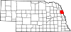 | |
| Villages | ||
| Unincorporated communities | ||
| Townships | ||
| Indian reservations | ||
| Ghost towns | ||
| Footnotes | ‡This populated place also has portions in an adjacent county or counties | |