Cassville, New Jersey
Cassville, New Jersey | |
|---|---|
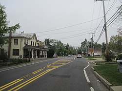
 Approaching the center of Cassville on eastbound CR 571 | |
| Coordinates: 40°6′16″N 74°23′12″W / 40.10444°N 74.38667°W | |
| Country | |
| State | |
| County | Ocean |
| Township | Jackson |
| Elevation | 44 m (144 ft) |
| Time zone | UTC-6 (Eastern (EST)) |
| • Summer (DST) | UTC-5 (CDT) |
Cassville (also Downsville, Goshen, Jackson) is an unincorporated community in Jackson Township, in Ocean County, New Jersey, United States.[1][2] Located at the intersection of County Routes 528 and 571, the community is made up of residential homes lining surrounding roads with small businesses located along the main roads.[3] The area is a part of the New Jersey Pine Barrens.
References
- ^ "Cassville, New Jersey". Geographic Names Information System. United States Geological Survey, United States Department of the Interior.
- ^ Locality Search, State of New Jersey. Accessed June 9, 2016.
- ^ Google (May 17, 2015). "Aerial view of Cassville" (Map). Google Maps. Google. Retrieved May 17, 2015.


