Doncaster Power Station
Appearance
This article needs additional citations for verification. (March 2009) |
| Doncaster Power Station | |
|---|---|
 Doncaster power station in 1957 | |
 | |
| Official name | Doncaster power station |
| Country | England |
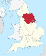
| Location | South Yorkshire |
| Coordinates | 53°31′27″N 1°08′46″W / 53.5242°N 1.1462°W |
| Commission date | 1953 |
| Decommission date | 1983 |
| Operator | Central Electricity Generating Board |
| Thermal power station | |
| Primary fuel | Coal |
| Power generation | |
| Nameplate capacity | 122 MW |
| External links | |
| Commons | Related media on Commons |
grid reference SE567034 | |
Doncaster Power Station was a coal-fired power station situated in the centre of Doncaster in South Yorkshire, England. It was located on Crimpsall Island, surrounded by the River Don and the Sheffield and South Yorkshire Navigation (S&SYN). It opened in 1953[1] and received significant quantities of its coal by boat, to its own staithe, using the S&SYN. It closed on 31 October 1983 and had a generating capacity of 122 MW.[2] HM Prison Doncaster, a private prison, has been built on the power station's site.
References
- ^ "Power station opens today". Yorkshire Evening Post. 28 September 1953. p. 7. Retrieved 22 March 2015 – via British Newspaper Archive. (subscription required)
- ^ Mr. Redmond (16 January 1984). "Coal-fired Power Stations". Hansard. Retrieved 1 September 2009.

