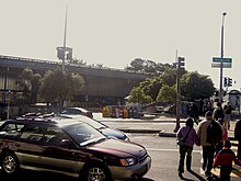
Glen Park, San Francisco
Glen Park | |
|---|---|
| Coordinates: 37°44′02″N 122°26′00″W / 37.73389°N 122.43333°W | |
| Country | |
| State | |
| City-county | San Francisco |
| Government | |
| • Supervisor | Jeff Sheehy[1] |
| • Assemblymember | Matt Haney (D)[2] |
| • State Senator | Scott Wiener (D)[2] |
| • U. S. Rep. | Barbara Lee (D)[3] |
| Area | |
| • Total | 1.26 km2 (0.485 sq mi) |
| • Land | 1.26 km2 (0.485 sq mi) |
| Population (2008)[5] | |
| • Total | 6,979 |
| • Density | 5,559/km2 (14,397/sq mi) |
| ZIP Code | 94131 |
| Area codes | 415/628 |
Glen Park is a small, primarily residential neighborhood in San Francisco, California, named for the adjacent Glen Canyon Park.
Geography

The neighborhood is nestled at the southeastern edge of San Francisco's central hills, the San Miguel Range. It includes the easternmost peak in that range, known as Fairmount Heights or Billy Goat Hill, as well as the south and east slopes. The neighborhood's streets follow the hill's contours down to a small commercial district ("downtown Glen Park") at the intersection of Chenery and Diamond streets.
As defined by the San Francisco Planning Department, the neighborhood borders Diamond Heights to the northwest, along Diamond Heights Boulevard; Noe Valley to the north, along 30th Street; Bernal Heights to the east, along San Jose Avenue; and Outer Mission to the south, along Bosworth Street. (The San Francisco Association of Realtors draws a wider southwestern boundary and calls the adjacent neighborhood Sunnyside.)
To the west, the ravine at Glen Canyon Park is the source of upper Islais Creek, which historically flowed through the Glen Park neighborhood (parallel to Chenery and Bosworth) on its way to the San Francisco Bay. It is currently buried in an underground culvert, although organizations such as the San Francisco Planning and Urban Research Association have proposed to daylight it.
History and characteristics
Glen Park developed as a streetcar suburb beginning in the 1890s, after the San Francisco and San Mateo Electric Railway opened access to southern areas of the city. Transit was improved further in 1916, when the SF & SM was acquired by the San Francisco Municipal Railway. A branch of the San Francisco Public Library opened in 1927. Today, transit is provided by the Glen Park BART station, the J Church line of the Muni Metro, and several Muni bus lines. Interstate 280 is also nearby.
Because of Glen Park's small size and mom and pop businesses, the neighborhood is sometimes described as having a village atmosphere. [citation needed] A multi-use, urban infill project opened in 2006, anchored by a natural foods grocery and a new branch library.[6] Public spaces include Walter Haas Playground, Billy Goat Hill Park, and Fairmont Plaza.
See also
References
- ^ "AIDS activist Sheehy to succeed Wiener as SF supervisor". SF Chronicle. Retrieved May 11, 2017.
- ^ a b "Statewide Database". UC Regents. Retrieved December 29, 2014.
- ^ "California's 12th Congressional District - Representatives & District Map". Civic Impulse, LLC.
- ^ [1]
- ^ [2]
- ^ [3]
- Demographics: "District 8: Under the rainbow" by Betsey Culp. San Francisco Call, 25 September 2000. [4]
External links
- Glen Park: The Architecture and Social History
- Glen Park Community Plan San Francisco Planning Dept. page
- Glen Park Association Volunteer community group
- Glen Park Neighborhoods History Project


