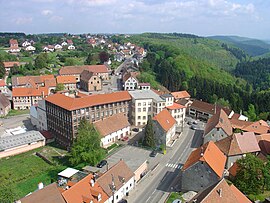
Goetzenbruck
Appearance
Goetzenbruck | |
|---|---|
 A general view of Goetzenbruck | |
| Coordinates: 48°58′41″N 7°22′50″E / 48.9781°N 7.3806°E | |
| Country | France |
| Region | Grand Est |
| Department | Moselle |
| Arrondissement | Sarreguemines |
| Canton | Bitche |
| Intercommunality | Pays de Bitche |
| Government | |
| • Mayor (2008–2020) | Joël Romang |
| Area 1 | 8.12 km2 (3.14 sq mi) |
| Population (2013) | 1,608 |
| • Density | 200/km2 (510/sq mi) |
| Time zone | UTC+01:00 (CET) |
| • Summer (DST) | UTC+02:00 (CEST) |
| INSEE/Postal code | 57250 /57620 |
| Elevation | 260–432 m (853–1,417 ft) (avg. 386 m or 1,266 ft) |
| 1 French Land Register data, which excludes lakes, ponds, glaciers > 1 km2 (0.386 sq mi or 247 acres) and river estuaries. | |
Goetzenbruck or Gœtzenbruck (Template:Lang-de, Lorraine Franconian: Getzebrikk) is a commune in the Moselle department of the Grand Est administrative region in north-eastern France.
The village belongs to the Pays de Bitche and to the Northern Vosges Regional Nature Park. As of the 2013 France census, the village's population is 1,608. The inhabitants of the commune are known as Goetzenbruckois and Goetzenbruckoises.
The present municipality of Goetzenbruck was originally divided into three municipalities. They underwent several changes before the two remaining municipalities of Goetzenbruck and Sarreinsberg merged in 1947 (the latter had already merged with the third municipality, Althorn, back in 1837).
See also
Wikimedia Commons has media related to Goetzenbruck.


