Istrana Air Base
Appearance
Istrana Air Base | |||||||||||
|---|---|---|---|---|---|---|---|---|---|---|---|
| Summary | |||||||||||
| Airport type | Military | ||||||||||
| Location | Treviso | ||||||||||
| Elevation AMSL | 137 ft / 42 m | ||||||||||
| Coordinates | 45°41′06″N 012°04′59″E / 45.68500°N 12.08306°E | ||||||||||
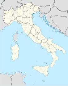
| Map | |||||||||||
 | |||||||||||
| Runways | |||||||||||
| |||||||||||
Sources: World Aero Data[1] | |||||||||||
Istrana Air Base (ICAO: LIPS) is a military airport located in Treviso, Veneto, Italy. It is home to the Italian Air Force's 51º Stormo Ferruccio, consisting of 103º and 132º Gruppo flying the AMX and 651ª Squadriglia Collegamenti with the AB.212 and the Aermacchi MB-339.
See also
References
External links
- Airport information for Istrana Airport at Great Circle Mapper. Source: DAFIF (effective October 2006).

