
Klickitat County, Washington
Klickitat County | |
|---|---|
 Klickitat County Courthouse | |
 Location within the U.S. state of Washington | |
 Washington's location within the U.S. | |
| Coordinates: 45°52′N 120°47′W / 45.87°N 120.79°W | |
| Country | |
| State | |
| Founded | December 20, 1859 |
| Named for | Klickitat Tribe |
| Seat | Goldendale |
| Largest city | Goldendale |
| Area | |
| • Total | 1,904 sq mi (4,930 km2) |
| • Land | 1,871 sq mi (4,850 km2) |
| • Water | 33 sq mi (90 km2) 1.7% |
| Population | |
| • Estimate (2014) | 20,861 |
| • Density | 11/sq mi (4/km2) |
| Time zone | UTC−8 (Pacific) |
| • Summer (DST) | UTC−7 (PDT) |
| Congressional district | 3rd |
| Website | www |
Klickitat County is a county located in the U.S. state of Washington. As of the 2010 census, the population was 20,318.[1] The county seat and largest city is Goldendale.[2] The county is named after the Klickitat tribe of the Yakama Native Americans.
History

Klickitat County was created out of Walla Walla County on December 20, 1859.[3] Samuel Hill was an early promoter of the area, promoting better roads and building local landmarks such as a war memorial replica of Stonehenge (Maryhill Stonehenge) and a mansion that would become the Maryhill Museum of Art. The Sam Hill Memorial Bridge across the Columbia River is named after him.
Geography

According to the U.S. Census Bureau, the county has a total area of 1,904 square miles (4,930 km2), of which 1,871 square miles (4,850 km2) is land and 33 square miles (85 km2) (1.7%) is water.[4]
Geographic features
Major highways
Adjacent counties
- Yakima County - north
- Benton County - northeast
- Morrow County, Oregon - southeast
- Gilliam County, Oregon - southeast
- Sherman County, Oregon - south
- Hood River County, Oregon - southwest
- Wasco County, Oregon - southwest
- Skamania County - west
National protected areas
Demographics
| Census | Pop. | Note | %± |
|---|---|---|---|
| 1860 | 230 | — | |
| 1870 | 329 | 43.0% | |
| 1880 | 4,055 | 1,132.5% | |
| 1890 | 5,167 | 27.4% | |
| 1900 | 6,407 | 24.0% | |
| 1910 | 10,180 | 58.9% | |
| 1920 | 9,268 | −9.0% | |
| 1930 | 9,825 | 6.0% | |
| 1940 | 11,357 | 15.6% | |
| 1950 | 12,049 | 6.1% | |
| 1960 | 13,455 | 11.7% | |
| 1970 | 12,138 | −9.8% | |
| 1980 | 15,822 | 30.4% | |
| 1990 | 16,616 | 5.0% | |
| 2000 | 19,161 | 15.3% | |
| 2010 | 20,318 | 6.0% | |
| 2014 (est.) | 20,861 | [5] | 2.7% |
| U.S. Decennial Census[6] 1790-1960[7] 1900-1990[8] 1990-2000[9] 2010-2014[1] | |||
As of the census[10] of 2000, there were 19,161 people, 7,473 households, and 5,305 families residing in the county. The population density was 10 people per square mile (4/km²). There were 8,633 housing units at an average density of 5 per square mile (2/km²). The racial makeup of the county was 87.56% White, 0.27% Black or African American, 3.47% Native American, 0.73% Asian, 0.21% Pacific Islander, 5.02% from other races, and 2.75% from two or more races. 7.81% of the population were Hispanics or Latinos of any race. 17.7% were of German, 14.0% United States or American, 11.1% English and 9.6% Irish ancestry. 90.3% spoke English and 7.8% Spanish as their first language.
There were 7,473 households out of which 32.30% had children under the age of 18 living with them, 57.70% were married couples living together, 9.10% had a female householder with no husband present, and 29.00% were non-families. 23.80% of all households were made up of individuals and 9.00% had someone living alone who was 65 years of age or older. The average household size was 2.54 and the average family size was 2.99.
The age distribution was 27.10% under the age of 18, 6.50% from 18 to 24, 25.70% from 25 to 44, 27.00% from 45 to 64, and 13.80% who were 65 years of age or older. The median age was 40 years. For every 100 females there were 99.50 males. For every 100 females age 18 and over, there were 98.80 males.
The median income for a household in the county was $34,267, and the median income for a family was $40,414. Males had a median income of $36,067 versus $21,922 for females. The per capita income for the county was $16,502. About 12.60% of families and 17.00% of the population were below the poverty line, including 22.50% of those under age 18 and 15.10% of those age 65 or over.
Government and politics
This section needs expansion. You can help by adding to it. (February 2009) |
Klickitat is located in Washington's 3rd congressional district, which has a Cook Partisan Voting Index of R+2 and has been represented by Republican Jaime Herrera Beutler since 2012. In state government the county is part of the fifteenth district so is represented by representative Bruce Chandler (R) in the Washington House of Representatives and Jim Honeyford (R) in the Washington State Senate.[11]
In Presidential elections Klickitat is something of a "swing county." In 1988 Michael Dukakis narrowly won the county with 49.15% of the vote.[12] Richard Nixon (1960, 1972), Ronald Reagan,[13] Bill Clinton, and George W. Bush[14] all won the county twice. In 2008 Democrat Barack Obama won Klickitat County over Republican John McCain by only 21 votes or percentage wise 48.85% to 48.64%. In 2012 Republican candidate Mitt Romney won the county by a greater margin than in the previous election. He won the county with 51.74% of the vote compared to President Obamas 44.75%.[15]
Communities

Cities
- Bingen
- Goldendale (county seat)
- White Salmon
Census-designated places
Unincorporated communities
See also
References
- ^ a b "State & County QuickFacts". United States Census Bureau. Retrieved January 7, 2014.
- ^ "Find a County". National Association of Counties. Retrieved 2011-06-07.
- ^ "Milestones for Washington State History — Part 2: 1851 to 1900". HistoryLink.org. March 6, 2003.
- ^ "2010 Census Gazetteer Files". United States Census Bureau. August 22, 2012. Retrieved July 7, 2015.
- ^ "Annual Estimates of the Resident Population for Incorporated Places: April 1, 2010 to July 1, 2014". Retrieved June 4, 2015.
- ^ "U.S. Decennial Census". United States Census Bureau. Retrieved January 7, 2014.
- ^ "Historical Census Browser". University of Virginia Library. Retrieved January 7, 2014.
- ^ "Population of Counties by Decennial Census: 1900 to 1990". United States Census Bureau. Retrieved January 7, 2014.
- ^ "Census 2000 PHC-T-4. Ranking Tables for Counties: 1990 and 2000" (PDF). United States Census Bureau. Retrieved January 7, 2014.
- ^ "American FactFinder". United States Census Bureau. Retrieved 2011-05-14.
- ^ "Page Not Found". wa.gov.
{{cite web}}: Cite uses generic title (help) - ^ "1988 Presidential Election Statistics". uselectionatlas.org.
- ^ "Dave Leip's Atlas of U.S. Presidential Elections - Compare Maps". uselectionatlas.org.
- ^ The New York Times Electoral Map (Zoom in on Washington)
- ^ "Dave Leip's Atlas of U.S. Presidential Elections - State Data". uselectionatlas.org.
External links
- Official County website
- Klickitat County, Washington at HistoryLink.org
Places adjacent to Klickitat County, Washington | ||||||||||||||||
|---|---|---|---|---|---|---|---|---|---|---|---|---|---|---|---|---|
| ||||||||||||||||
Municipalities and communities of Klickitat County, Washington, United States | ||
|---|---|---|
| Cities | 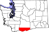 | |
| CDPs | ||
| Unincorporated communities | ||
| Ghost towns | ||
| Indian reservation | ||
| Footnotes | ‡This populated place also has portions in an adjacent county or counties | |