Jump to content

Nagothane railway station

Coordinates: 18°32′24″N 73°08′28″E / 18.540°N 73.141°E / 18.540; 73.141
From Wikipedia, the free encyclopedia

This is an old revision of this page, as edited by Mackensen (talk | contribs) at 16:26, 1 May 2018 (remove infobox rdt). The present address (URL) is a permanent link to this revision, which may differ significantly from the current revision.

Nagothane
General information
Coordinates18°32′24″N 73°08′28″E / 18.540°N 73.141°E / 18.540; 73.141
Owned byIndian Railway
Line(s)Panvel - Roha line
Other information
Station codeNGTN
Fare zoneCentral Railway
History
ElectrifiedNo
Services
Preceding station  
MSR
  Following station
Template:Mumbai Suburban Railway lines
Vasai Road-Roha line
Location
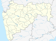
Nagothane is located in Maharashtra
Nagothane
Nagothane
Location within Maharashtra

Nagothane railway station is a railway station on the Panvel - Roha route of Central Railway. It is at a distance of 130.91 km from Chhatrapati Shivaji Terminus via Diva junction. Its station code is NGTN. It belongs to the Mumbai division of Central Railway.[1]

The station is situated in Raigad district, of Maharashtra an Indian state. It is situated between Kasu and Nidi railway stations.[1]

References

  1. ^ a b "Central Railway Mumbai Division System Map". Central Railway. 1 April 2010. Retrieved 4 May 2013.