From Wikipedia, the free encyclopedia
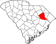
Location of Florence County in South Carolina This is a list of the National Register of Historic Places listings in Florence County, South Carolina .
This is intended to be a complete list of the properties and districts on the National Register of Historic Places in Florence County , South Carolina , United States . The locations of National Register properties and districts for which the latitude and longitude coordinates are included below, may be seen in a map.[1]
There are 23 properties and districts listed on the National Register in the county, including 1 National Historic Landmark .
This National Park Service list is complete through NPS recent listings posted May 10, 2024. [2]
Current listings
[3] Name on the Register[4]
Image
Date listed[5]
Location
City or town
Description
1
W.T. Askins House Upload image May 26, 1995 (#95000636 ) 178 S. Acline Ave. 33°52′11″N 79°45′22″W / 33.869722°N 79.756111°W / 33.869722; -79.756111 (W.T. Askins House ) Lake City
2
Blooming Grove Blooming Grove June 1, 2005 (#05000517 ) Eastern end of Rogers Court 34°16′06″N 79°42′51″W / 34.268333°N 79.714167°W / 34.268333; -79.714167 (Blooming Grove ) Florence
3
Bonnie Shade Bonnie Shade November 14, 1978 (#78002506 ) 1439 Cherokee Rd. 34°11′07″N 79°47′40″W / 34.185278°N 79.794444°W / 34.185278; -79.794444 (Bonnie Shade ) Florence
4
Browntown Browntown June 28, 1982 (#82003850 ) South Carolina Highway 341 33°47′59″N 79°37′49″W / 33.799722°N 79.630278°W / 33.799722; -79.630278 (Browntown ) Johnsonville
5
Christ Episcopal Church Christ Episcopal Church November 14, 1978 (#78002507 ) Northeast of Florence on South Carolina Highway 327 34°14′32″N 79°11′35″W / 34.242222°N 79.193056°W / 34.242222; -79.193056 (Christ Episcopal Church ) Florence
6
Claussen House Claussen House April 11, 2001 (#01000343 ) 5109 Old River Rd. 34°07′53″N 79°37′44″W / 34.131389°N 79.628889°W / 34.131389; -79.628889 (Claussen House ) Florence
7
Florence Downtown Historic District Florence Downtown Historic District July 2, 2008 (#08000621 ) Portions of W. Evans, N. Dargan St., and S. Dargan St. and 124-201 W. Evans St., 34°11′52″N 79°45′59″W / 34.197743°N 79.766306°W / 34.197743; -79.766306 (Florence Downtown Historic District ) Florence
8
Florence National Cemetery Florence National Cemetery January 5, 1998 (#97001207 ) 803 E. National Cemetery Rd. 34°11′05″N 79°45′16″W / 34.184722°N 79.754444°W / 34.184722; -79.754444 (Florence National Cemetery ) Florence
9
Florence Public Library Florence Public Library November 15, 2006 (#06001041 ) 319 S. Irby St. 34°11′31″N 79°46′06″W / 34.191944°N 79.768333°W / 34.191944; -79.768333 (Florence Public Library ) Florence
10
Gregg-Wallace Farm Tenant House Upload image January 28, 2002 (#01001550 ) 310 Price Rd. 34°12′06″N 79°39′07″W / 34.201667°N 79.651944°W / 34.201667; -79.651944 (Gregg-Wallace Farm Tenant House ) Mars Bluff
11
Hopewell Presbyterian Church and Hopewell Cemetery Hopewell Presbyterian Church and Hopewell Cemetery June 2, 2000 (#00000589 ) 5314 Old River Rd. 34°07′42″N 79°37′26″W / 34.128333°N 79.623889°W / 34.128333; -79.623889 (Hopewell Presbyterian Church and Hopewell Cemetery ) Florence
12
Lake City Downtown Historic District Upload image January 24, 2003 (#01001551 ) Main St. and Acline Ave. 33°52′22″N 79°45′17″W / 33.872778°N 79.754722°W / 33.872778; -79.754722 (Lake City Downtown Historic District ) Lake City
13
Mt. Zion Rosenwald School Mt. Zion Rosenwald School October 12, 2001 (#01001098 ) 5040 Liberty Chapel Rd. 34°10′45″N 79°38′35″W / 34.179167°N 79.643056°W / 34.179167; -79.643056 (Mt. Zion Rosenwald School ) Florence
14
Poynor Junior High School Poynor Junior High School May 19, 1983 (#83002194 ) 301 S. Dargan St. 34°11′36″N 79°45′56″W / 34.193333°N 79.765556°W / 34.193333; -79.765556 (Poynor Junior High School ) Florence
15
Rankin-Harwell House Rankin-Harwell House October 9, 1974 (#74001855 ) 6 miles northeast of Florence off South Carolina Highway 305 34°13′55″N 79°08′47″W / 34.231944°N 79.146389°W / 34.231944; -79.146389 (Rankin-Harwell House ) Florence
16
Red Doe Red Doe October 29, 1982 (#82001521 ) East of Florence on South Carolina Highway 327 34°10′29″N 79°38′51″W / 34.174722°N 79.6475°W / 34.174722; -79.6475 (Red Doe ) Florence
17
Roseville Plantation Roseville Plantation September 25, 1997 (#97001158 ) 3636 Williston Rd. 34°16′37″N 79°42′04″W / 34.276944°N 79.701111°W / 34.276944; -79.701111 (Roseville Plantation ) Florence
18
Slave Houses, Gregg Plantation Upload image July 22, 1974 (#74001856 ) Francis Marion College campus34°11′28″N 79°09′06″W / 34.191111°N 79.151667°W / 34.191111; -79.151667 (Slave Houses, Gregg Plantation ) Mars Bluff
19
Smith-Cannon House Upload image July 28, 1983 (#83002195 ) 106 W. Market St. 34°08′05″N 79°56′35″W / 34.134722°N 79.943056°W / 34.134722; -79.943056 (Smith-Cannon House ) Timmonsville
20
Snow's Island Upload image March 14, 1973 (#73001708 ) Along the Pee Dee River , east of Johnsonville[6] 33°49′39″N 79°20′38″W / 33.8275°N 79.3439°W / 33.8275; -79.3439 (Snow's Island ) Johnsonville A National Historic Landmark
21
The Stockade The Stockade November 28, 1980 (#80003669 ) Address Restricted Florence
22
U.S. Post Office U.S. Post Office December 21, 1977 (#77001221 ) Irby and W. Evan Sts. 34°11′50″N 79°46′07″W / 34.197222°N 79.768611°W / 34.197222; -79.768611 (U.S. Post Office ) Florence
23
Young Farm Young Farm November 10, 1983 (#83003854 ) West of Florence on U.S. Route 76 34°09′28″N 79°52′15″W / 34.157778°N 79.870833°W / 34.157778; -79.870833 (Young Farm ) Florence
Former listings See also References
^ The latitude and longitude information provided in this table was derived originally from the National Register Information System, which has been found to be fairly accurate for about 99% of listings. Some locations in this table may have been corrected to current GPS standards.
^ National Park Service, United States Department of the Interior , "National Register of Historic Places: Weekly List Actions" , retrieved May 10, 2024.
^ a b Numbers represent an alphabetical ordering by significant words. Various colorings, defined here , differentiate National Historic Landmarks and historic districts from other NRHP buildings, structures, sites or objects.
^ "National Register Information System" . National Register of Historic Places National Park Service . March 13, 2009.^ The eight-digit number below each date is the number assigned to each location in the National Register Information System database, which can be viewed by clicking the number.
^ Location derived from its GNIS feature record ; the NRIS lists the site as "Address Restricted"
Topics Lists Lists by city Other lists


.jpg)


_1938.jpg)