RAF Ashford
RAF Ashford USAAF Station AAF-417  | |||||||||||||||
|---|---|---|---|---|---|---|---|---|---|---|---|---|---|---|---|
 Ashford Airfield, taken on 11 May 1944, during the tenure of the 406th Fighter Group, 3 weeks before D-Day. | |||||||||||||||
| Summary | |||||||||||||||
| Airport type | Military | ||||||||||||||
| Owner | Air Ministry | ||||||||||||||
| Operator | Royal Canadian Air Force Royal Air Force United States Army Air Forces | ||||||||||||||
| Location | Ashford, Kent, United Kingdom | ||||||||||||||
| Built | 1944 | ||||||||||||||
| In use | 1944-1944 | ||||||||||||||
| Elevation AMSL | 125 ft / 38 m | ||||||||||||||
| Coordinates | 51°07′31″N 000°48′58″E / 51.12528°N 0.81611°E | ||||||||||||||
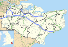
| Map | |||||||||||||||
 | |||||||||||||||
| Runways | |||||||||||||||
| |||||||||||||||


RAF Ashford is a former Royal Air Force Advanced Landing Ground in Kent, England. The landing ground is located approximately 3 miles (4.8 km) west of Ashford just south of the A28 near the junction with Old Surrenden Manor Road; about 50 miles (80 km) southeast of London
Opened in 1943, Ashford was one of several a prototypes for the temporary Advanced Landing Ground airfields built in France after D-Day, required as the Allied forces moved east across France and Germany. It was used by British, Dominion and the United States Army Air Forces. It was closed in September 1944.
Today the airfield is a mixture of agricultural fields with few recognisable remains: part of runway 15 - 33 is visible on Google Earth at 51.125594° 0.818962°.
History
| Unit | Dates | Aircraft | Variant | Notes |
|---|---|---|---|---|
| No. 65 Squadron RAF | October 1943 | Supermarine Spitfire | IX | [1] |
| No. 122 Squadron RAF | October 1943 | Supermarine Spitfire | IX | [2] |
| No. 414 Squadron RCAF | August–October 1943 | North American Mustang | I | Part of the Canadian Reconnaissance Wing |
| No. 430 Squadron RCAF | August–October 1943 | North American Mustang | I | Part of the Canadian Reconnaissance Wing |
United States Army Air Forces use
Ashford was known as USAAF Station AAF-417 for security reasons by the USAAF during the war, and by which it was referred to instead of location. It's USAAF Station Code was "AF".
406th Fighter Group
On 5 April the airmen of the 406th Fighter Group arrived, having crossed the Atlantic by troopship. The group arrived from Congaree Army Airfield South Carolina. Operational fighter squadrons and fuselage codes were:
- 512th Fighter Squadron (L3) (yellow)
- 513th Fighter Squadron (4P) (red)
- 514th Fighter Squadron (O7) (blue)
The 406th Fighter Group was part of the 303d Fighter Wing, XIX Tactical Air Command.
The 406th Fighter Group conducted its first operation on 9 May and was chiefly involved in fighter-bomber work. On 18 when the 513th started to use ALG A-13 at Tour-en-Bessin. The last remnants of the 406th departed RAF Ashford on 31 July.
Bombing
The airfield was bombed during a night-time raid on 22 May 1944, at 12:35 am. A 1,000-pound (450 kg) high-explosive bomb was dropped in the tented area which accommodated the reserve flight pilots and other staff. These were RAF Volunteer Reservists of 5003 Airfield Construction Squadron based at RAF Great Chart, some 1.2 km northeast of the airfield. There were 30 casualties, 14 being fatal.[3]
Current use
With the facility released from military control, Ashford was rapidly returned to agricultural use. There is little to indicate that an airfield ever existed at this location.
See also
References
![]() This article incorporates public domain material from the Air Force Historical Research Agency
This article incorporates public domain material from the Air Force Historical Research Agency
Citations
- ^ Jefford 1988, p. 45.
- ^ Jefford 1988, p. 56.
- ^ "SHORT ARTICLES - based on archive information (Turvey Airmen)". www.mackz.net. Retrieved 9 April 2008.
Bibliography
- The Military Airfields of Britain, pp 30–31, Ken Delve, 2005, Crowood, ISBN 1-86126-729-0
- Freeman, Roger A. (1994) UK Airfields of the Ninth: Then and Now, 1994. After the Battle ISBN 0-900913-80-0
- Freeman, Roger A. (1996) The Ninth Air Force in Colour: UK and the Continent-World War Two. After the Battle ISBN 1-85409-272-3
- Jefford, C.G, MBE,BA ,RAF (Retd). RAF Squadrons, a Comprehensive Record of the Movement and Equipment of all RAF Squadrons and their Antecedents since 1912. Shrewsbury, Shropshire, UK: Airlife Publishing, 1988. ISBN 1-84037-141-2.
- Maurer, Maurer (1983). Air Force Combat Units Of World War II. Maxwell AFB, Alabama: Office of Air Force History. ISBN 0-89201-092-4.
- USAAS-USAAC-USAAF-USAF Aircraft Serial Numbers--1908 to present
- British Automobile Association (AA), (1978), Complete Atlas of Britain, ISBN 0-86145-005-1


