Reinsdorf Airfield
Appearance
Reinsdorf Airfield | |||||||||||
|---|---|---|---|---|---|---|---|---|---|---|---|
 | |||||||||||
| Summary | |||||||||||
| Airport type | Civilian | ||||||||||
| Operator | Flugplatz Reinsdorf Betriebs GmbH | ||||||||||
| Serves | Jüterbog | ||||||||||
| Location | Reinsdorf, Teltow-Fläming | ||||||||||
| Elevation AMSL | 335 ft / 102 m | ||||||||||
| Coordinates | 51°54′06″N 13°11′48″E / 51.90167°N 13.19667°E | ||||||||||
| Website | www.edod.de | ||||||||||
| Map | |||||||||||
| Runways | |||||||||||
| |||||||||||
| Statistics | |||||||||||
| |||||||||||
Frequency: 122.85 MHz Source:[1] | |||||||||||
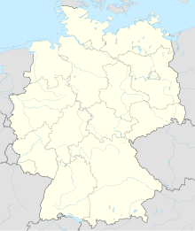
Reinsdorf Airfield is a civilian airfield located in Reinsdorf (Teltow-Fläming), approximately 15 kilometres (9.3 mi) south-east of Jüterbog in Brandenburg, Germany.
The airport is mostly used by the civil aviation, including single engine aircraft up to 5 tons, ultralight aircraft, gliders and motorgliders. Over half of the flights are performed by gliders.
In the northern part of the airfield, gliders can perform high altitude winch launches with 2,600 cable,[2] which makes this airfield almost unique in the world (together with the Rothenburg/Görlitz Airfield).
External links
References
- ^ Reinsdorf Airfield Data
- ^ Höhenschlepps, Aero-Club-Berlin

