
Snyder County, Pennsylvania
Snyder County | |
|---|---|
 Location within the U.S. state of Pennsylvania | |
 Pennsylvania's location within the U.S. | |
| Coordinates: 40°46′N 77°05′W / 40.77°N 77.08°W | |
| Country | |
| State | |
| Founded | March 2, 1855 |
| Seat | Middleburg |
| Largest city | Selinsgrove |
| Area | |
| • Total | 332 sq mi (860 km2) |
| • Land | 331 sq mi (860 km2) |
| • Water | 1 sq mi (3 km2) 0.29% |
| Population (2010) | |
| • Total | 39,702 |
| • Density | 120/sq mi (46.3/km2) |
| Time zone | UTC−5 (Eastern) |
| • Summer (DST) | UTC−4 (EDT) |
| Website | www |
Snyder County is a county located in the U.S. state of Pennsylvania. As of the 2010 census, the population was 39,702.[1] The county seat is MiddleburgTemplate:GR. Snyder County was formed in 1855 from parts of Union County.
History
Snyder County was settled in the 1740s by Pennsylvania Germans from Berks and Lancaster Counties, and became an independent political unit on March 2, 1855 when formed under part of Union County. Snyder County took its name in honor of the famous citizen and political figure, Simon Snyder, who was governor of Pennsylvania for three terms, from 1808 to 1817, and made his home in Selinsgrove. The county seat of Middleburg was laid out in 1800 and incorporated in 1864.[2]
Geography
According to the U.S. Census Bureau, the county has a total area of 333 square miles (860 km2), of which 329 square miles (850 km2) is land and 2.8 square miles (7.3 km2) (0.8%) is water.Template:GR Snyder County is in the Appalachian Mountain Section of the Ridge and Valley Province. Two parallel mountain ridges run southwest to northeast. The Susquehanna River is the eastern border. Between the ridges are steep hills, gently rolling hills, and flat creek valleys. With over 400 active farms in the county, agriculture plays an important role in the economy and environment. Roughly half the county remains forested with both softwoods and hardwoods. These woods provide a place for wildlife to roam which provides for the sport of hunting.
Adjacent counties
- Union County (north)
- Northumberland County (east)
- Juniata County (south)
- Mifflin County (west)
Demographics
| Census | Pop. | Note | %± |
|---|---|---|---|
| 1860 | 15,035 | — | |
| 1870 | 15,606 | 3.8% | |
| 1880 | 17,797 | 14.0% | |
| 1890 | 17,651 | −0.8% | |
| 1900 | 17,304 | −2.0% | |
| 1910 | 16,800 | −2.9% | |
| 1920 | 17,129 | 2.0% | |
| 1930 | 18,836 | 10.0% | |
| 1940 | 20,208 | 7.3% | |
| 1950 | 22,912 | 13.4% | |
| 1960 | 25,922 | 13.1% | |
| 1970 | 29,269 | 12.9% | |
| 1980 | 33,584 | 14.7% | |
| 1990 | 36,680 | 9.2% | |
| 2000 | 37,546 | 2.4% | |
| 2010 | 39,702 | 5.7% | |
| 2012 (est.) | 39,672 | −0.1% | |
2012 Estimate[1] | |||
As of the censusTemplate:GR of 2000, there were 37,546 people, 13,654 households, and 9,981 families residing in the county. The population density was 113 people per square mile (44/km²). There were 14,890 housing units at an average density of 45 per square mile (17/km²). The racial makeup of the county was 97.93% White, 0.82% Black or African American, 0.05% Native American, 0.42% Asian, 0.01% Pacific Islander, 0.30% from other races, and 0.48% from two or more races. 0.98% of the population were Hispanic or Latino of any race. 48.2% were of German, 17.2% American and 5.5% English ancestry according to Census 2000. 4.19% report speaking Pennsylvania German at home.[2]
There were 13,654 households out of which 32.10% had children under the age of 18 living with them, 62.00% were married couples living together, 7.40% had a female householder with no husband present, and 26.90% were non-families. 22.40% of all households were made up of individuals and 10.30% had someone living alone who was 65 years of age or older. The average household size was 2.58 and the average family size was 3.02.
In the county, the population was spread out with 24.00% under the age of 18, 11.20% from 18 to 24, 27.40% from 25 to 44, 23.30% from 45 to 64, and 14.00% who were 65 years of age or older. The median age was 37 years. For every 100 females there were 95.60 males. For every 100 females age 18 and over, there were 93.10 males.
The Average Wage per job reported for 2003 was $26,650. County population in 2003 had risen to 37,965. Jobs in 2003 were 17,907 with a Total labor force in 2004 of 19,863. The unemployment rate in 2004 was reported at 4.8%. Average household size in Snyder County in 2004 was 2.58.
Municipalities

Under Pennsylvania law, there are four types of incorporated municipalities: cities, boroughs, townships, and, in at most two cases, towns. The following boroughs and townships are located in Snyder County:
Boroughs
Townships
Census-designated places
Census-designated places are geographical areas designated by the U.S. Census Bureau for the purposes of compiling demographic data. They are not actual jurisdictions under Pennsylvania law. Other unincorporated communities, such as villages, may be listed here as well.
|
Economics
Manufacturing since the year 2001 was faced with the largest loss in employment in Snyder County. The sector dealt with a loss of 427 jobs, or 7.2 percent of the employment in the industry. This made up a total of 36 percent of all county employment losses since 2001. Employment Report for Snyder County, Pennsylvania. U.S. Department of Labor. Bureau of Labor Statistics.
County Major Employers and Industry Sector as reported by Pennsylvania Department of Labor and Industry December 2006.
- Wood Mode Manufacturing
- Susquehanna University Educational Services
- Conestoga Wood Specialties Corp Manufacturing
- Selinsgrove Area School District Educational Services
- Midd West School District Educational Services
- Apex Homes Inc Manufacturing
- Wal-Mart Associates Inc Retail Trade
- National Beef Wholesale Trade
- Penn Lyon Homes Inc Manufacturing
- Professional Building Systems Manufacturing
In 2005 manufacturing was the largest of 20 major sectors. It had an average wage per job of $34,042. Per capita income grew by 7.7% between 1994 and 2004 (adjusted for inflation).
Two Selinsgrove based manufacturing facilities announced closings in Spring 2007. Both are building related manufacturing facilities. Together they represent a loss of over 250 jobs.
During the Spring of 2008 a new manufacturing facility, Icon Legacy Custom Modular Homes, opened in Selinsgrove, PA adding 100 jobs to the local economy.[4]
The county and region are struggling economically. The reasons include: a lack of inter-municipal coordination and cooperation, a changing employment base and a dearth of jobs paying a living wage, out-migration of young people, an aging population, the need for workforce development, and an inequitable local tax structure.[5]
Between 2000 and 2005, a total of two businesses in Snyder County received funds totaling $550,000 through the Pennsylvania Department of Community and Economic Development’s Opportunity Grant Program.[6]
Transportation
Snyder County has two main arteries. U.S. Routes 11/15 travel through the county on the east end generally following the path of the Susquehanna River. The highway is a major travel artery through the region. Flow is constant (truck and vehicle) with very heavy loads and backups on Fridays (especially in the afternoon) and holiday weekends. There is a proposed major highway bypass project called the Central Susquehanna Valley Thruway. It is meeting with funding challenges that have delayed the project for decades. The proposed thruway would cross Monroe Township just north of Shamokin Dam. Many residential properties are designated for eminent domain actions.[citation needed] Residents[who?] along the proposed route have expressed concerns about the negative impact on their quality of life that the thruway would mean. Others[who?] are concerned that the bypass will mean the loss of local revenue and jobs that the traffic brings to the many local restaurants and hotels that are located along the current U.S. 11/15 highway. In June 2007 another two-year delay was announced by the Pennsylvania Department of Transportation.[citation needed] The primary roadblock is a lack of funding for the estimated over $300 million project.[citation needed]
U.S. Route 522 begins in Selinsgrove and travels west through Kreamer, Middleburg and on to Lewistown. Route 35 begins on U.S. 11/15 south of Selinsgrove borough and runs roughly parallel to Route 522 crossing through Freeburg and Mount Pleasant Mills then westward to McAllisterville and Richfield, in western Snyder County.
Snyder County is in Pennsylvania Department Of Transportation District 3. According to PennDOT there are 240 state owned bridges in the county. Currently, many existing bridges and roads in the county in need of repair. PennDOT report on Snyder County roads and bridges in need of repair. [7][8] In 2007, 27 of the bridges are rated structurally deficient and 4 are posted with weight limits. The bridge that spans Middle Creek in Kreamer has been deemed structurally deficient by the state.[9]
State routes 235, 104 and 204 cross the county in a north - south direction. State route 104 joins State Route 45 with U.S. 11/15 in Juniata County.
Education
Colleges and Universities

Public School Districts
- Midd-West School District
- Selinsgrove Area School District
- SusQ-Cyber Charter School
Early Child Education
According to the Office of Child Development and Early Learning of the Pennsylvania Department of Education June 2007 report, Snyder County is rated low to moderate risk level for children who are “at risk” and therefore might benefit from more taxpayer funded services. Snyder County was rated 1.86 ARL, in the lowest 25% of counties for average risk level.[10]
- Children's Discovery Centers Inc
- Loving Hearts Day Care - Middleburg
- Susquehanna Valley Preschool
- Rock Preschool - Shamokin Dam
- Selinsgrove High School Children's Center
- SUMCD - Susquehanna Children's Center - Selinsgrove
Head Start PreSchool Programs
Head Start is a federally and state funded preschool program for low income children. The program serves 3 and 4 year olds. In order to participate the family income must be below federal poverty guidelines.
- Middleburg Head Start Center[11]
Private schools
As reported by the National Center for Educational Statistics[12]
- Bannerville School, Mcclure, Grades 2-8
- Chapman Parochial School, Port Trevorton, Grades 1-9
- Gospel Christian Academy, Selinsgrove, Grades KG-11
- Jacks Mountain School, Mcclure, Grades 1-8
- Kantz Church School, Middleburg, Grades 1-8
- Lakeview School, Port Trevorton, Grades 1-8
- Leaning Oak School, Mount Pleasant Mills, Grades 1-9
- Locust Grove School, Mount Pleasant Mills, Grades 1-8
- Meadow View School, Trevorton, Grades 1-8
- New Story School, Special education K-12, Selinsgrove
- Palace Creek School, Mount Pleasant Mills, Grades 1-8
- Penn View Christian Academy, Penns Creek, Grades PK-12
- Shady Grove Parochial School, Port Trevorton, Grades 1-8
- White Oak School Liverpool, Grades 1-8
Boards and Agencies
- Snyder County Conservation District The conservation district is governed by a seven member board of volunteer directors. The Conservation District is a delegated authority to administer in Snyder County the state Erosion and Sediment Pollution Control (ESPC) program under PA Code Title 25 Chapter 102 and Chapter 105 Rules and Regulations and the Clean Streams Law. Act 217, the Conservation District law, permits conservation districts to charge fees for services, under certain circumstances. Their motto is Conservation Through Education. They offer programs regarding nutrient management, erosion prevention, Improving Dirt & Gravel Roads, and Watershed Protection. SCCD location map.
- Snyder County Cooperative Extension Board Snyder County Courthouse, Middleburg, PA. Through educational programs, publications, and events, cooperative extension agents deliver unbiased, research-based information to Snyder County citizens.
- Snyder County Geographical Information System (GIS) 44 Universal Road, off Rte 522, Selinsgrove, PA. This agency produces maps of county locations with additional layers of information like watershed data or building addressing. These maps are used in development planning, dispatching timely emergency services, flood plain tracking and epidemiology.
- Snyder County Housing Authority's mission is to promote safe, sanitary, and affordable housing, and maintain a good quality of life for Snyder County residents. Provides rental assistance to low income county residents using a voucher system for renting suitable housing. The authority meets at 9 am on the third Monday of each month in the conference room of its Administrative offices located at 103 Drake Court, Middleburg, PA 17842. Denise Miller is the Executive Director. Phone: 570-837-3979
- Emergency Management Agency is run by a Coordinator. The office is located at 30 Universal Rd. Route 522, Selinsgrove, PA 17870 Office: 570-372-0535 Snyder County Hazard Mitigation Plan
- Columbia, Montour, Snyder and Union Joinder Board and Local Emergency Planning Committee
- Snyder County Agricultural Land Preservation Board
- Tourism Fund Review Panel for Snyder County
- SEDA-Council of Governments Board of Directors
- Central Pennsylvania Workforce Development Corp. board
- Snyder County Prison Board
- Snyder County Waste Management Authority 713 Bridge Street, Suite 9, Selinsgrove, Pa 17870 The Authority is charged with the planning of how to manage the solid waste in the County. A recycling program is available throughout the county with a varying schedule. Additionally, it is examining the issue of a single waste hauler contract for the county or to continue to allow individuals to contract privately with individual haulers.
- Snyder County Amateur Radio Emergency Communications provide vital communication resources during a crisis or disaster. Efforts go through the County's Emergency Management Coordinator.
Environmental Issues
In 2002, Snyder County ranked among the dirtiest/worst 10% of all counties in the U.S. in terms of cancer risk score (air and water releases). In 1999, this county ranked among the dirtiest/worst 10% of all counties in the U.S. in terms of sulfur dioxide emissions.
Snyder County’s water supply includes wells, springs/streams, reservoirs, the Susquehanna River, treatment plants, and pumping stations. Water distribution can be affected in three ways: the amount of water available; the quality of the water; and the viability of the physical components of the distribution systems. The quantity of water usually depends on nature. Humans, on the other hand, are primarily responsible for the maintenance of water quality. Water contamination can occur naturally, by human error or intentionally. Occasionally, releases of manure and milk into the water supply can cause contamination. There are also times when accidental spills and releases of hazardous materials contaminate water. Water supplies along transportation routes have been affected by hazardous materials spills.
- Ongoing pollution and soil erosion in the region continue to degrade the water quality and the environment locally as well as regionally. Farming, wastewater treatment facilities and industrial spills are cited as contributing factors to loss of water quality. Local pollution and erosion also contributes to the pollution of the Chesapeake Bay. Controlling the wastewater discharges alone is expected to cost local taxpayers billions of dollars.
- Ground water is being monitored by the USGS. Ground-Water-Quality Data in Pennsylvania - A Compilation of Computerized Electronic Databases, 1979-2004
- Groundwater - A Primer for Pennsylvanians is provided by the Water Resources Education Network to encourage safeguarding the quality of the groundwater.
- Department of Environmental Protection Bureau of Water supply and Wastewater Management has a Northcentral Region office at 208 W. Third St., Suite 101 Williamsport, Pa 17701
- The Master Well Owner Network is a network of trained volunteers dedicated to promoting the proper construction and maintenance of private water systems in Pennsylvania. There are 286 trained Master Well Owner Volunteers in 60 counties in Pennsylvania. They have provided assistance to over 8,000 homeowners with private water systems. MWON is facilitated by Penn State Cooperative Extension.
- The Lower Penns Creek Watershed Association’s central purpose is to protect, conserve, and improve the Lower Penn’s Creek watershed by promoting the wise stewardship of the land and aquatic resources. The organization is open to all citizens. The organization has sponsored a main stream assessment The Lower Penns Creek watershed is approximately 163 square miles (420 km2) within Snyder and Union Counties. It drains into the Susquehanna River on the northern border of the community of Selinsgrove, Pennsylvania. It is located within the Lower Susquehanna subbasin. LPCWA’s efforts contribute to the success of the missions of the Susquehanna Greenway Partnership and the Susquehanna River Basin Commission. The Snyder County Conservation District and the Union County Conservation District both have watershed specialists that participate in LPCWA. Growing Greener grants support watershed specialists who provide technical assistance and coordination of watershed restoration and protection efforts.
- Private Landowners Assistance Program (PLAP), helps landowners develop habitat management plans, increasing its value to wildlife and helping to keep at bay the ongoing decline in habitat quality and loss of wildlife habitat on lands in private ownership. There is no charge for participating in PLAP, nor is there a public access requirement. Southcentral: Adams, Bedford, Blair, Cumberland, Franklin, Fulton, Huntingdon, Juniata, Mifflin, Perry and Snyder counties - Game Commission Bureau of Wildlife Management Biologist Dan Mummert at 814-542-8759.
- Natural Resources Extension provides information for sound wood lot and forest stewardship of private lands.
Utilities
Electric – All 21 municipalities within Snyder County receive electric service from PPL Electric Utilities, Inc. According to the U.S. Department of Energy, a 500 kilovolt line runs through Snyder County. Three 138 kilovolt lines stem from this 500 kilovolt line at the Sunbury Generation coal-fired power plant in Shamokin Dam, which is capable of producing roughly 400 megawatts of electrical power.
Water – Water service in Snyder County is provided by various municipal and regional authorities, private water providers, and private well water sources.
Gas – UGI Penn Natural Gas is the only natural gas provider in Snyder County, providing service to Jackson, Middlecreek, Monroe, and Penn Townships, as well as Selinsgrove and Shamokin Dam Boroughs. Several propane dealers exist to service the rural community.
Communications – Verizon provides telephone service and EvenLink provides VoIP telephone service to all 21 municipalities in Snyder County.
Cable television service is provided by Service Electric Cablevision, Nittany Media, Inc., Zampelli Electronics, and Beaver Springs Community TV Association.
High-speed Internet access is principally provided by Verizon, EvenLink, and Service Electric Cablevision.
There are several restaurants featuring high speed wireless internet in Snyder County. Dunkin Donuts and Applebee's provide fee-based services provided by PenTeleData Unleashed. The White House Deli in MP Mills provides a free service.
Politics
The county is strongly Republican in presidential elections. The last Republican nominee to receive less than 60% of the county's vote was Bob Dole. In 2008 John McCain received 64% of the county's vote.[13] Snyder County was one of the only counties in Pennsylvania to go for Barry Goldwater.[14] The last Republican presidential candidate to lose Snyder County was incumbent president William Howard Taft when he split the Republican vote with challenger and former president Theodore Roosevelt, who took the county for the insurgent Progressive Party.[15] In fact, no Democratic presidential candidate has been able to claim the county since Pennsylvania native James Buchanan won the presidency in 1856. The only county in Pennsylvania to be more steadfastly Republican (or indeed, remain so one-sidedly partisan for either party in Pennsylvania) in presidential contests has been Snyder County's neighbor to the north, Union County, which voted for John C. Fremont over Buchanan in 1856.[16]
The county is located in Pennsylvania's 10th congressional district, which has a Cook Partisan Voting Index of R+8 and is represented by Republican Tom Marino. As part of Pennsylvania Senate, District 27 it is represented by Republican John Gordner. The county contains locations in Pennsylvania House of Representatives, District 82, Pennsylvania House of Representatives, District 85, and Pennsylvania House of Representatives, District 108. All of these have been represented by Republicans since 1989.
Of "Straight Party" voters in Snyder 73.2% are Republican and 24.65% are Democratic. In the 2008 election Republicans won in all races and in most they won by over 20%. Chris Carney lost by roughly 13% in the county[17] while winning by 12% in the district.
County Commissioners
- Joseph Kantz, Chairman
- Malcolm Derk, Vice-Chair
- Peggy Chamberlain Roup, Secretary
Row Offices
- Teresa J. Berger, Prothonotary and Clerk of Courts
- Michael Piecuch, District Attorney
- Stacy Zerbe, Register and Recorder
- Joseph Reigle Jr, Sheriff
Cultural Elements
Snyder County is well known for its unmistakable Pennsylvania German language and culture, agricultural heritage, as well as its fraktur, Kentucky rifles, wood products industries, Middleswarth chip factory, and the annual fairs, festivals, and auctions that keep the local heritage alive. Some of the more famous historical structures of the county are the Governor Snyder Mansion, Pomfret’s Castle, Schoch Block House, ruins of the Pennsylvania Canal, and its covered bridges. Snyder County is also home to Snyder-Middleswarth State Park, the Tall Timbers Natural Area, and thirteen Pennsylvania State Historical markers.
Historical Markers
- Pennsylvania Canal (Susquehanna Division) – US 11 & 15 at Port Trevorton.
- Simon Snyder – SR 2017 (old US 11 & 15) just S of Selinsgrove.
- Simon Snyder Mansion (Plaque) – 121 N. Market St. (old US 11 & 15), Selinsgrove.
- Coxey’s Army – 814 N. Market St. (old US 11 & 15), Selinsgrove.
- Penns Creek Massacre – SR 2017 (old US 11 & 15) just N of Selinsgrove.
- Penns Creek Massacre (Plaque) – S end Old Trail (just E of US 11 & 15), Penns Creek N of Selinsgrove.
- Schoch Blockhouse – US 522 at Kreamer.
- Susquehanna University – US 522, .5 mile W of old US 11 & 15, Selinsgrove.
- Albany Purchase – US 522 (old US 11 & 15) 1 mile N of Selinsgrove.
- Harris Ambush (Plaque) – At the Old Bridge, 1/2 mile W of Selinsgrove.
- Sunbury – U.S. 11 & 15, 4 miles N of Selinsgrove
- Shikellamy – US 11, 5.4 miles N of Selinsgrove entrance to Shikellamy State Park
- Snyder County – County courthouse, 9 W. Market St. (US 522), Middleburg[18]
See also
References
- ^ a b "State & County QuickFacts". United States Census Bureau. Retrieved November 22, 2013.
- ^ "Historical Society." Snyder County - Default. Web. 27 Oct. 2011. http://www.snydercounty.org/Depts/Historical_Society/Pages/HistoricalSociety.aspx
- ^ "U.S. Decennial Census". Census.gov. Retrieved November 22, 2013.
- ^ [1][dead link]
- ^ Alter, Theodore R. "Strengthening Rural Pennsylvania" Brookings Institute. March 2007. http://www.brook.edu/metro/pubs/committingtoprosperity.htm
- ^ Auditor General Jack Wagner Faults DCED’s Monitoring of Opportunity Grant Program
- ^ Gessel, Damian, "State of Bridges", The Daily Item, August 5, 2007
- ^ Levy, Marc, "Long road ahead", The Daily Item, August 5, 2007
- ^ Gessel, Damian, "State of Valley Bridges", The Daily Item. August 5, 2007.
- ^ Early Child Education Program Reach Analysis 2007
- ^ Snyder, Union, Mifflin Child Development Report. Feb 2010
- ^ ies, National Center for Education Statistics, US Department of Education, Institute of Education Sciences, Private School Universe Survey 2008
- ^ The New York Times Electoral Map (Zoom in on Pennsylvania)
- ^ David Leip's Presidential Election Atlas
- ^ Geographie Electorale
- ^ Wilkes University Election Statistics Project: Pennsylvania Election Statistics, 1682-2006
- ^ Snyder County election site
- ^ http://www.snydercounty.org/Depts/Historical_Society/Pages/HistoricalSociety.aspx
External links
- Snyder County
- Pennsylvania Department of Transportation, Bureau of Planning and Research, Geographic Information Division, "2005 General Highway Map of Union and Snyder Counties". Note: shows boroughs, townships, roads, villages, some streams. URL accessed on April 5, 2006.
- Hazardous Air Pollutant Report
- Central Susquehanna Valley Thruway
- Public Hunting Map. Snyder County
- Governor's Center for Local Government Services
Municipalities and communities of Snyder County, Pennsylvania, United States | ||
|---|---|---|
| Boroughs | 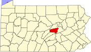 | |
| Townships | ||
| CDPs | ||
| Other communities | ||
| Footnotes | ‡This populated place also has portions in an adjacent county or counties | |