Roeburndale
Appearance
| Roeburndale | |
|---|---|
 Roeburndale Methodist Chapel | |
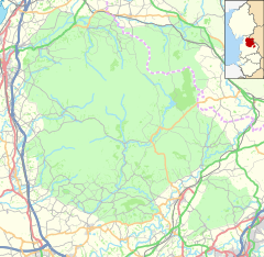
Location within Lancashire | |
| Population | 76 (2001) |
| OS grid reference | SD6063 |
| Civil parish |
|
| District | |
| Shire county | |
| Region | |
| Country | England |
| Sovereign state | United Kingdom |
| Post town | LANCASTER |
| Postcode district | LA2 |
| Dialling code | 015242 |
| Police | Lancashire |
| Fire | Lancashire |
| Ambulance | North West |
| UK Parliament | |
Roeburndale is a civil parish in the City of Lancaster and the English county of Lancashire. In 2001 it had a population of 76.[1] In the 2011 census Roeburndale was grouped with Claughton. The parish includes the village of Salter. The River Roeburn flows through the parish.
History
[edit]In January 2022, one person was killed and others were injured when a bridge collapsed into the River Roeburn in Roeburndale.[2][3]
See also
[edit]References
[edit]- ^ "Parish headcount" (PDF). Archived from the original (PDF) on 10 December 2006. Retrieved 13 April 2008.
- ^ "Man dead, several injured following bridge collapse". belfasttelegraph. ISSN 0307-1235. Retrieved 19 January 2022.
- ^ "Four rescued from Roeburndale river after bridge crash". BBC News. 18 January 2022. Retrieved 19 January 2022.


