
Administrative divisions of Croatia
This article needs additional citations for verification. (August 2012) |
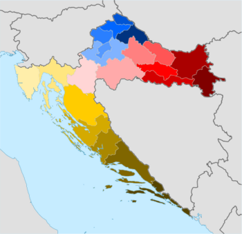
The subdivisions of Croatia on the first level are the 20 counties (županija, pl. županije) and one city-county (grad, "city"). On the second level these are municipalities (općina, pl. općine) and cities (grad, pl. gradovi). Both of these types of subdivisions encompass one or multiple settlements (naselje, pl. naselja) which are not public or legal entities, the Croatian Bureau of Statistics consider them as non-administrative units – human settlements, similar to the United States census designated places. As parts of the cities or the (larger) municipalities they may form city districts or local committee areas. Small municipalities usually consist of only one settlement.
Current (since 1992)
- Counties (21)
- Cities and Municipalities (428)[1]
- City districts and Local committee areas
- Settlements (6,749) (non-legal, non-public entities)
1975–1990

- Unions of Municipalities (11), including City of Zagreb Union of Municipalities (Zagreb metropolitan area) and City of Split Union of Municipalities (Split metropolitan area)
- Municipalities
- Local communities
- Settlements (non legal or public entities)
1967 - 1975
- Municipalities
- Settlements (non legal or public entities)
1952–1967
- Districts
- Cities, City Municipalities and Municipalities
- Settlements (non legal or public entities)
1949–1952
1945 - 1949
1941–1945

1941-1943 (1st)
1943-1944 (2nd)
- Counties (22)
- Baranja
- Bilogora
- Bribir and Sidraga
- Cetina
- Dubrava
- Gora
- Hum
- Krbava – Psat
- Lašva and Glaž
- Lika and Gacka
- Livac and Zapolje
- Modruš
- Pliva and Rama
- Pokupje
- Posavje
- Prigorje
- Sana and Luka
- Usora and Soli
- Vinodol and Podgorje
- Vrhbosna
- Vuka
- Zagorje
- Zagreb
- Districts
- Municipalities
- Cadastral municipalities (non legal or public entities, non local authorities)
1929–1941
- Banovinas
- Banovina of Croatia
- Districts
- Cities and municipalities
- Cadastral municipalities (non legal or public entities, non local authorities)
1922–1929

- Oblasts
- Oblast of Dubrovnik
- Oblast of Karlovac
- Oblast of Osijek
- Oblast of Split
- Oblast of Vukovar (partially)
- Oblast of Zagreb
- Districts
- Cities and municipalities
- Cadastral municipalities (non legal or public entities, non local authorities)
Kingdom of Croatia-Slavonia (1868–1922)

- Counties
- Districts
- Cities and municipalities
- Cadastral municipalities (non legal or public entities, non local authorities)
Medieval Croatian Kingdom

- Counties[2]
- Livno
- Cetina
- Imotski
- Pliva
- Pesenta
- Klis
- Bribir
- Nin
- Knin
- Sidraga
- Luka
See also
- Counties of Croatia
- Croatian cities
- Municipalities of Croatia
- NUTS of Croatia
- ISO 3166-2 codes of Croatia
- Counties of the Independent State of Croatia
- Former counties of Croatia (in Kingdom of Croatia-Slavonia)
References
- ^ "Popis gradova i općina". uprava.hr (in Croatian). Ministry of Public Administration, Croatia. 10 June 2013. Archived from the original (Microsoft Excel) on 8 December 2015. Retrieved 2 December 2015.
{{cite web}}: Unknown parameter|dead-url=ignored (|url-status=suggested) (help) - ^ Vrbošić, Josip. POVIJESNI PREGLED RAZVITKA ŽUPANIJSKE UPRAVE I SAMOUPRAVE U HRVATSKOJ, University of Osijek.
