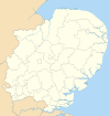
Broadland
Broadland District | |
|---|---|
 Broadland shown within Norfolk | |
| Sovereign state | United Kingdom |
| Constituent country | England |
| Region | East of England |
| Non-metropolitan county | Norfolk |
| Status | Non-metropolitan district |
| Admin HQ | Thorpe St Andrew |
| Incorporated | 1 April 1974 |
| Government | |
| • Type | Non-metropolitan district council |
| • Body | Broadland District Council |
| • Leadership | Leader & Cabinet (Conservative) |
| • MPs | Keith Simpson Chloe Smith |
| Area | |
| • Total | 213.3 sq mi (552.4 km2) |
| • Rank | 70th (of 296) |
| Population (2022) | |
| • Total | 133,872 |
| • Rank | 178th (of 296) |
| • Density | 630/sq mi (240/km2) |
| • Ethnicity | 98.8% White |
| Time zone | UTC0 (GMT) |
| • Summer (DST) | UTC+1 (BST) |
| ONS code | 33UC (ONS) E07000144 (GSS) |
| OS grid reference | TG2682109307 |
| Website | www |
Broadland is a local government district in Norfolk, England, named after the Norfolk Broads. Its council is based in Thorpe St Andrew, which is a suburb of the City of Norwich.
History
The district was formed on 1 April 1974 by the merger of St. Faiths and Aylsham Rural District and part of Blofield and Flegg Rural District.
Composition
The district is entirely parished, and is made up of 65 civil parishes. At the time of the 2001 census, the district had an area of 546 square kilometres (211 sq mi), with a population of 118,513 in 50,009 households.[1]
The district contains the following civil parishes:
- Acle, Alderford, Attlebridge, Aylsham
- Beeston St. Andrew, Beighton, Belaugh, Blickling, Blofield, Booton, Brampton, Brandiston, Brundall, Burgh and Tuttington, Buxton Lammas, Buxton
- Cantley, Cawston, Coltishall, Crostwick
- Drayton
- Felthorpe, Foulsham, Freethorpe, Frettenham
- Great Plumstead, Great Witchingham, Guestwick
- Hainford, Halvergate, Haveringland, Hellesdon, Hemblington, Hevingham, Heydon, Honingham, Horsford, Horsham St Faith, Horsham St Faith and Newton St Faith, Horstead with Stanninghall
- Lingwood and Burlingham, Little Plumstead, Little Witchingham
- Marsham, Morton on the Hill
- Old Catton, Oulton
- Postwick with Witton
- Rackheath, Reedham, Reepham, Ringland
- Salhouse, Salle, South Walsham, Spixworth, Sprowston, Stratton Strawless, Strumpshaw, Swannington
- Taverham, Themelthorpe, Thorpe St. Andrew
- Upton with Fishley
- Weston Longville, Woodbastwick, Wood Dalling, Wroxham
References
- ^ Office for National Statistics & Norfolk County Council (2001). Census population and household counts for unparished urban areas and all parishes. Retrieved December 2, 2005.

