
Jabel Mukaber: Difference between revisions
Undid revision 901307609 by 77.13.21.65 (talk) |
replace template per tfd outcome |
||
| Line 1: | Line 1: | ||
{{Infobox |
{{Infobox settlement |
||
|name=Jabel Mukaber |
| name = Jabel Mukaber |
||
| translit_lang1 = Arabic |
|||
|image=Gabbel4.jpg |
|||
| translit_lang1_type = [[Arabic script|Arabic]] |
|||
| ⚫ | |||
| |
| translit_lang1_info = {{lang|ar|جبل مكبر}} |
||
| translit_lang1_type1 = [[Latin script|Latin]] |
|||
| ⚫ | |||
| ⚫ | |||
|meaning= |
|||
| translit_lang2 = Hebrew |
|||
| ⚫ | |||
| translit_lang2_type = [[Hebrew script|Hebrew]] |
|||
|founded= |
|||
| ⚫ | |||
|type=munb |
|||
| type = [[Municipality (Palestinian Authority)|Municipality type B]] |
|||
|typefrom= |
|||
| image_skyline = Gabbel4.jpg |
|||
|altOffSp= |
|||
| imagesize = |
|||
| ⚫ | |||
| ⚫ | |||
|governorate=jl |
|||
| image_blank_emblem = |
|||
|population=16,030 |
|||
| blank_emblem_type = |
|||
|popyear= |
|||
| blank_emblem_size = |
|||
|area= |
|||
| pushpin_map = Palestine |
|||
|areakm= |
|||
| pushpin_label_position = |
|||
}} |
|||
| pushpin_map_caption = Location of Jabel Mukaber within [[State of Palestine|Palestine]] |
|||
| ⚫ | |||
| image_map = |
|||
| ⚫ | |||
| mapsize = |
|||
| map_caption = |
|||
| ⚫ | |||
| grid_name = [[Palestine grid|Palestine grid]] |
|||
| grid_position = |
|||
| subdivision_type = State |
|||
| subdivision_name = [[State of Palestine]] |
|||
| subdivision_type1 = [[Governorates of the Palestinian National Authority|Governorate]] |
|||
| subdivision_name1 = jl |
|||
| established_title = Founded |
|||
| established_date = |
|||
| government_footnotes = <!-- for references: use <ref> tags --> |
|||
| government_type = [[Municipality (Palestinian Authority)|Municipality]] |
|||
| leader_title = |
|||
| leader_name = |
|||
| unit_pref = dunam |
|||
| area_footnotes = |
|||
| area_total_km2 = |
|||
| area_total_dunam = |
|||
| elevation_footnotes = |
|||
| elevation_m = |
|||
| elevation_min_m = |
|||
| elevation_max_m = |
|||
| population_footnotes = |
|||
| population_total = 16,030 |
|||
| population_as_of = |
|||
| population_note = |
|||
| population_density_km2 = auto |
|||
| blank_name_sec1 = |
|||
| blank_info_sec1 = |
|||
| website = |
|||
| footnotes = |
|||
}}[[Category:Municipalities of the State of Palestine]] |
|||
| ⚫ | |||
| ⚫ | |||
[[File:Greater Jerusalem May 2006 CIA remote-sensing map 3500px.jpg|thumb|200px|Jabel Mukaber is in the middle of the map.]] |
[[File:Greater Jerusalem May 2006 CIA remote-sensing map 3500px.jpg|thumb|200px|Jabel Mukaber is in the middle of the map.]] |
||
Revision as of 14:19, 28 June 2019
Jabel Mukaber | |
|---|---|
| Arabic transcription(s) | |
| • Arabic | جبل مكبر |
| • Latin | Jabal Mukaber Jabel Muqaber Jabal Mukkaber (unofficial) |
| Hebrew transcription(s) | |
| • Hebrew | Template:Hebrew |
 Jabel Mukaber with the Dome of the Rock seen in the background. | |
 Jabel Mukaber Location of Jabel Mukaber within Palestine | |
| Coordinates: 31°45′16.75″N 35°14′27.65″E / 31.7546528°N 35.2410139°E | |
| State | State of Palestine |
| Governorate | jl |
| Government | |
| • Type | Municipality |
| Population | |
| • Total | 16,030 |


Jabel Mukaber (Arabic: جبل مكبر, Template:Lang-he-n) is a predominantly Palestinian neighborhood in southern East Jerusalem.[1] It is bordered by East Talpiot[2] to the west, Abu Tor and Silwan to the north and Sur Baher to the south. Jabel Mukaber has a population of 14,000.[2]
History
According to local legend, Jabel Mukaber is named after Umar ibn al-Khattab, a disciple of Muhammad and the second caliph of the Islamic Caliphate, who cried Allahu Akbar at this site. During the Mandatory Palestine, the offices of the British High Commissioner, the representative of British imperial rule in Mandatory Palestine were located in Jabel Mukaber.[3] During the 1948 Arab–Israeli War, the Egyptian Muslim Brotherhood battled Jewish forces in the neighborhood.[4] Jabel Mukaber and other Arab neighborhoods in East Jerusalem were captured and annexed by Jordan. Since the 1967 Six-Day War, Jabel Mukaber has been under the jurisdiction of the Jerusalem Municipality.[5]
Demography
Many residents of Jabel Mukaber rejected Israeli citizenship to demonstrate their solidarity with Palestinians in the West Bank,[5] but they are considered permanent residents. As holders of blue identity cards, they have wide freedom of movement within Israel, and have access to health care, unemployment and other benefits.[5][6]
The construction of the Israeli West Bank barrier has divided Jabel Mukaber in half and left some neighborhood residents on the West Bank side of the wall, meaning that they hold Palestinian IDs rather than Israeli IDs, and cannot cross into Israel itself.[7] Running through the centre of the neighbourhood, the barrier often separates members of the same family from one another, disrupting normal family life.[7] Jabel Mukaber is under-budgeted for municipal services, leading to sewage blockages in parts of the neighborhood and a shortage of classrooms.[8]
Arab-Israeli conflict
East Talpiot was established in 1970 in close proximity to Jabel Mukaber during the upswing of building that followed the Six-Day War.[6] When the Second Intifada (uprising) began, the mood changed. Since then, Jabel Mukaber has been the scene of numerous demonstrations, protests and riots in support of the Palestinian cause.[9][10]
Landmarks
A Tolerance Monument sculpted by Czesław Dźwigaj in collaboration with Michal Kubiak is situated on a hill marking the divide between Jewish East Talpiot and Arab Jabel Mukaber, standing opposite the United Nations headquarters in Jerusalem in a park near Goldman Promenade. Unveiled in Jerusalem in 2008, it was funded by Polish businessman Aleksander Gudzowaty as a symbol to promote peace in the Israeli–Palestinian conflict.[11]
See also
References
- ^ "Israel approves major settlement expansion in Palestinian neighborhood in East Jerusalem". haaretz.com. 2017-10-25. Retrieved 2019-05-31.
- ^ a b Segev, Tom (1 September 2005). "A good friend jumps the fence - Haaretz.co.il". Haaretz Daily Newspaper Ltd. Retrieved 2011-07-17.
- ^ A.B.H. Kargbo. History & Holy Places. Bait Mal al-Quds al-Sharif.
{{cite book}}:|access-date=requires|url=(help) - ^ ʻUwaysī, ʻAbd al-Fattāḥ Muḥammad. (1998). The Muslim Brothers and the Palestine Question 1928-1947 I.B.Tauris, p.209. ISBN 1-86064-214-4.
- ^ a b c Eric Westervelt (July 10, 2008). "Israelis Propose Laws To Punish Terrorists' Families". National Public Radio (NPR).
- ^ a b Gorenberg, Gershom (October 2, 2007). "A Note to Hillary on Jerusalem Disunited - prospect.org". The American Prospect. Retrieved 2008-09-07.
- ^ a b Ghiath Nasser (17 January 2008). "Like the Berlin Wall..." Common Ground News Service. Archived from the original on 2010-12-23. Retrieved 2008-09-09.
{{cite web}}: Unknown parameter|dead-url=ignored (|url-status=suggested) (help) - ^ Sela, Neta (2006-05-23). "The Jerusalemites Israel doesn't like - ynet". ynetnews.com. Retrieved 2018-05-30.
- ^ Zino, Aviram (16 March 2008). "Rightists hurl stones at Arab homes in Jerusalem - ynet". ynetnews.com. Retrieved 2008-09-07.
- ^ "Israelis try to destroy attacker's house - USAtoday". Usa today. 2008-03-16. Retrieved 2008-09-07.
- ^ KERSHNER, Isabel (2008-10-17). "Symbol of Peace Stands at Divide Between Troubled Jerusalem's East and West". New York Times. Retrieved 2008-10-18.
External links
- Survey of Western Palestine, Map 17: IAA, Wikimedia commons
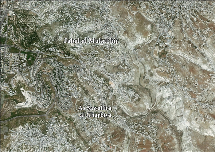
- Jabal al Mukabbir & al Sawahreh al Gharbiyya (Fact Sheet), Applied Research Institute–Jerusalem, (ARIJ)
- Jabal al Mukabbir & As Sawahira al Gharbiya Town Profile, ARIJ
- Jabal al Mukabbir & As Sawahira al Gharbiya picture, ARIJ
- Locality Development Priorities and Needs in Jabal al Mukabbir & As Sawahira al Gharbiya, ARIJ