
Greenfield, Massachusetts: Difference between revisions
m Fixing links to disambiguation pages, improving links, other minor cleanup tasks using AWB |
→County Seat: Jail location. |
||
| Line 124: | Line 124: | ||
===County Seat=== |
===County Seat=== |
||
As county seat, Greenfield is also home to many different state offices, including courthouses and one of the offices of the Northwest District Attorney, Elizabeth D. Scheibel. The Franklin County [[Sheriff]] is based in Greenfield and operates the Franklin County Jail |
As county seat, Greenfield is also home to many different state offices, including courthouses and one of the offices of the Northwest District Attorney, Elizabeth D. Scheibel. The Franklin County [[Sheriff]] is based in Greenfield and operates the Franklin County Jail at the corner of Elm and Allen streets. The city also has the central post office for the "013" series of [[ZIP code]]s, which extends through Franklin County and several towns in Worcester County. Greenfield is home to the privately-run [[Baystate Franklin Medical Center]], which serves much of the northern [[Pioneer Valley]]. |
||
===Legislative Delegation=== |
===Legislative Delegation=== |
||
Revision as of 11:46, 21 July 2009
Greenfield, Massachusetts | |
|---|---|
 Greenfield from Poet's Seat Tower, 1917 | |
 Location in Franklin County in Massachusetts | |
| Country | United States |
| State | Massachusetts |
| County | Franklin |
| Settled | 1686 |
| Incorporated | 1753 |
| Government | |
| • Type | Mayor-council city |
| Area | |
| • Total | 21.9 sq mi (56.8 km2) |
| • Land | 21.7 sq mi (56.3 km2) |
| • Water | 0.2 sq mi (0.5 km2) |
| Elevation | 250 ft (76 m) |
| Population (2000) | |
| • Total | 18,168 |
| • Density | 836.2/sq mi (322.9/km2) |
| Time zone | UTC-5 (Eastern) |
| • Summer (DST) | UTC-4 (Eastern) |
| ZIP code | 01301 |
| Area code | 413 |
| FIPS code | 25-27025 |
| GNIS feature ID | 0618166 |
| Website | www.townofgreenfield.org |
Greenfield is a city in Franklin County, Massachusetts, United States. The population was 18,168 at the 2000 census. It is the county seat of Franklin County.Template:GR Greenfield is home to Greenfield Community College, the Pioneer Valley Symphony Orchestra, and the Franklin County Fair. The city has a Main Street Historic District containing fine examples of Federal, Greek Revival and Victorian architecture.
Greenfield is part of the Springfield, Massachusetts Metropolitan Statistical Area.
History
Pocumtuck Indians (ancestors of present-day Abenaki Indians) first settled and originally inhabited the area. Native American artifacts in the area have been dated at 9,000 to 12,000 years B.P. (before present).[1] They planted field crops and fished the rivers. First colonized by the English in 1686 as part of Deerfield, it was defended repeatedly by Indians, with the last skirmish in 1756. The Native American population was eventually driven from the land and/or sold into slavery during the course of King Philip's War. In 1753, Greenfield was set off and incorporated as a separate town, named for the Green River. It was the eastern terminus of the Mohawk Trail, a principal route for Native American trade traveling west into Upstate New York.
In 1795, the South Hadley Canal opened, allowing boats to bypass the South Hadley falls and reach Greenfield via the Connecticut River. Located at the confluence of the Deerfield and Green rivers, and not far from where they merge into the Connecticut River, Greenfield developed into a trade center. It was designated county seat when Franklin County was created from Hampshire County in 1811. Falls provided water power for industry, and Greenfield grew into a prosperous mill town. John Russell established the Green River Works in 1834, hiring skilled German workers at what was the country's first cutlery factory. The Connecticut River Railroad would be the first of several railways to enter the town, replacing the former canal trade.
-
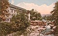 Old Stone Mill in c. 1920
 -
 Franklin Street in 1906
 -
 Mansion House in c. 1908


Geography

According to the United States Census Bureau, the town has a total area of 21.9 square miles (56.8 km²), of which, 21.7 square miles (56.3 km²) of it is land and 0.2 square miles (0.5 km²) of it (0.87%) is water. Greenfield is located at the center of the county, and is bordered by Colrain, Leyden and Bernardston to the north, Gill to the east, Montague to the southeast, Deerfield to the south, and Shelburne to the west. Greenfield is located thirty-nine miles north of Springfield and ninety miles west-northwest of Boston.
Greenfield lies at the confluence of the Deerfield, Green and Connecticut rivers. The Green River runs from the north, through town to the Deerfield, which lies along the city's southern border. From there, the Deerfield meets the Connecticut, which flows southward along the Montague border before bending eastward briefly before continuing southward. Several brooks flow into the three rivers, as well as a fourth river, the Fall River, which makes up the city's border with Gill. The city is located beside the Pocumtuck Range, the northernmost subridge of the Metacomet Ridge, and is surrounded by hills, with the town center lying on an elevated point above the rivers.
Greenfield lies at the junction of four roads. Interstate 91 heads north and south through the city, and is duplexed for a 3-mile stretch with Route 2, the Mohawk Trail. The Mohawk Trail enters over the Fall River as a surface road, before becoming a limited-access highway until I-91. Once it leaves the Interstate, Rooute 2 becomes a surface road again. Between the start of the limited access section of Route 2 and its split from I-91 at Exit 24, The Mohawk Trail follows Route 2A which uses Route 2's former right-of-way through town. At the town center, Route 2A meets the duplexed U.S. Route 5 and Route 10, the road that the Interstate replaced, which comes over the Deerfield River in the south before heading northward through town, with another interchange along the highway portion of Route 2.
Greenfield lies at the junction of two separate sets of the Springfield Terminal railway, the east-west line heading from the northern points of Worcester County towards the Hoosac Tunnel and Albany, and the north-south line heading from Springfield in the south towards Vermont in the north. The town is served by several bus lines taking tourists towards the northern Berkshires, as well as being the hub of the Franklin Regional Transit Authority (FRTA), whose local service extends from Bernardston to Northampton and from Athol to Charlemont. A new "intermodal transportation center" serving as the hub for FRTA bus service and possible passenger rail service is slated to open on Bank Row at the end of 2010.[2] The nearest general aviation airport is located in the Turners Falls section of Montague, and the nearest national air service is at Bradley International Airport in Windsor Locks, Connecticut.
Demographics
See also: Greenfield (CDP), Massachusetts

Greenfield, as the only community in the county with a population over 10,000, is the largest community by population and population density in the county. It is also the smallest mainland county seat in the Commonwealth, as only the island towns of Edgartown and Nantucket are smaller. As of the censusTemplate:GR of 2000, there were 18,168 people, 7,939 households, and 4,374 families residing in the city. The population density was 836.2 people per square mile (322.8/km²). There were 8,301 housing units at an average density of 382.1/sq mi (147.5/km²). The racial makeup of the city was 93.39% White, 1.34% Black or African American, 0.32% Native American, 1.10% Asian, 0.02% Pacific Islander, 1.41% from other races, and 2.43% from two or more races. Hispanic or Latino of any race were 3.54% of the population.
There were 7,939 households out of which 26.1% had children under the age of 18 living with them, 38.6% were married couples living together, 12.7% had a female householder with no husband present, and 44.9% were non-families. 36.9% of all households were made up of individuals and 13.6% had someone living alone who was 65 years of age or older. The average household size was 2.19 and the average family size was 2.88.

In the town the population was spread out with 21.9% under the age of 18, 8.4% from 18 to 24, 28.7% from 25 to 44, 23.5% from 45 to 64, and 17.5% who were 65 years of age or older. The median age was 40 years. For every 100 females there were 88.9 males. For every 100 females age 18 and over, there were 85.4 males.
The median income for a household in the town was $33,110, and the median income for a family was $46,412. Males had a median income of $33,903 versus $26,427 for females. The per capita income for the town was $18,830. About 11.4% of families and 14.0% of the population were below the poverty line, including 19.2% of those under age 18 and 11.1% of those age 65 or over.
Government

Although officially styled the "Town of Greenfield", the 2003 revised corporate charter changed Greenfield's governance model to a mayor-council government, making it the Commonwealth's newest city. Greenfield had formerly been governed by a town council and a town manager. Currently, the town council consists of four at-large councilors and nine councilors elected by precinct. The other town boards are appointed, with the exception of the seven-member school committee, which currently consists of the mayor plus six members elected at-large.
Mayor
Greenfield's first mayor, Christine Forgey, served until 2009 when she was defeated in a primary election. Greenfield's second mayor, Bill Martin took second place in the 2009 primary as a write-in candidate and went on to win the general election in June. Martin's tenure began with a formal inauguration ceremony, the city's first, which also featured a mayoral fanfare, Long Live our Mayor, written for the occasion in the style of Hail to the Chief. At the inauguration, Martin read a proclamation declaring July 1 as "Inauguration Day" in all following years.
In Greenfield, the Mayor appoints most of the members of the various town boards, with the town council approving appointments. The mayor also serves as a voting member of the school committee, but is currently forbidden to serve as its chairman or vice-chair. In addition, the mayor sits as a non-voting member of all the other town boards.
Municipal Services
Greenfield operates its own police, fire, and ambulance services. The town is also patrolled by the Second (Shelburne Falls) Barracks of Troop "B" of the Massachusetts State Police. [3] It runs a sizeable public works department and is the home base of the regional waste management system. The Greenfield Public Library is one of the larger libraries in the area, and is connected to the regional library network. Greenfield also operates numerous municipal parks and recreation areas including a town swimming center.
County Seat
As county seat, Greenfield is also home to many different state offices, including courthouses and one of the offices of the Northwest District Attorney, Elizabeth D. Scheibel. The Franklin County Sheriff is based in Greenfield and operates the Franklin County Jail at the corner of Elm and Allen streets. The city also has the central post office for the "013" series of ZIP codes, which extends through Franklin County and several towns in Worcester County. Greenfield is home to the privately-run Baystate Franklin Medical Center, which serves much of the northern Pioneer Valley.
Legislative Delegation
Greenfield is part of the Second Franklin district of the Massachusetts House of Representatives, which includes much of southeastern Franklin County and towns in western Worcester County. Currently Representative Christopher Donelan serves this district. In the Massachusetts Senate, the town is part of the Hampshire and Franklin district, which includes much of eastern Franklin and Hampshire Counties. State Senator Stanley C. Rosenberg currently represents this district. [4]
Nationally, Greenfield is represented in the United States House of Representatives as part of Massachusetts's 1st congressional district, and has been represented by John Olver of Amherst since June 1991. Massachusetts is represented in the United States Senate by senior Senator Ted Kennedy and junior Senator John Kerry.
Education
Greenfield operates its own public school system for the town's 1,700 students. Greenfield operates The Academy of Early Learning at North Parish for pre-kindergarten students, three elementary schools - the Four Corners School to the north, the Federal Street School centrally, and the Newton Elementary School to the west - for students from kindergarten through third grade, the Greenfield Middle School for students from fourth through seventh grades, and Greenfield High School for eighth through twelfth grades. Greenfield's athletic teams are nicknamed the Green Wave, and their school colors are green and white.
Alternative Public Schools
Greenfield operates the Poet Seat School, an alternative middle and high school for special needs students. On July 9, 2009, Greenfield's local school committee approved creation of the Massachusetts Virtual Academy or "MAVA @ Greenfield", the only kindergarten through twelfth grade distance learning school of its kind in the state.[5] The MAVA program is also expected to provide expanded course offerings to students in the traditional public schools. Greenfield is also home to the Four Rivers Charter Public School, which serves students in grades 7-12.
Private Schools
Greenfield also has several private schools. The oldest is the Stoneleigh-Burnham School, a private 7th-12th grade boarding school for girls. The Greenfield Center School serves students through eighth grade with an "ethical" approach to education. There are two religious schools, the Cornerstone Christian School and the Holy Trinity School, both of which serve pre-kindergarten through eighth grades.
Higher Education
Greenfield is home to the Greenfield Community College, which serves the northern Pioneer Valley and offers some courses to Greenfield High students seeking advanced learning opportunities. The nearest state college is Westfield State College, and the nearest state university is the University of Massachusetts Amherst. There are also several private colleges, including members of the Five Colleges and Seven Sisters, in the Northampton area.
Points of interest

- Historical Society of Greenfield, 43 Church Street
- Guiding Star Grange is a community hall, known for traditional music and dance in the Pioneer Valley.
- Greenfield Center School, an independent K-8th grade school, is the a site of the Coalition of Essential Schools and the home of the New England Coalition of Progressive Educators.
- Greenfield Energy Park, a community greenspace featuring renewable energy exhibits, gardens, native arboretum, caboose museum, concerts, and public art in the heart of downtown Greenfield. Site of former train station. Headquartered at the Northeast Sustainable Energy Association (NESEA).
- Leavitt-Hovey House, now the Greenfield Public Library, built in 1797 by Asher Benjamin for judge Jonathan Leavitt.
- The area is home to an optical illusion known as a gravity hill. It is located on Shelburne Road, while facing Greenfield, immediately after the Route 2 bridge. From under the overpass, the road appears to rise slightly to a crest a few hundred feet away. The illusion is slight, but convincing. A car in neutral at the "bottom" of the rise will appear to crawl uphill.
- Rocky Mountain Park features Poet's Seat Tower, a 1912 sandstone observation tower named for the site's attraction to poets, particularly Frederick Goddard Tuckerman. The annual Fourth of July fireworks celebration takes place at Poet's Seat, which overlooks Beacon Field.
Notable residents
- Charles Allen, jurist
- Meguey Baker, game designer
- Christopher Baldwin, comic strip artist (Bruno)
- Stan Batinski, football player
- Asher Benjamin, architect
- Peter Bergeron, baseball player
- Titus Billings, religious pioneer
- Scott Crago, musician
- Kelly Doton, field hockey player
- George Grennell, Jr., congressman
- Kevin Hassett, economist & author (Now lives in Washington DC)
- Herbert Huncke, Beat Generation figure
- Penn Jillette, magician
- Robin Lane, musician
- Jonathan Leavitt, lawyer, judge, state senator & banker
- Roger Hooker Leavitt, prominent abolitionist
- Winter Miller, playwright (In Darfur)
- Michael Moschen, juggler
- Al Norman, anti-Wal-Mart activist
- Steve Partenheimer, baseball player
- George Ripley, Transcendentalist and founder of the Brook Farm communal experiment
- John E. Russell, congressman
- Rufus Saxton, brigadier general
- Bennett Jones Sims, bishop
- Charles Pomeroy Stone, army officer & engineer
- Frederick Goddard Tuckerman, poet
- Fred Wallner, football player
- William B. Washburn, congressman & governor
- Van Hansis, Actor (As The World Turns)
- Lou Bush,College Football Player, led nation in TD's 1931, UMASS
References
- Francis M. Thompson, History of Greenfield, Shire Town of Franklin County, Massachusetts; T. Morey & Son, publishers; Greenfield, Massachusetts 1904
- History of Greenfield, Massachusetts (1879)
- History of the Green River Works
- Leavitt-Hovey House, History of Greenfield, Massachusetts, Francis Thompson, 1904
- [2]
- ^ * Hoffman, Curtiss (1991). A handbook of Indian artifacts from Southern New England. Lincoln, Massachusetts: Massachusetts Archaeological Society special publication ;, #4. p. 142.
{{cite book}}: Unknown parameter|coauthors=ignored (|author=suggested) (help) - ^ Comment welcome on new transit depot, Recorder Newspaper, June 10, 2009 [1]
- ^ Station B-2, SP Shelburne Falls
- ^ List of Massachusetts Legislators by City and Town
- ^ http://www.recorder.com/story.cfm?id_no=6351851 Recorder newspaper article about the virtual school- July 11, 2009
External links
- City of Greenfield, Massachusetts
- GreaterGreenfield.net serving Franklin County
- Greenfield Public Library
- Arena Civic Theatre
- Franklin County Fair
- Greenfield Community College
- Greenfield Optimist
- Greenfield Recorder
- Pioneer Valley Symphony Orchestra
- Greenfield Public Schools
- St. James' Coffeehouse
- Handwriting Analysis Research Library
Municipalities and communities of Franklin County, Massachusetts, United States | ||
|---|---|---|
| City |  | |
| Towns | ||
| CDPs | ||
| Other villages | ||
| Ghost town | ||