
Grand Lake, Colorado: Difference between revisions
JJMC89 bot (talk | contribs) Migrate {{Infobox settlement}} coordinates parameters to {{Coord}}, see Wikipedia:Coordinates in infoboxes |
Rescuing 4 sources and tagging 1 as dead. #IABot (v1.3beta3) |
||
| Line 36: | Line 36: | ||
|subdivision_type1 = [[Political divisions of the United States|State]] |
|subdivision_type1 = [[Political divisions of the United States|State]] |
||
|subdivision_name1 = {{flag|Colorado}} |
|subdivision_name1 = {{flag|Colorado}} |
||
|subdivision_type2 = [[List of counties in Colorado|County]]<ref name=COMun>{{cite web |
|subdivision_type2 = [[List of counties in Colorado|County]]<ref name=COMun>{{cite web|url=http://www.dola.state.co.us/dlg/local_governments/municipalities.html |title=Active Colorado Municipalities |publisher=[[Colorado|State of Colorado]], Department of Local Affairs |accessdate=2007-09-01 |deadurl=yes |archiveurl=http://www.webcitation.org/5uRWqBo2m?url=http://www.dola.state.co.us/dlg/local_governments/municipalities.html |archivedate=2010-11-22 |df= }}</ref> |
||
|subdivision_name2 = [[Grand County, Colorado|Grand]] |
|subdivision_name2 = [[Grand County, Colorado|Grand]] |
||
|subdivision_type3 = |
|subdivision_type3 = |
||
| Line 106: | Line 106: | ||
|elevation_ft = 8369 |
|elevation_ft = 8369 |
||
<!-- Area/postal codes & others --------> |
<!-- Area/postal codes & others --------> |
||
|postal_code_type = [[ZIP code]]<ref name=ZIPcode>{{cite web |
|postal_code_type = [[ZIP code]]<ref name=ZIPcode>{{cite web|url=http://zip4.usps.com/zip4/citytown.jsp |title=ZIP Code Lookup |format=[[JavaScript]]/[[HTML]] |publisher=[[United States Postal Service]] |accessdate=September 24, 2007 |deadurl=yes |archiveurl=http://www.webcitation.org/5uRWp2Zfd?url=http://zip4.usps.com/zip4/citytown.jsp |archivedate=November 22, 2010 |df= }}</ref> |
||
|postal_code = 80447 |
|postal_code = 80447 |
||
|area_code = [[Area code 970|970]] |
|area_code = [[Area code 970|970]] |
||
| Line 266: | Line 266: | ||
|estyear=2015 |
|estyear=2015 |
||
|estimate=483 |
|estimate=483 |
||
|estref=<ref name="USCensusEst2015">{{cite web|url=http://www.census.gov/popest/data/cities/totals/2015/SUB-EST2015.html|title=Annual Estimates of the Resident Population for Incorporated Places: April 1, 2010 to July 1, 2015|accessdate=July 2, 2016}}</ref> |
|estref=<ref name="USCensusEst2015">{{cite web|url=http://www.census.gov/popest/data/cities/totals/2015/SUB-EST2015.html |title=Annual Estimates of the Resident Population for Incorporated Places: April 1, 2010 to July 1, 2015 |accessdate=July 2, 2016 }}{{dead link|date=March 2017 |bot=InternetArchiveBot |fix-attempted=yes }}</ref> |
||
|footnote=<center>U.S. Decennial Census<ref name="DecennialCensus">{{cite web|url=http://www.census.gov/prod/www/decennial.html|title=Census of Population and Housing|publisher=Census.gov|accessdate=June 4, 2015}}</ref></center> |
|footnote=<center>U.S. Decennial Census<ref name="DecennialCensus">{{cite web|url=http://www.census.gov/prod/www/decennial.html |title=Census of Population and Housing |publisher=Census.gov |accessdate=June 4, 2015 |deadurl=yes |archiveurl=http://www.webcitation.org/6YSasqtfX?url=http%3A%2F%2Fwww.census.gov%2Fprod%2Fwww%2Fdecennial.html |archivedate=May 11, 2015 |df= }}</ref></center> |
||
}} |
}} |
||
As of the [[census]]<ref name="GR2">{{cite web|url=http://factfinder2.census.gov|publisher=[[United States Census Bureau]]|accessdate=2008-01-31|title=American FactFinder}}</ref> of 2000, there were 447 people, 219 households, and 121 families residing in the town. The [[population density]] was 472.5 people per square mile (181.7/km²). There were 748 housing units at an average density of 790.7 per square mile (304.0/km²). The racial makeup of the town was 96.20% [[White (U.S. Census)|White]], 0.67% [[African American (U.S. Census)|African American]], 0.89% [[Native American (U.S. Census)|Native American]], 0.67% [[Asian (U.S. Census)|Asian]], 0.22% from [[Race (United States Census)|other races]], and 1.34% from two or more races. [[Hispanic (U.S. Census)|Hispanic]] or [[Latino (U.S. Census)|Latino]] of any race were 2.68% of the population. |
As of the [[census]]<ref name="GR2">{{cite web|url=http://factfinder2.census.gov |publisher=[[United States Census Bureau]] |accessdate=2008-01-31 |title=American FactFinder |deadurl=yes |archiveurl=https://web.archive.org/web/20130911234518/http://factfinder2.census.gov/ |archivedate=2013-09-11 |df= }}</ref> of 2000, there were 447 people, 219 households, and 121 families residing in the town. The [[population density]] was 472.5 people per square mile (181.7/km²). There were 748 housing units at an average density of 790.7 per square mile (304.0/km²). The racial makeup of the town was 96.20% [[White (U.S. Census)|White]], 0.67% [[African American (U.S. Census)|African American]], 0.89% [[Native American (U.S. Census)|Native American]], 0.67% [[Asian (U.S. Census)|Asian]], 0.22% from [[Race (United States Census)|other races]], and 1.34% from two or more races. [[Hispanic (U.S. Census)|Hispanic]] or [[Latino (U.S. Census)|Latino]] of any race were 2.68% of the population. |
||
There were 219 households out of which 21.0% had children under the age of 18 living with them, 46.6% were [[Marriage|married couples]] living together, 3.2% had a female householder with no husband present, and 44.7% were non-families. 35.2% of all households were made up of individuals and 5.5% had someone living alone who was 65 years of age or older. The average household size was 2.02 and the average family size was 2.60. |
There were 219 households out of which 21.0% had children under the age of 18 living with them, 46.6% were [[Marriage|married couples]] living together, 3.2% had a female householder with no husband present, and 44.7% were non-families. 35.2% of all households were made up of individuals and 5.5% had someone living alone who was 65 years of age or older. The average household size was 2.02 and the average family size was 2.60. |
||
Revision as of 04:24, 24 March 2017
Grand Lake, Colorado | |
|---|---|
 Grand Lake village in winter | |
 Location in Grand County and the state of Colorado | |
| Coordinates: 40°15′2″N 105°49′28″W / 40.25056°N 105.82444°W | |
| Country | |
| State | |
| County[1] | Grand |
| Established | 1879 |
| Incorporated (town) | June 23, 1944[2] |
| Government | |
| • Type | Statutory Town[1] |
| Area | |
| • Total | 1.0 sq mi (2.7 km2) |
| • Land | 1.0 sq mi (2.7 km2) |
| • Water | 0 sq mi (0 km2) |
| Elevation | 8,369 ft (2,551 m) |
| Population (2010) | |
| • Total | 471 |
| • Density | 446/sq mi (172.3/km2) |
| Time zone | UTC-7 (MST) |
| • Summer (DST) | UTC-6 (MDT) |
| ZIP code[3] | 80447 |
| Area code | 970 |
| FIPS code | 08-31715 |
| GNIS feature ID | 0202505 |
| Website | www |
Grand Lake is a statutory town in Grand County, Colorado, United States. The population was 471 at the 2010 census.[4]
Established in 1881, Grand Lake sits at an elevation of 8,369 feet (2,551 m) and derives its name from the lake on whose shores it is situated: Grand Lake, the largest natural body of water in Colorado. The town of Grand Lake was originally an outfitting and supply point for the mining settlements of Lulu City, Teller City, and Gaskill, but today is a tourist destination adjacent to the western entrance to Rocky Mountain National Park, which surrounds the lake and the town on three sides. Grand Lake was the Grand County seat of government from 1882-1888. It was incorporated on June 23, 1944.[2]
Geography
Grand Lake is located in northeastern Grand County at 40°15′2″N 105°49′28″W / 40.25056°N 105.82444°W (40.250493, -105.824323).[5] U.S. Route 34 (Trail Ridge Road) runs through the western side of the town, entering Rocky Mountain National Park just north of town and leading 45 miles (72 km) across the mountains to Estes Park. To the southwest, US 34 leads 15 miles (24 km) to Granby.
According to the United States Census Bureau, the town has a total area of 1.0 square mile (2.7 km2), all of it land.[4]
Climate
Due to its elevation, Grand Lake has a subalpine climate (Köppen climate classification Dfc) with a short growing season, averaging just 49 days per year.[6] Temperatures are chilly at night even through the summer months, and only three months have an average temperature of above 10 °C (50 °F).
| Climate data for Grand Lake (1 NW), Colorado (1981–2010 normals) | |||||||||||||
|---|---|---|---|---|---|---|---|---|---|---|---|---|---|
| Month | Jan | Feb | Mar | Apr | May | Jun | Jul | Aug | Sep | Oct | Nov | Dec | Year |
| Record high °F (°C) | 53 (12) |
56 (13) |
67 (19) |
73 (23) |
82 (28) |
89 (32) |
92 (33) |
92 (33) |
89 (32) |
80 (27) |
68 (20) |
55 (13) |
92 (33) |
| Mean daily maximum °F (°C) | 32.4 (0.2) |
36.0 (2.2) |
43.3 (6.3) |
50.5 (10.3) |
60.1 (15.6) |
70.6 (21.4) |
76.4 (24.7) |
74.3 (23.5) |
67.8 (19.9) |
56.0 (13.3) |
40.6 (4.8) |
31.5 (−0.3) |
53.3 (11.8) |
| Mean daily minimum °F (°C) | 4.3 (−15.4) |
6.3 (−14.3) |
13.4 (−10.3) |
20.3 (−6.5) |
28.0 (−2.2) |
34.1 (1.2) |
39.4 (4.1) |
38.3 (3.5) |
31.4 (−0.3) |
23.5 (−4.7) |
13.6 (−10.2) |
5.1 (−14.9) |
21.5 (−5.8) |
| Record low °F (°C) | −43 (−42) |
−41 (−41) |
−36 (−38) |
−21 (−29) |
1 (−17) |
16 (−9) |
21 (−6) |
18 (−8) |
7 (−14) |
−8 (−22) |
−28 (−33) |
−35 (−37) |
−43 (−42) |
| Average precipitation inches (mm) | 1.52 (39) |
1.42 (36) |
1.38 (35) |
1.59 (40) |
1.78 (45) |
1.60 (41) |
1.91 (49) |
2.31 (59) |
1.82 (46) |
1.49 (38) |
1.27 (32) |
1.70 (43) |
19.79 (503) |
| Average snowfall inches (cm) | 27.3 (69) |
20.9 (53) |
16.3 (41) |
15.5 (39) |
3.3 (8.4) |
0.2 (0.51) |
0 (0) |
0 (0) |
0.5 (1.3) |
7.5 (19) |
20.1 (51) |
25.7 (65) |
142.8 (363) |
| Average precipitation days (≥ 0.01 in) | 14 | 12 | 12 | 11 | 13 | 12 | 14 | 15 | 13 | 10 | 12 | 14 | 150 |
| Average snowy days (≥ 0.1 in) | 14 | 11 | 8 | 6 | 1 | 0 | 0 | 0 | 0 | 3 | 10 | 13 | 72 |
| Source: NOAA (extremes 1939–present)[6] | |||||||||||||
Grand Lake

Grand Lake is Colorado's largest and deepest natural lake, and is part of the headwaters of the Colorado River. The lake became a component in the Colorado-Big Thompson Project (C-BT) in 1937, when it was recruited as a conduit for C-BT project water. The C-BT project diverts water from the Colorado River Basin east via the Alva B. Adams Tunnel under the Continental Divide and Rocky Mountain National Park to the Big Thompson River watershed, thence the South Platte River and ultimately the Mississippi River basin.
Grand Lake Yacht Club is a private club that hosts sailing races on the lake, and there are also publicly and privately operated marinas, a public boat ramp, and public boat docks on the lake.
Demographics
| Census | Pop. | Note | %± |
|---|---|---|---|
| 1950 | 309 | — | |
| 1960 | 170 | −45.0% | |
| 1970 | 189 | 11.2% | |
| 1980 | 382 | 102.1% | |
| 1990 | 259 | −32.2% | |
| 2000 | 447 | 72.6% | |
| 2010 | 471 | 5.4% | |
| 2015 (est.) | 483 | [7] | 2.5% |
As of the census[9] of 2000, there were 447 people, 219 households, and 121 families residing in the town. The population density was 472.5 people per square mile (181.7/km²). There were 748 housing units at an average density of 790.7 per square mile (304.0/km²). The racial makeup of the town was 96.20% White, 0.67% African American, 0.89% Native American, 0.67% Asian, 0.22% from other races, and 1.34% from two or more races. Hispanic or Latino of any race were 2.68% of the population.
There were 219 households out of which 21.0% had children under the age of 18 living with them, 46.6% were married couples living together, 3.2% had a female householder with no husband present, and 44.7% were non-families. 35.2% of all households were made up of individuals and 5.5% had someone living alone who was 65 years of age or older. The average household size was 2.02 and the average family size was 2.60.
In the town, the population was spread out with 16.8% under the age of 18, 6.3% from 18 to 24, 29.3% from 25 to 44, 35.6% from 45 to 64, and 12.1% who were 65 years of age or older. The median age was 44 years. For every 100 females there were 124.6 males. For every 100 females age 18 and over, there were 122.8 males.
The median income for a household in the town was $45,096, and the median income for a family was $55,750. Males had a median income of $30,833 versus $26,250 for females. The per capita income for the town was $34,676. About 3.0% of families and 7.0% of the population were below the poverty line, including 7.4% of those under age 18 and none of those age 65 or over.
Culture


Grand Lake is home to the Rocky Mountain Repertory Theatre. This summer stock theatre company produces three Broadway musicals from June through August and one musical in September. In the spring of 2010, a new 12,000-square-foot (1,100 m2) theatre complex was built for RMRT in Grand Lake.
Notable residents
- Marvin Heemeyer
- John Wayne, former resident, vacation home
See also
- Outline of Colorado
- State of Colorado
- Arapaho National Forest
- Arapaho National Recreation Area
- Grand Lake
- Grand Lake Yacht Club
- Grand River (Colorado)
- Rocky Mountain National Park
- History of Rocky Mountain National Park
References
- ^ a b "Active Colorado Municipalities". State of Colorado, Department of Local Affairs. Archived from the original on 2010-11-22. Retrieved 2007-09-01.
{{cite web}}: Unknown parameter|deadurl=ignored (|url-status=suggested) (help) - ^ a b "Colorado Municipal Incorporations". State of Colorado, Department of Personnel & Administration, Colorado State Archives. 2004-12-01. Retrieved 2007-09-02.
- ^ "ZIP Code Lookup". United States Postal Service. Archived from the original (JavaScript/HTML) on November 22, 2010. Retrieved September 24, 2007.
{{cite web}}: Unknown parameter|deadurl=ignored (|url-status=suggested) (help) - ^ a b "Geographic Identifiers: 2010 Demographic Profile Data (G001): Grand Lake town, Colorado". American Factfinder. U.S. Census Bureau. Retrieved November 17, 2016.
- ^ "US Gazetteer files: 2010, 2000, and 1990". United States Census Bureau. 2011-02-12. Retrieved 2011-04-23.
- ^ a b "NowData - NOAA Online Weather Data". National Oceanic and Atmospheric Administration. Retrieved May 30, 2016.
- ^ "Annual Estimates of the Resident Population for Incorporated Places: April 1, 2010 to July 1, 2015". Retrieved July 2, 2016.[permanent dead link]
- ^ "Census of Population and Housing". Census.gov. Archived from the original on May 11, 2015. Retrieved June 4, 2015.
{{cite web}}: Unknown parameter|deadurl=ignored (|url-status=suggested) (help) - ^ "American FactFinder". United States Census Bureau. Archived from the original on 2013-09-11. Retrieved 2008-01-31.
{{cite web}}: Unknown parameter|deadurl=ignored (|url-status=suggested) (help)
External links
Municipalities and communities of Grand County, Colorado, United States | ||
|---|---|---|
| Towns | 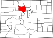 | |
| CDPs | ||
| Unincorporated communities | ||
| Ghost towns | ||