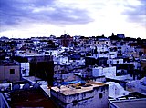
Bay of Tangier
Appearance
From Wikipedia, the free encyclopedia
This is an old revision of this page, as edited by Isoglosse (talk | contribs) at 21:06, 21 September 2023 (#suggestededit-add 1.0). The present address (URL) is a permanent link to this revision, which may differ significantly from the current revision.
Bay on the Mediterranean in northern Morocco
The Bay of Tangier (Arabic: خليج طنجة) is a bay around Tangier on the Mediterranean in northern Morocco. It forms the body of water between the port and Cap Malabata in a semi circular shape. Avenue d'Espagne runs along the bay and is known for its hotels and large modern establishments.[1]
References
- ^ Morocco. Dorling Kindersley Eyewitness Travel Guides. 2006. p. 141.
History |
| |
---|---|---|
Economy | ||
Districts and streets | ||
Religious buildings | ||
Palaces and museums | ||
Other buildings | ||
Schools and colleges | ||
Transport | ||
Sport and culture | ||
Geography |
35°47′28″N 5°46′58″W / 35.79111°N 5.78278°W / 35.79111; -5.78278
This Tanger-Tetouan-Al Hoceima location article is a stub. You can help Wikipedia by expanding it. |