
Lincolnton, Georgia
Lincolnton, Georgia | |
|---|---|
 Location in Lincoln County and the state of Georgia | |
| Country | United States |
| State | Georgia |
| County | Lincoln |
| Area | |
| • Total | 3.2 sq mi (8.3 km2) |
| • Land | 3.2 sq mi (8.3 km2) |
| • Water | 0 sq mi (0 km2) |
| Elevation | 469 ft (143 m) |
| Population (2000) | |
| • Total | 1,595 |
| • Density | 498.4/sq mi (192.2/km2) |
| Time zone | UTC-5 (Eastern (EST)) |
| • Summer (DST) | UTC-4 (EDT) |
| ZIP code | 30817 |
| Area code | 706 |
| FIPS code | 13-46552Template:GR |
| GNIS feature ID | 0328514Template:GR |
Lincolnton is a city in and the county seat of Lincoln County, Georgia, United States.Template:GR The population was 1,595 at the 2000 census.
Geography
Lincolnton is located at 33°47′40″N 82°28′35″W / 33.79444°N 82.47639°WInvalid arguments have been passed to the {{#coordinates:}} function (33.794414, -82.476450)Template:GR.
According to the United States Census Bureau, the city has a total area of 3.2 square miles (8.3 km²), all of it land.
Demographics
As of the censusTemplate:GR of 2000, there were 1,595 people, 610 households, and 428 families residing in the city. The population density was 498.6 people per square mile (192.4/km²). There were 657 housing units at an average density of 205.4/sq mi (79.3/km²). The racial makeup of the city was 56.80% White, 42.19% African American, 0.06% Native American, 0.38% Asian, 0.13% from other races, and 0.44% from two or more races. Hispanic or Latino of any race were 1.13% of the population.
There were 610 households out of which 32.3% had children under the age of 18 living with them, 43.8% were married couples living together, 22.8% had a female householder with no husband present, and 29.8% were non-families. 27.7% of all households were made up of individuals and 15.9% had someone living alone who was 65 years of age or older. The average household size was 2.50 and the average family size was 3.05.
In the city the population was spread out with 26.1% under the age of 18, 8.5% from 18 to 24, 28.0% from 25 to 44, 21.4% from 45 to 64, and 16.0% who were 65 years of age or older. The median age was 36 years. For every 100 females there were 83.1 males. For every 100 females age 18 and over, there were 78.9 males.
The median income for a household in the city was $30,074, and the median income for a family was $34,943. Males had a median income of $28,750 versus $19,375 for females. The per capita income for the city was $15,428. About 15.8% of families and 19.2% of the population were below the poverty line, including 27.1% of those under age 18 and 21.1% of those age 65 or over.
Notable residents
- Garrison Hearst, former NFL football player
- Barney Bussey, fomer NFL football player
- Lewis Family, Musicians
- Tom Poland, Writer
References
External links
Municipalities and communities of Lincoln County, Georgia, United States | ||
|---|---|---|
| Cities | 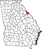 | |
| Unincorporated communities | ||
| Ghost town | ||