
Sheridan County, North Dakota
47°35′N 100°20′W / 47.58°N 100.34°W
Sheridan County | |
|---|---|
 Location within the U.S. state of North Dakota | |
 North Dakota's location within the U.S. | |
| Coordinates: 47°35′N 100°20′W / 47.58°N 100.34°W | |
| Country | |
| State | |
| Seat | McClusky |
| Largest city | McClucky |
| Area | |
| • Total | 1,006 sq mi (2,610 km2) |
| • Land | 972 sq mi (2,520 km2) |
| • Water | 34 sq mi (90 km2) 3.38% |
| Population | |
| • Estimate (2009) | 1,228 |
| • Density | 3/sq mi (1/km2) |
Sheridan County is a county located in the U.S. state of North Dakota. As of 2000, the population was 1,710. Its county seat is McClusky.Template:GR
Geography
According to the U.S. Census Bureau, the county has a total area of 1,006 square miles (2,605 km²), of which, 972 square miles (2,517 km²) of it is land and 34 square miles (88 km²) of it (3.38%) is water. Sheridan County was named after American Civil War general Philip Henry Sheridan.
Townships
|
|
|
Defunct Townships
Major highways
Adjacent counties
- McHenry County (north)
- Pierce County (northeast)
- Wells County (east)
- Kidder County (southeast)
- Burleigh County (south)
- McLean County (west)
Places adjacent to Sheridan County, North Dakota | ||||||||||||||||
|---|---|---|---|---|---|---|---|---|---|---|---|---|---|---|---|---|
| ||||||||||||||||
National protected area
Demographics
| Census | Pop. | Note | %± |
|---|---|---|---|
| 1910 | 8,103 | — | |
| 1920 | 7,935 | −2.1% | |
| 1930 | 7,373 | −7.1% | |
| 1940 | 6,616 | −10.3% | |
| 1950 | 5,253 | −20.6% | |
| 1960 | 4,350 | −17.2% | |
| 1970 | 3,232 | −25.7% | |
| 1980 | 2,819 | −12.8% | |
| 1990 | 2,148 | −23.8% | |
| 2000 | 1,710 | −20.4% | |
| 2009 (est.) | 1,228 |
As of the censusTemplate:GR of 2000, there were 1,710 people, 731 households, and 515 families residing in the county. The population density was 2 people per square mile (1/km²). There were 924 housing units at an average density of 1 per square mile (0/km²). The racial makeup of the county was 99.24% White, 0.12% Black or African American, 0.41% Native American, 0.06% from other races, and 0.18% from two or more races. 0.35% of the population were Hispanic or Latino of any race. 72.3% were of German and 12.5% Norwegian ancestry according to Census 2000.
There were 731 households out of which 25.00% had children under the age of 18 living with them, 62.80% were married couples living together, 4.40% had a female householder with no husband present, and 29.50% were non-families. 27.50% of all households were made up of individuals and 16.70% had someone living alone who was 65 years of age or older. The average household size was 2.31 and the average family size was 2.80.
In the county the population was spread out with 21.40% under the age of 18, 3.80% from 18 to 24, 19.90% from 25 to 44, 28.30% from 45 to 64, and 26.60% who were 65 years of age or older. The median age was 48 years. For every 100 females there were 105.80 males. For every 100 females age 18 and over, there were 104.30 males.
The median income for a household in the county was $24,450, and the median income for a family was $30,156. Males had a median income of $21,094 versus $14,327 for females. The per capita income for the county was $13,283. About 16.00% of families and 21.00% of the population were below the poverty line, including 24.90% of those under age 18 and 18.30% of those age 65 or over.
Places
Cities
Note: all incorporated communities in North Dakota are called "cities" regardless of their size.
Unincorporated community
References
External links
Municipalities and communities of Sheridan County, North Dakota, United States | ||
|---|---|---|
| Cities | 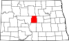 | |
| Townships | ||
| Unorganized territories | ||
| CDP | ||
