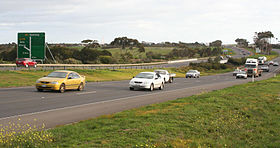
Freeways in Australia
This is a list of freeways (or motorways) in Australia, sorted by states and territories and their corresponding routes. This list includes tollways / toll roads such as the CityLink freeway system in Melbourne. This list has over 70 entries. The only jurisdiction in Australia without freeways is the Northern Territory. Victoria has the largest and densest freeway network in Australia.
Australian Capital Territory
- Majura Parkway
- Gungahlin Drive Extension
- Capital Circle
- Parkes Way*
- Tuggeranong Parkway
- Adelaide Avenue
- Yarra Glen
*Partially limited-access
Tasmania

While the overall quality of Tasmania's Highway network has been constructed to a high standard, its grade separated Freeway network is limited. In the past, Hobart and Launceston have each had comprehensive transport studies conducted, proposing Grade separated Freeways running through and around them. While some of these roads have been constructed, the majority are limited access featuring At-grade intersections. Devonport and Burnie are the only major population centres with Freeway standard roads linking each other. There has been repeated proposals in recent years to fully upgrade the Midland Highway to grade separated Freeway standards.[1][2]
This List is limited to Tasmania's Freeway standard Roads.
Hobart Region

- Southern Outlet (Hobart to Kingston)
Rural Region
- Bass Highway (Burnie to Devonport and Prospect to Illawarra Main Road)
- Midland Highway (South Launceston to Breadalbane)
New South Wales
Sydney region
![]()
- Gore Hill Freeway
- Warringah Freeway
- Sydney Harbour Tunnel (fully electronically tolled for southbound traffic)
- Cahill Expressway
- Eastern Distributor (fully electronically tolled for northbound traffic)
- Southern Cross Drive
- General Holmes Drive, the Airport Tunnel
![]()
- Lane Cove Tunnel (fully electronically tolled)
- M2 Hills Motorway (fully electronically tolled)
![]()
![]()
- Cross City Tunnel (fully electronically tolled)
- M4 Western Motorway
- Western Distributor
![]()
- M5 South Western Motorway (fully electronically tolled)
- M5 East Freeway
![]()
- Westlink M7 (fully electronically tolled)
Rural region
![]()
![]()
- Pacific Motorway (Northern NSW, from Ewingsdale to QLD border)
- Pacific Motorway (Sydney to Newcastle), also known as the F3
- Pacific Highway, 70% of which is of freeway or dual carriageway standard.
- Princes Motorway, also known as the F6
- Princes Highway, 16% of which is of freeway or dual carriageway standard.
![]()
![]()
- Hume Motorway, also known as the F5
- Hume Highway, 100% of which is of freeway or dual carriageway standard.
![]()
Under Construction
Queensland
Brisbane region
- Bruce Highway
- Gateway Motorway (Gateway Bridge crossing over Brisbane River)
- Pacific Motorway
- Ipswich Motorway
- Logan Motorway (Tolled)
- Gateway Motorway (Tolled)
- Logan Motorway (Tolled)
- Ipswich Motorway (Goodna to Archerfield)
- Airport Link Tunnel (Tolled)
- Clem Jones Tunnel (Clem7) (Tolled)
![]()
Gold Coast region
![]()
Sunshine Coast region
![]()
Townsville region
- Douglas Arterial Road (part of the greater Townsville Ring Road)
South Australia

- South Road Superway (Under Construction)
- Gawler Bypass - freeway grade road
- Northern Expressway
- Northern Connector (proposed)
Victoria
Victoria has the largest number and highest density of freeways in Australia, with the majority being located in Melbourne City or the metropolitan areas.
The reason behind Victoria having a high density of arterial roads, highways and freeways, is due to a low population density over a large area (like most of Australia), where towns are sparse or located a significant distance from each other; but with Victoria having towns located throughout the entire state, with large numbers of inhabitants, in both urban and rural areas (many of which are major) such as Ballarat or Bendigo. This is compared to New South Wales (for instance), where the majority of the state to the central and west is rural and has hardly any inhabitants.


Melbourne region (Urban Freeways)
- CityLink (Fully electronically tolled)
- Monash Freeway
- West Gate Freeway
- Princes Freeway (from Werribee-Main Road or Duncans Road)
- CityLink (also
 ) (Fully electronically tolled)
 - Tullamarine Freeway (also

 )
)
- Eastern Freeway
- EastLink (Fully electronically tolled)
- Frankston Freeway
Rural Freeways
- Princes Freeway (West)
Melbourne to Werribee section is classified as an 'Urban Freeway'. - Princes Freeway (East)
Narre Warren to Pakenham section is classified as an 'Urban Freeway'.
Note: 'East' and 'West' sections are officially part of the same freeway and route corridor.
- Western Freeway
Deer Park Bypass section is classified as an 'Urban Freeway'.
- Calder Freeway (also
 )
)
Melbourne to Taylors Lakes section is classified as an 'Urban Freeway'.
Under Construction
- East West Link (major multi-billion dollar cross-city tollway. Stage 1 - Tunnel / Stage 2 - CityLink to Western Ring Road)
- Geelong Ring Road (Stage 4 - Status: Complete)
- Princes Freeway (Geelong to Colac)
- Princes Freeway (Traralgon to Sale)
- Western Freeway (Ballarat to Stawell)
Western Australia

 Kwinana Freeway (State Route 2 (all sections) / National Route 1 (Como - Brentwood))
 Mitchell Freeway (State Route 2)
 Graham Farmer Freeway (State Route 8)
See also
- Highways in Australia
- Highway 1
- National Highway (Australia)
- Transport in Australia
- Road transport in Australia
- List of roads and highways
- List of Australian airports
- List of Australian ports
References
- ^ "Plan for four-lane Midland Highway". The Examiner. December 2010. Retrieved 3 November 2011.
- ^ "Abbott Doorstop in Launceston - Midland Highway upgrade". Liberal Party of Australia. February 2010. Retrieved 3 November 2011.
- ^ "PTUA - 'The Alternative to Melbourne's Freeway Explosion'". Retrieved 26 July 2007.
