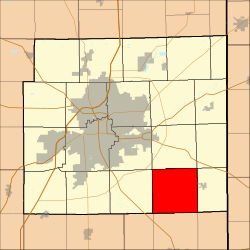
Madison Township, Allen County, Indiana
Appearance
Madison Township | |
|---|---|
 Location in Allen County, Indiana | |
| Coordinates: 40°57′33″N 84°56′28″W / 40.95917°N 84.94111°W | |
| Country | |
| State | |
| County | Allen |
| Government | |
| • Type | Indiana township |
| Area | |
• Total | 36.58 sq mi (94.75 km2) |
| • Land | 36.58 sq mi (94.75 km2) |
| • Water | 0 sq mi (0 km2) 0% |
| Elevation | 807 ft (246 m) |
| Population (2010) | |
• Total | 1,771 |
| • Density | 48/sq mi (18.7/km2) |
| ZIP codes | 46733, 46745, 46773, 46816 |
| GNIS feature ID | 0453587 |
Madison Township is one of twenty townships in Allen County, Indiana, United States. As of the 2010 census, its population was 1,771.[1]
Geography
According to the United States Census Bureau, Madison Township covers an area of 36.58 square miles (94.75 km2).[1]
Unincorporated towns
- Boston Corner at 40°56′54″N 84°54′01″W / 40.948381°N 84.900243°W
- Hoagland at 40°56′52″N 84°59′30″W / 40.947826°N 84.991634°W
(This list is based on USGS data and may include former settlements.)
Adjacent townships
- Jefferson Township (north)
- Jackson Township (northeast)
- Monroe Township (east)
- Union Township, Adams County (southeast)
- Root Township, Adams County (south)
- Preble Township, Adams County (southwest)
- Marion Township (west)
- Adams Township (northwest)
Cemeteries
The township contains Massilon Cemetery.
Airports and landing strips
- Valhalla Airport
Landmarks
- Bobilya Park
School districts
- East Allen County Schools
Political districts
- Indiana's 3rd congressional district
- State House District 79
- State Senate District 14
References
- United States Census Bureau 2008 TIGER/Line Shapefiles
- United States Board on Geographic Names (GNIS)
- IndianaMap
- ^ a b "Geographic Identifiers: 2010 Demographic Profile Data (DP-1): Madison township, Allen County, Indiana". U.S. Census Bureau, American Factfinder. Archived from the original on February 10, 2020. Retrieved March 26, 2013.

