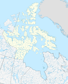
Mount Arthur (Nunavut)
Appearance
| Mount Arthur | |
|---|---|
| Highest point | |
| Elevation | 1,310 m (4,300 ft)[1] |
| Coordinates | 81°19′59″N 74°46′01″W / 81.33306°N 74.76694°W[1] |
| Geography | |
| Location | Nunavut, Canada |
| Parent range | Arctic Cordillera |
| Topo map | NTS 340D7 Mount Sherwood |
| Climbing | |
| First ascent | July 1882 |
Mount Arthur is a mountain located on Ellesmere Island, Nunavut, Canada in the Quttinirpaaq National Park. First mapped by the Lady Franklin Bay Expedition, it was named for Chester A. Arthur the 21st President of the United States.
External links
- "Mount Arthur, Nunavut". Peakbagger.com. Retrieved 2010-03-02.
- Mount Arthur on peakvisor.com
- sunset/sunrise moonset/moonrise times
- Mount Arthur current updated weather
References
- Geographical Names of the Ellesmere Island National Park Reserve and Vicinity by Geoffrey Hattersley-Smith (1998) ISBN 0-919034-96-9
- Notes
- ^ a b "Mount Arthur". Bivouac.com. Retrieved 2014-08-21.

