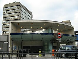
Southwark tube station
| Southwark | |
|---|---|
 Entrance on The Cut | |
| Location | Bankside |
| Local authority | London Borough of Southwark |
| Managed by | London Underground |
| Number of platforms | 2 |
| Accessible | Yes[1] |
| Fare zone | 1 |
| OSI | Waterloo East Blackfriars at Bankside entrance |
| London Underground annual entry and exit | |
| 2019 | |
| 2020 | |
| 2021 | |
| 2022 | |
| 2023 | |
| Railway companies | |
| Original company | London Regional Transport |
| Key dates | |
| 20 November 1999 | Opened |
| Other information | |
| External links | |
| Coordinates | 51°30′14″N 0°06′18″W / 51.5039°N 0.105°W |
Southwark is a London Underground station in the London Borough of Southwark at the corner of Blackfriars Road and The Cut. It is between Waterloo and London Bridge stations on the Jubilee line, and is in Travelcard Zone 1. It was opened on 20 November 1999 as part of the Jubilee Line Extension.[8] The station is somewhat west of historic Southwark, which is served by Borough and London Bridge stations. Its entrance is across the road from the disused Blackfriars Road railway station.
The original plan for the Extension did not include a station between those at Waterloo and London Bridge; Southwark station was added after lobbying by the local council, it is in fact sited right next to the borough's boundary with Lambeth at Joan Street. Although it is close to Waterloo, not near the Bankside attractions it was intended to serve, and its only National Rail interchange is to London Waterloo East main line station; the passenger usage matches those of other minor central stations. It does however get over twice the traffic of nearby Borough station, and around three times that of Lambeth North.
History
Southwark station was designed by Sir Richard MacCormac of MJP Architects. It is on a cramped site, with its platforms underneath the Victorian main line viaduct between Waterloo East and London Bridge stations. The site presented significant technical and architectural difficulties which were resolved by constructing two concourses at different levels.
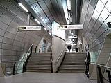
The two platforms have platform screen doors which are meant to prevent passengers or debris from falling onto the tracks. They are connected at each end to the lower concourse which is a simple tunnel between the platforms and is illuminated by glass and steel "beacons" at each end, and is faced with stainless steel panels, deliberately left unpolished. Stairs lead up to a section of high floor in the central area of the tunnel, from where three narrow tube-like escalator shafts lead sideways (south) to the higher concourse.
The upper concourse is the centrepiece of the station. It is a space 16 metres (52 ft) high with a glass roof that allows daylight to enter deep into the station. It is faced with a spectacular glass wall, 40 metres (130 ft) long, consisting of 660 specially cut pieces of blue glass, which was designed by the artist Alexander Beleschenko. The wall is one of the extension's more celebrated architectural features, winning critical approval and a number of awards.
MacCormac said the design of this and the lower concourse was inspired by the work of the 19th-century Prussian architect Karl Friedrich Schinkel.
One end of the higher concourse connects to Waterloo East station, and the other end to the station's modest low-rise entrance building which is intended as a base for a future commercial development.
Connections
London Buses routes 40, 63 and night routes N63 and N89 serve the station.[9][10]
Gallery
-
Entrance
-
Intermediate concourse
-
Westbound platform
-
New roundel design by Michael Craig-Martin in celebration of the new Tate Modern in collaboration with Art on the Underground
Additional images of Southwark Underground Station, and an architectural case study, are available on the Commission for Architecture and the Built Environment (CABE) web site.[11]
Nearby sights
- Shakespeare's Globe
- Young Vic theatre
- Old Vic theatre
- Tate Modern
References
- ^ "Step free Tube Guide" (PDF). Transport for London. April 2021. Archived (PDF) from the original on 15 May 2021.
- ^ "Out of Station Interchanges" (XLSX). Transport for London. 16 June 2020. Retrieved 5 November 2020.
- ^ "Station Usage Data" (XLSX). Usage Statistics for London Stations, 2019. Transport for London. 23 September 2020. Archived from the original on 9 November 2020. Retrieved 9 November 2020.
- ^ "Station Usage Data" (XLSX). Usage Statistics for London Stations, 2020. Transport for London. 16 April 2021. Retrieved 1 January 2022.
- ^ "Station Usage Data" (XLSX). Usage Statistics for London Stations, 2021. Transport for London. 12 July 2022. Retrieved 7 September 2022.
- ^ "Station Usage Data" (XLSX). Usage Statistics for London Stations, 2022. Transport for London. 4 October 2023. Retrieved 10 October 2023.
- ^ "Station Usage Data" (XLSX). Usage Statistics for London Stations, 2023. Transport for London. 8 August 2024. Retrieved 16 September 2024.
- ^ "The new JLE Station at Southwark opens". London Transport. 15 November 1999. Archived from the original on 3 March 2000. Retrieved 27 May 2020.
- ^ "Buses from Southwark" (PDF). TfL. June 2022. Retrieved 20 July 2022.
- ^ "Southwark Underground Station". TfL. Retrieved 20 July 2022.
- ^ "Southwark Underground Station (photos)". Commission for Architecture and the Built Environment (CABE). Archived from the original on 11 April 2008. Retrieved 1 March 2008.
| Preceding station | Following station | |||
|---|---|---|---|---|
| Waterloo towards Stanmore
|
Jubilee line | London Bridge towards Stratford
| ||


