
Lisburn Plantation
Lisburn Plantation House | |
 | |
| Location | Along Vidal Island Plantation Road, about 4.4 miles (7.1 km) northeast of Ferriday |
|---|---|
| Nearest city | Ferriday, Louisiana |
| Coordinates | 31°42′32″N 91°27′01″W / 31.70886°N 91.45038°W |
| Area | less than one acre |
| Built | 1852 |
| Architectural style | Greek Revival |
| NRHP reference No. | 79001057[1] |
| Added to NRHP | July 26, 1979 |
The Lisburn Plantation is a plantation with a historic mansion in Ferriday, Louisiana, U.S.. It was built in 1852, a decade prior to the American Civil War of 1861–1865.[2][3][4]
The house has been listed on the National Register of Historic Places on July 26, 1979[1] and has been apparently moved from its 1977 location some time after its listing.[a]
See also
References
- ^ a b "National Register Information System". National Register of Historic Places. National Park Service. July 9, 2010.
- ^ "Lisburn Plantation House" (PDF). State of Louisiana's Division of Historic Preservation. Retrieved April 30, 2018. with three photos and two maps
- ^ James H. Brown, Jr. "National Register of Historic Places Inventory/Nomination Form: Lisburn Plantation House". National Park Service. Retrieved April 30, 2018. With five photos from 1979.
- ^ "Real Estate". The Old-House Journal. September 1988. Retrieved July 18, 2016.
Notes
- ^ Check satellite imagery with maps attached to NRHP registraion

Municipalities and communities of Concordia Parish, Louisiana, United States | ||
|---|---|---|
| Cities | 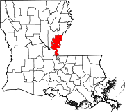 | |
| Towns | ||
| CDPs | ||
| Other communities |
| |
This article about a property in Louisiana on the National Register of Historic Places is a stub. You can help Wikipedia by expanding it. |
Categories:
- Houses on the National Register of Historic Places in Louisiana
- Greek Revival architecture in Louisiana
- Houses completed in 1852
- Buildings and structures in Concordia Parish, Louisiana
- Antebellum architecture
- Plantations in Louisiana
- 1852 establishments in Louisiana
- Louisiana Registered Historic Place stubs