Fombell, Pennsylvania

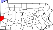
Fombell is an unincorporated community that includes both Franklin Township and Marion Township, Beaver County, Pennsylvania, United States.[1] Its U.S. postal zip code is 16123.[2] Its elevation ranges from 879 feet (268 m) along the creek to 1280 feet on top of the hills, and it is located at 40°48′34″N 80°12′6″W / 40.80944°N 80.20167°W (40.8095093, -80.2017277).[3]
Located along the Connoquenessing Creek northwest of Zelienople, Fombell lies in the northeastern corner of Beaver County.[1] It was originally the location of a station of the narrow gauge Pittsburgh and Western Railroad.[4]
References
- ^ a b DeLorme. Pennsylvania Atlas & Gazetteer. 8th ed. Yarmouth: DeLorme, 2003, 56. ISBN 0-89933-280-3.
- ^ USPS Look Up a ZIP Code™ {https://tools.usps.com/go/ZipLookupAction_input}
- ^ U.S. Geological Survey Geographic Names Information System: Fombell, Pennsylvania
- ^ Bausman, Joseph H. History of Beaver County Pennsylvania and Its Centennial Celebration. New York: Knickerbocker, 1904, 968-969.


