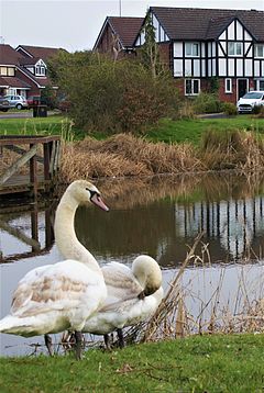
Sandymoor
| Sandymoor | |
|---|---|
 A snapshot of Sandymoor | |
Location within Cheshire | |
| Population | 2,678 [1] |
| OS grid reference | SJ559836 |
| Civil parish |
|
| Unitary authority | |
| Ceremonial county | |
| Region | |
| Country | England |
| Sovereign state | United Kingdom |
| Post town | RUNCORN |
| Postcode district | WA7 |
| Dialling code | 01928 |
| Police | Cheshire |
| Fire | Cheshire |
| Ambulance | North West |
| UK Parliament | |
Sandymoor is a civil parish in Runcorn, Halton, Cheshire, England, with a population of approximately 2,678.[1] The majority of housing in Sandymoor was built post-1990 and the parish was formed in 2008 by the Halton (Parish Electoral Arrangements) Order 2008.[3] Sandymoor lies approximately 3 miles east of Runcorn town centre, 4 miles south-west from Warrington town centre and 2 miles north of the M56 motorway.
Sandymoor is an affluent parish, having been ranked among the 10% least deprived LSOAs (Neighbourhoods) in the country in the Department for Communities and Local Government's 'English indices of Deprivation'.[4] Sandymoor has a relatively young population with an average age of 33.6 years, compared to an average age of 40 years for the general UK population.[1]
Sandymoor has been undergoing rapid development in recent years, with construction of new homes anticipated to be complete by 2019.[5]
Further improvements have been discussed, including opening a primary school and creating a station on the Chester-Manchester railway line which runs along the eastern edge of the parish.[citation needed]
History
The area of Sandymoor was designated as part of Runcorn New Town in 1964 and was initially allocated to industry.[6] The new town masterplan was amended in 1975 and the land redesignated as residential.[7] In 2008, Sandymoor Parish Council was created.[8]
Places of interest
Within Sandymoor
- Sandymoor Hall, a community hall hosting daily clubs, classes and events.
- Sandymoor Ormiston Academy, a secondary free school established in 2012.
- Manor Park, an industrial estate containing manufacturing, office and warehouse facilities for companies including Thermo Fisher Scientific, The Protein Works, Warburtons, Lidl, B&M and Cheshire Constabulary Custody Suite.
Near to Sandymoor
- Norton Priory, a museum and the most excavated monastery site in Britain
- Sci-Tech Daresbury, a science and innovation campus whose tenants include the Daresbury Laboratory and Cockcroft Institute
- Runcorn Shopping City, the main shopping area in Runcorn opened by Queen Elizabeth II in 1972
- The Mersey Gateway bridge, a 1,000 m long cable-stayed bridge across the River Mersey between Runcorn and Widnes. On the Runcorn side this bridge connects to the Daresbury Expressway (A558) and the Central Expressway (A533) towards Sandymoor.
- Daresbury Village, famous as the birthplace of Lewis Carroll
- Creamfields, a large dance music festival which is held on August Bank Holiday
- The Brindley theatre and arts centre, an award-winning theatre and arts centre in Runcorn Old Town
- Runcorn East railway station
- Walton Hall
- Halton Castle
- Norton Water Tower
- Bridgewater Canal
- Manchester Ship Canal
Education
Sandymoor is served by a number of nearby schools, namely:
- Sandymoor Ormiston Academy, a secondary free school which opened in 2012, rated as 'good' by Ofsted in 2014 and 'inadequate' by them in 2018[9]
- Windmill Hill Primary School, rated as 'outstanding' by Ofsted in 2013 [10]
- Daresbury Primary School, rated as 'outstanding' by Ofsted in 2008 [11]
- Moore Primary School, rated as 'good' by Ofsted in 2013 [12]
References
- ^ a b c UK Census (2011). "Local Area Report – Sandymoor Parish (E04000318)". Nomis. Office for National Statistics. Retrieved 26 May 2020.
- ^ http://www.sandymoorparishcouncil.gov.uk/
- ^ Halton (Parish Electoral Arrangements) Order 2008 (PDF), Electoral Commission, retrieved 15 January 2009
- ^ "English Indices of Deprivation 2010".
- ^ "Sandymoor Supplementary Planning Document 2009" (PDF).
- ^ Runcorn New Town Master Plan (PDF), Runcorn Development Corporation, 1967, archived from the original (PDF) on 21 June 2018, retrieved 25 February 2018
- ^ "Runcorn New Town Master Plan Amendment No.2" (PDF). Runcorn Development Corporation. 1975. Archived from the original (PDF) on 7 February 2014. Retrieved 24 July 2020.
{{cite web}}:|archive-date=/|archive-url=timestamp mismatch; 11 April 2013 suggested (help) - ^ Halton (Parish Electoral Arrangements) Order 2008 (PDF), Electoral Commission, retrieved 15 January 2009
- ^ Ofsted: Sandymoor
- ^ Ofsted: Windmill Hill Primary School
- ^ Ofsted: Daresbury Primary School
- ^ Ofsted: Moore Primary School
External links

