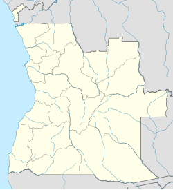
Virei
Appearance
Virei | |
|---|---|
Municipality & Town | |
| Coordinates: 15°43′S 12°57′E / 15.717°S 12.950°E | |
| Country | |
| Province | Namibe |
| Area | |
| • Total | 15,092 km2 (5,827 sq mi) |
| Population (2014 Census)[1] | |
| • Total | 32,445 |
| • Density | 0.6/km2 (2/sq mi) |
| Time zone | UTC+1 (WAT) |
| Climate | BWh |
Virei is a town and municipality of Namibe Province, Angola. It has an area of 15,092 km2. The municipality had a population of 32,445 in 2014.[1]
References
[edit]- ^ a b "Resultados Definitivos Recenseamento Geral da População e Habitação – 2014 Província do Namibe" (PDF). Instituto Nacional de Estatística, República de Angola. Retrieved 3 May 2020.

